
MyTopo
Byers Peak MyTopo Explorer Series Map
Couldn't load pickup availability
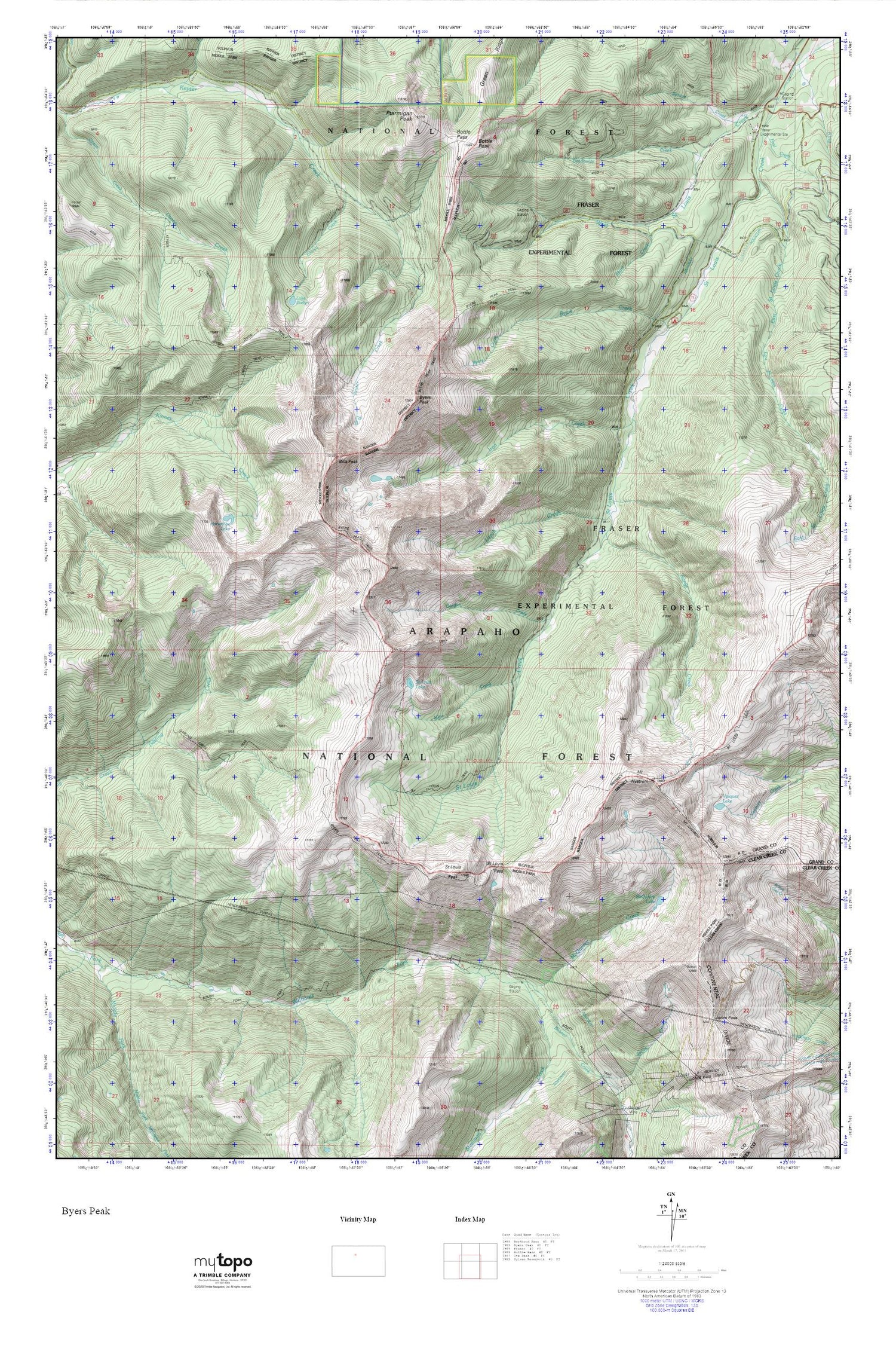
Topographic map of Byers Peak in the state of Colorado. From the MyTopo Explorer Series.
This topo map features shaded relief and comes with UTM / MGRS and Latitude/Longitude grids.
For more than two decades, MyTopo has provided maps to the most adventurous among us.. those who love to explore our nation’s remote wilderness areas, climb our highest peaks, and trek across our vast public lands. This map is part of a curated collection of the most popular places for which MyTopo customers have designed maps. It is a “bucket list” of the most amazing places to hike, hunt, and explore.
This map contains the following named places: Arapaho National Forest,Bills Peak,Bobtail Creek,Bottle Pass,Bottle Peak,Bull Ditch,Bull Seep,Byers Creek,Byers Creek Campground,Byers Peak,Byers Peak Trail,Byers Peak Wilderness,Darling Creek Trail,Deadhorse Creek,East Saint Louis Creek,Evelyn Creek,Fool Creek,Fraser Experimental Forest,Fraser Experimental Station,Gordon Creek,Green Ridge,Horseshoe and Idlewild Trail,Horseshoe Lake,Hull Creek,Iron Creek,Jones Pass,Kinney Creek Trail,Lake Evelyn,Lunch Creek,McQueary Creek,McQueary Lake,Mine Creek,Mount Nystrom,Ptarmigan Peak,Range Creek,Riverdale Grange Hall,Saint Louis Lake,Saint Louis Pass,Saint Louis Peak,Saint Louis Trail,Short Creek,Spruce Creek,Steelman Creek,Vasquez Lake


