MyTopo
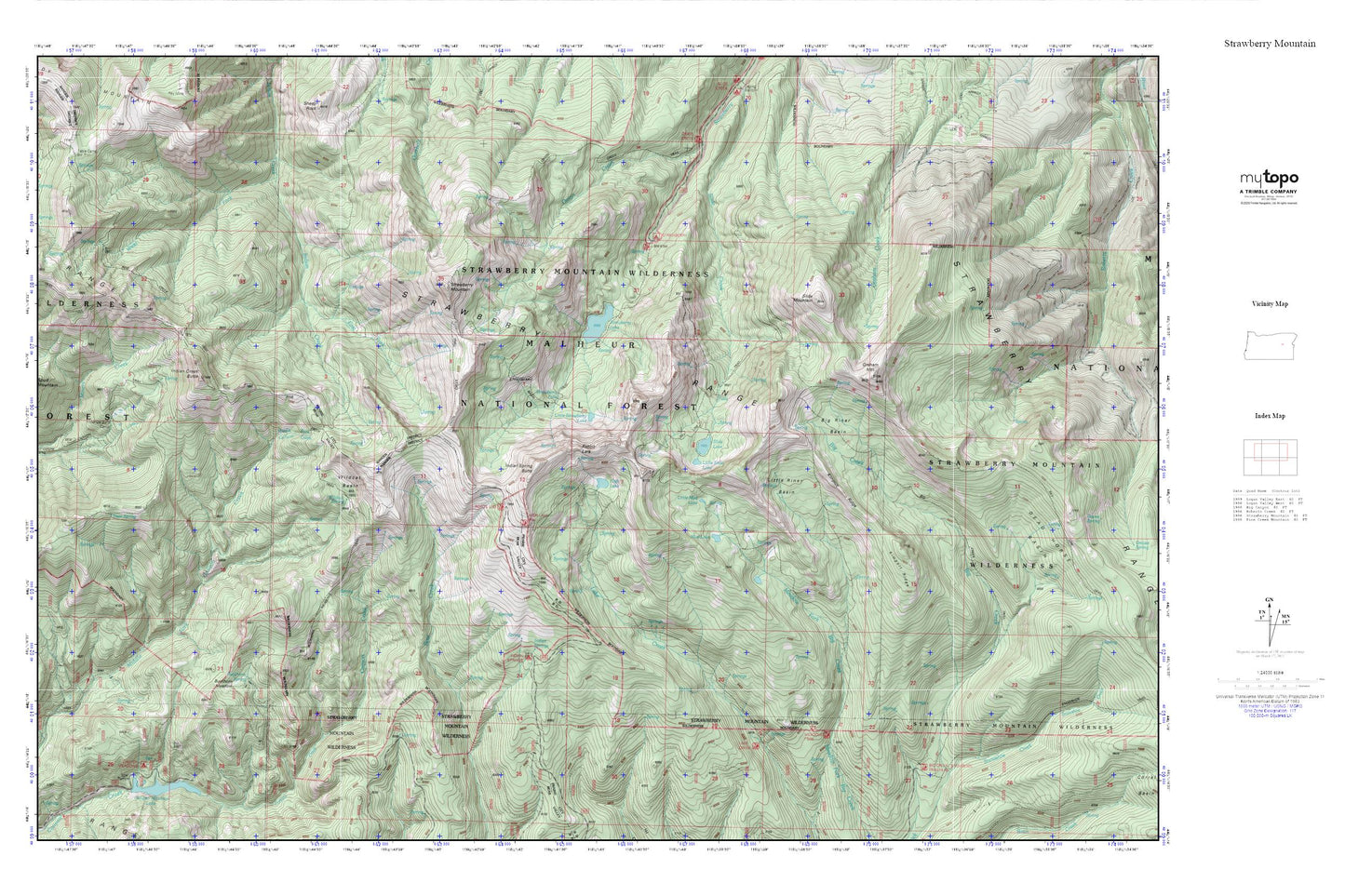
Strawberry Mountain MyTopo Explorer Series Map
Couldn't load pickup availability
Topographic map of Strawberry Mountain in the state of Oregon. From the MyTopo Explorer Series.
This topo map features shaded relief and comes with UTM / MGRS and Latitude/Longitude grids.
For more than two decades, MyTopo has provided maps to the most adventurous among us.. those who love to explore our nation’s remote wilderness areas, climb our highest peaks, and trek across our vast public lands. This map is part of a curated collection of the most popular places for which MyTopo customers have designed maps. It is a “bucket list” of the most amazing places to hike, hunt, and explore.
This map contains the following named places: Big Creek Trail,Big Riner Basin,Buckhorn Meadow,Buckhorn Meadow Recreation Site,Buckhorn Meadow Trailhead,Buckhorn Meadows Trail,Buckhorn Spring,Canyon Creek Trail,Canyon Meadows,Canyon Meadows Recreation Site,Deer Spring,East Fork Indian Creek,Graham Mountain,High Lake,High Lake Rim Recreation Site,High Lake Rim Trailhead,Hotel de Bum Camp,Indian Creek Butte,Indian Creek Trail,Indian Spring Butte,Indian Springs,Indian Springs Campground,Kimport Ridge,Lake Creek Trail,Little Mud Lake,Little Riner Basin,Little Slide Lake,Little Strawberry Lake,Meadow Fork Trail,Mud Lake,Mud Lake Trail,Pine Creek Trail,Rabbit Ears,Roads End Camp,Roads End Trailhead,Slide Basin Trail,Slide Falls,Slide Lake,Slide Mountain,Snowshoe Camp,Snowshoe Creek,Snowshoe Trailhead,Strawberry Basin Trail,Strawberry Falls,Strawberry Lake,Strawberry Lake Camp,Strawberry Mountain,Strawberry Mountain Wilderness,Strawberry Range,Strawberry Recreation Site,Strawberry Spring,Table Mountain Cutoff Trail,Twin Springs Trail,West Fork Indian Creek,Wildcat Basin,Wildcat Spring