MyTopo
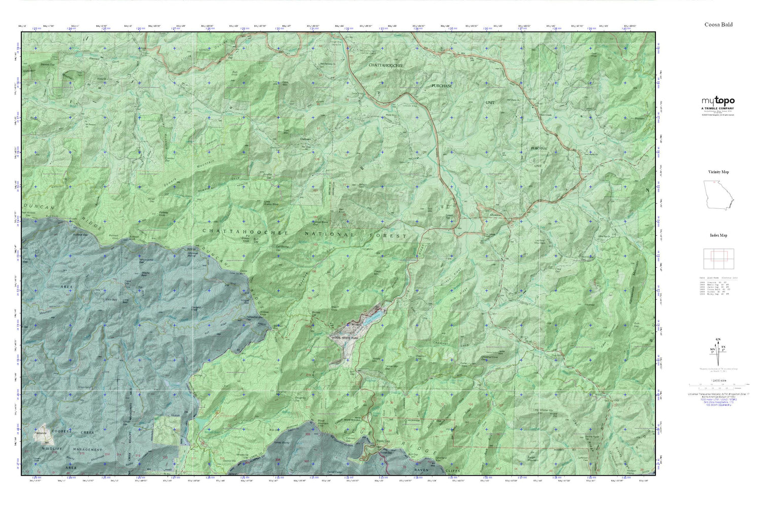
Coosa Bald MyTopo Explorer Series Map
Couldn't load pickup availability
Topographic map of Coosa Bald in the state of Georgia. From the MyTopo Explorer Series.
This topo map features shaded relief and comes with UTM / MGRS and Latitude/Longitude grids.
For more than two decades, MyTopo has provided maps to the most adventurous among us.. those who love to explore our nation’s remote wilderness areas, climb our highest peaks, and trek across our vast public lands. This map is part of a curated collection of the most popular places for which MyTopo customers have designed maps. It is a “bucket list” of the most amazing places to hike, hunt, and explore.
This map contains the following named places: Addie Gap,Alex Cove,Allison Branch,Allison Ridge,Ben Knob,Berry School,Betty Cove Branch,Big Branch,Big Grassy Knob,Bird Gap,Blairsville-Suches Division,Blood Mountain,Board Camp Creek,Bowers Cove,Bowers Mountain,Bryant Gap,Buck Knob,Buckeye Cove,Buckeye Gap,Buckeye Knob,Bull Gap,Burnett Branch,Burnett Creek,Burnett Gap,Burnt Ridge,Calf Stomp Gap,Calf Stump Branch,Chestnut Cove,Chestnut Cove Gap,Chestnut Knob,Chestnut Mountain,Choestoe,Choestoe Baptist Church,Choestoe Cemetery,Choestoe School,Cindy Cove,Cob Ridge,Cook Mountain,Coosa Backcountry Trail,Coosa Bald,Craig Gap,Crawley Gap,Crawley Mountain,Dug Gap,Duncan Ridge,Duncan Ridge Trail,East Seabolt Creek,Edwards Cove,Fain,Fain Creek,Fanny Gap,Fisher Knob,Flat Creek,Flatrock Gap,Fort Mountain,Fortenberry Creek,Frady Branch,Frady Mountain,Frogtown Cove,Frozentop,Garland Knob,Garrett Creek,Gillespie Branch,Gillespie Ridge,Grace Calvary Mission,Hatchet Creek,Helton Creek,Helton Creek Falls,Henson Cemetery,Hicks Gap Branch,Hicks Ridge,Hogpen Branch,Hood,Hood School,Jacks Mountain,Jarrard Creek,Jones Branch,Jones Gap,Lake Trahlyta,Lake Trahlyta Dam,Lake Winfield Scott,Lake Winfield Scott Campground,Lake Winfield Scott Dam,Lance Branch,Lark Gap,Laughter Branch,Laura,Ledford Mountain,Levelland Cove,Little Bald,Little Grassy Knob,Little Wildcat Mountain,Locust Gap,Locust Stake Gap,Logan Creek,Long Ridge,Middle Bald,Middle Ridge,Miller Cove,Miller Cove Branch,Mount Pleasant Cemetery,Mount Pleasant Church,Mount Pleasant School,Mulky Gap Branch,Nance Payne Cove,Nance Ridge,New Hope Church,New Liberty Cemetery,New Liberty Church,New Liberty School,Nicholson Bridge,Noah Branch,Nottely Falls,Old Liberty Cemetery,Old Liberty Church,Old Liberty School,Otto,Owl Hollow,Owltown,Owltown Cemetery,Owltown Gap,Picketts Knob,Pineflat Gap,Polly Branch,Pretty Branch,Reece Bridge,Reece State Memorial,Rich Ridge,Richland Creek,Roaring Fork,Salem Cemetery,Salem Top,Sasebee Cove Scenic Area,Self Mountain,Shady Grove Cemetery,Shady Grove Church,Shady Grove School,Shadydale School,Shanty Branch,Sheriff Knob,Shoal Branch,Slaughter Creek,Slaughter Gap,Slaughter Mountain,Smith Mill,Sosebee Cove,Spiva Branch,Spriggs Cemetery,Spriggs Chapel School,Stink Creek,Tanner Cove,Tigue Branch,Tigue Gap,Town Creek,Town Creek School,Trail Ridge,Turkey Creek,Twomile Gap,Union Baptist Church,Union Cemetery,Union County Fire Department Station 12,Union County Fire Department Station 3,Union County Fire Department Station 9,Victory Church,West Fork Wolf Creek,West Seabolt Creek,West Wildcat Gap,West Wildcat Knob,White Cemetery,Whiteoak Stomp,Wildcat Branch,Wildcat Gap,Wildcat Knob,Wilson Branch,Wilson Mountain,Wolf Creek,Wolf Stake Gap,Wolfpen Gap,Yellow Mountain,Yellow Mountain Gap,Yellowhammer Gap,Yellowjacket Gap


