
MyTopo
Blackwater Falls MyTopo Explorer Series Map
Couldn't load pickup availability
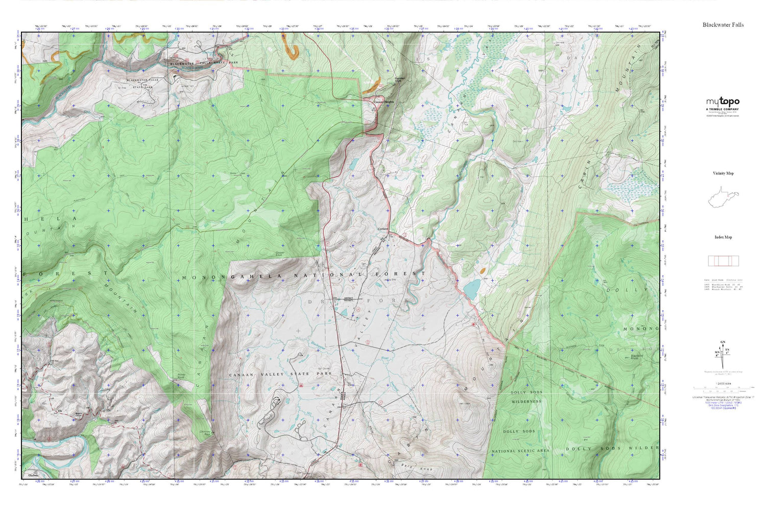
Topographic map of Blackwater Falls in the state of West Virginia. From the MyTopo Explorer Series.
This topo map features shaded relief and comes with UTM / MGRS and Latitude/Longitude grids.
For more than two decades, MyTopo has provided maps to the most adventurous among us.. those who love to explore our nation’s remote wilderness areas, climb our highest peaks, and trek across our vast public lands. This map is part of a curated collection of the most popular places for which MyTopo customers have designed maps. It is a “bucket list” of the most amazing places to hike, hunt, and explore.
This map contains the following named places: 26260,Breathed Mountain Trail,Brights Chapel,Buena,Canaan Heights,Canaan Mountain,Canaan Valley National Wildlife Refuge,Canaan Valley Resort State Park,Canaan Valley Resorts Golf Course,Canaan Valley Volunteer Fire Department,Cascade School,Chimney Rock,Club Run,Cooper Knob,Cortland,Cortland Cemetery,Cortland Grade School,Cosner School,Dry Fork District,Elk,Elklick Run,Flat Run,Flat Run Lake Dam,Freeland Run,Graham Farm Spring,Harmon School,Lindy Run,Lindy Run Trail,Maple Grove School,Mill Run,Mill Run Church,Mill Run School,North Branch Blackwater River,North Fork Red Run,Plantation Trail,Pointy Knob,Sand Run,South Fork Red Run,Spruce Island Lake,Spruce Island Lake Dam,Tub Run,Tucker County Emergency Medical Services Substation,Windwood Fly-In Resort Airport,Yoakum Run


