MyTopo
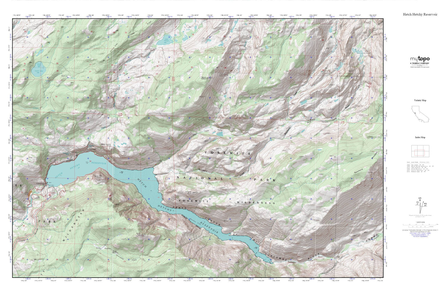
Hetch Hetchy Reservoir MyTopo Explorer Series Map
Couldn't load pickup availability
Topographic map of Hetch Hetchy Reservoir in the state of California. From the MyTopo Explorer Series.
This topo map features shaded relief and comes with UTM / MGRS and Latitude/Longitude grids.
For more than two decades, MyTopo has provided maps to the most adventurous among us.. those who love to explore our nation’s remote wilderness areas, climb our highest peaks, and trek across our vast public lands. This map is part of a curated collection of the most popular places for which MyTopo customers have designed maps. It is a “bucket list” of the most amazing places to hike, hunt, and explore.
This map contains the following named places: Beehive,Breeze Creek,Deep Canyon,Falls Creek,Grand Canyon of the Tuolumne River,Hetch Hetchy Backpackers Campground,Hetch Hetchy Campground,Hetch Hetchy Dome,Hetch Hetchy Ranger Station,Hetch Hetchy Reservoir,Hetch Hetchy Valley,Kolana Rock,Laurel Lake,Le Conte Point,Little Hetch Hetchy Valley,Mount Gibson,O'Shaughnessy Dam,Rancheria Creek,Rancheria Falls,Smith Meadow,Smith Peak,Tiltill Creek,Tiltill Valley,Tueeulala Falls,Tuolumne Wild and Scenic River,Wapama Falls