MyTopo
Pierce Pond MyTopo Explorer Series Map
Couldn't load pickup availability
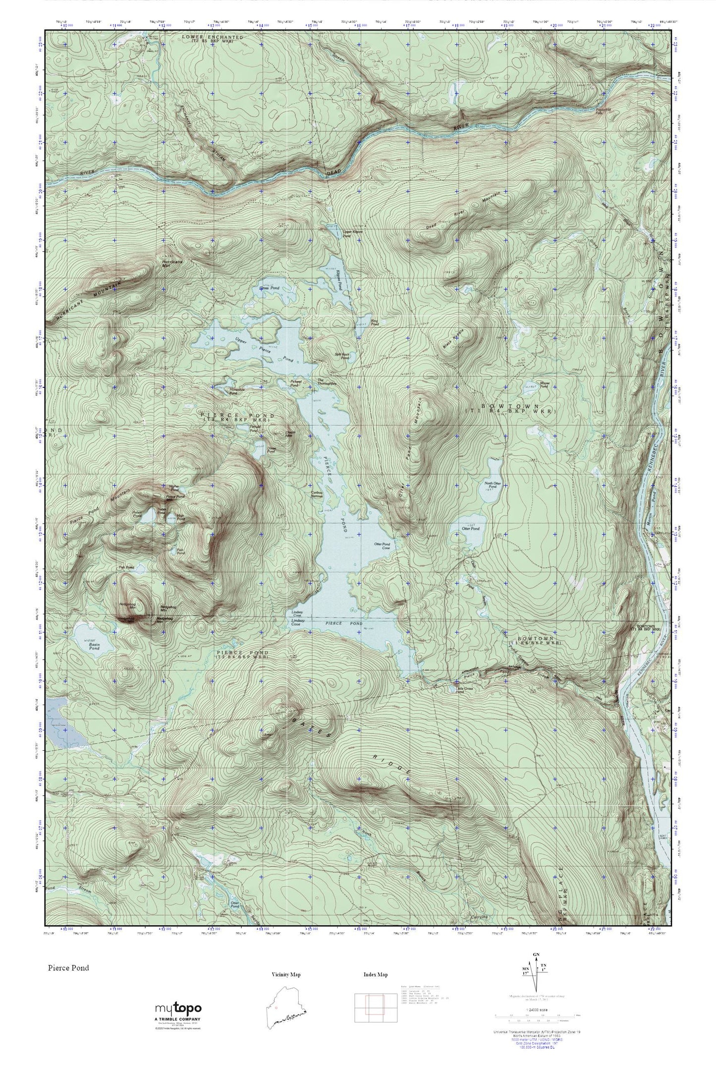
Topographic map of Pierce Pond in the state of Maine. From the MyTopo Explorer Series.
This topo map features shaded relief and comes with UTM / MGRS and Latitude/Longitude grids.
For more than two decades, MyTopo has provided maps to the most adventurous among us.. those who love to explore our nation’s remote wilderness areas, climb our highest peaks, and trek across our vast public lands. This map is part of a curated collection of the most popular places for which MyTopo customers have designed maps. It is a “bucket list” of the most amazing places to hike, hunt, and explore.
This map contains the following named places: Appletree Inn,Bates Ridge,Black Nubble,Bowtown Township,Caribou Narrows,Dead River Mountain,Dixon Mountain,Dixon Pond,Enchanted Stream,Fernald Pond,Fish Pond,Grass Pond,Gulf Stream,Hedgehog Mountain,Helen Pond,High Pond,Higher Pond,Horseshoe Pond,Kilgore Pond,King Pond,Lindsay Cove,Little Grass Pond,Moose Pond,North Otter Pond,Otter Pond,Otter Pond Camps,Otter Pond Cove,Otter Pond Mountain,Otter Pond Stream,Pickerel Pond,Pierce Pond,Pierce Pond Camps,Pierce Pond Dam,Pierce Pond Mountain,Pierce Pond Township,Poplar Hill Falls,Salmon Stream,Split Rock Pond,Sterlings Camps,Stony Brook Camp,The Thoroughfare,Upper Kilgore Pond,Upper Pierce Pond