MyTopo
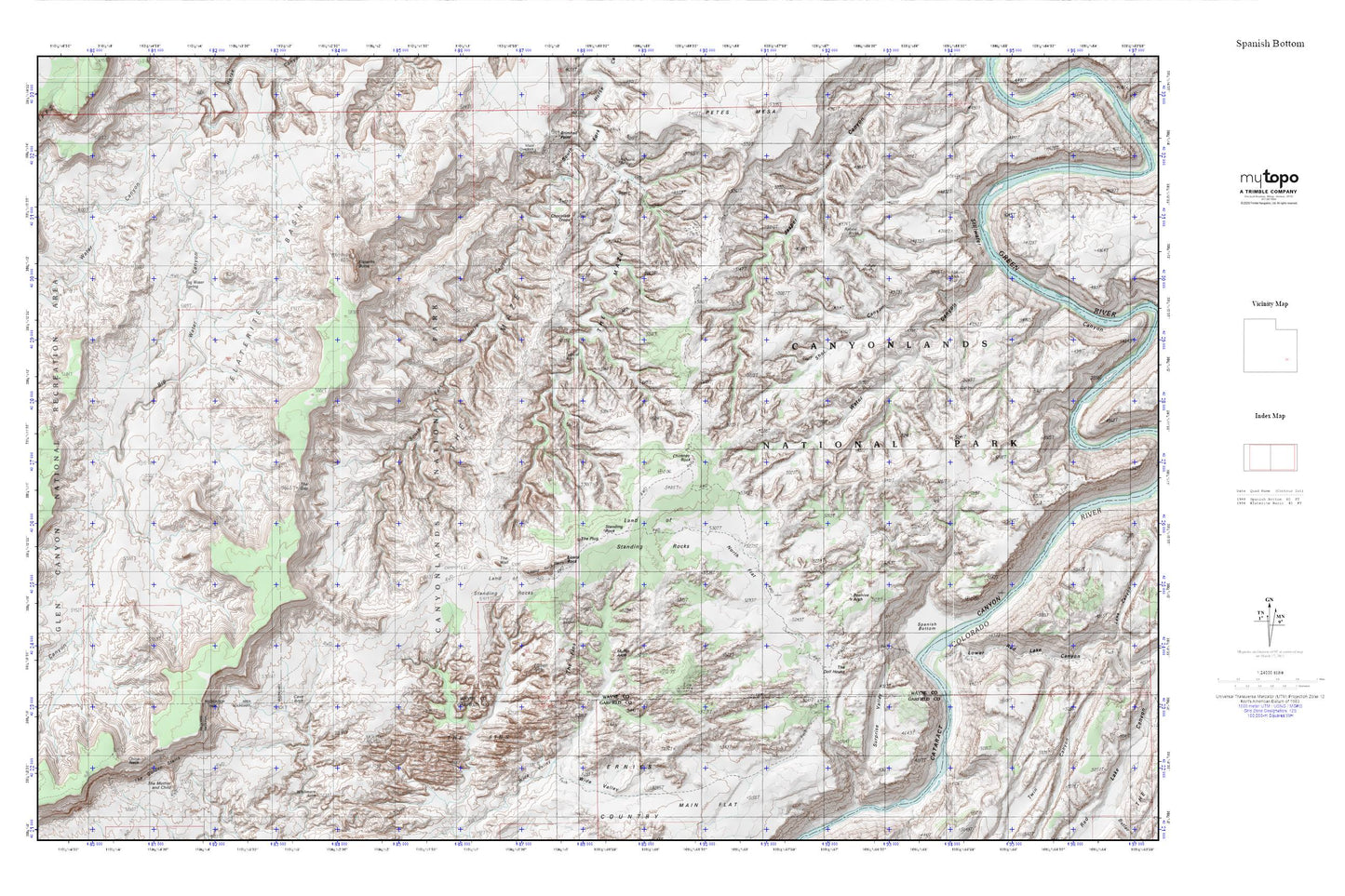
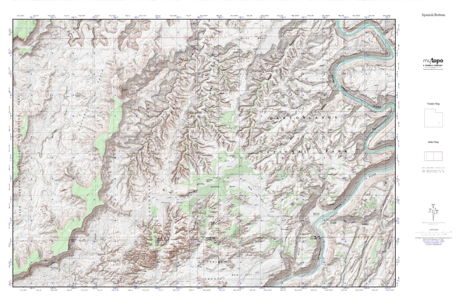
Elaterite Basin MyTopo Explorer Series Map
Couldn't load pickup availability
Topographic map of Elaterite Basin in the state of Utah. From the MyTopo Explorer Series.
This topo map features shaded relief and comes with UTM / MGRS and Latitude/Longitude grids.
For more than two decades, MyTopo has provided maps to the most adventurous among us.. those who love to explore our nation’s remote wilderness areas, climb our highest peaks, and trek across our vast public lands. This map is part of a curated collection of the most popular places for which MyTopo customers have designed maps. It is a “bucket list” of the most amazing places to hike, hunt, and explore.
This map contains the following named places: Beehive Arch,Big Water Spring,Brown Betty Rapids,Butler Wash,Cave Arch,Chimney Rock,China Neck,Chocolate Drops,Elaterite Basin,Elaterite Butte,Land of Standing Rocks,Lizard Rock,Lower Red Lake Canyon,Muffin Arch,North Flat,North Trail Canyon,Shot Canyon,Spanish Bottom,Standing Rock,Suprise Valley,Tapestry Slab,The Doll House,The Fins,The Gap,The Golden Stairs,The Maze,The Mother and Child,The Plug,The Wall,Thieves Cache Arch,Tibbett Arch,Water Canyon