MyTopo
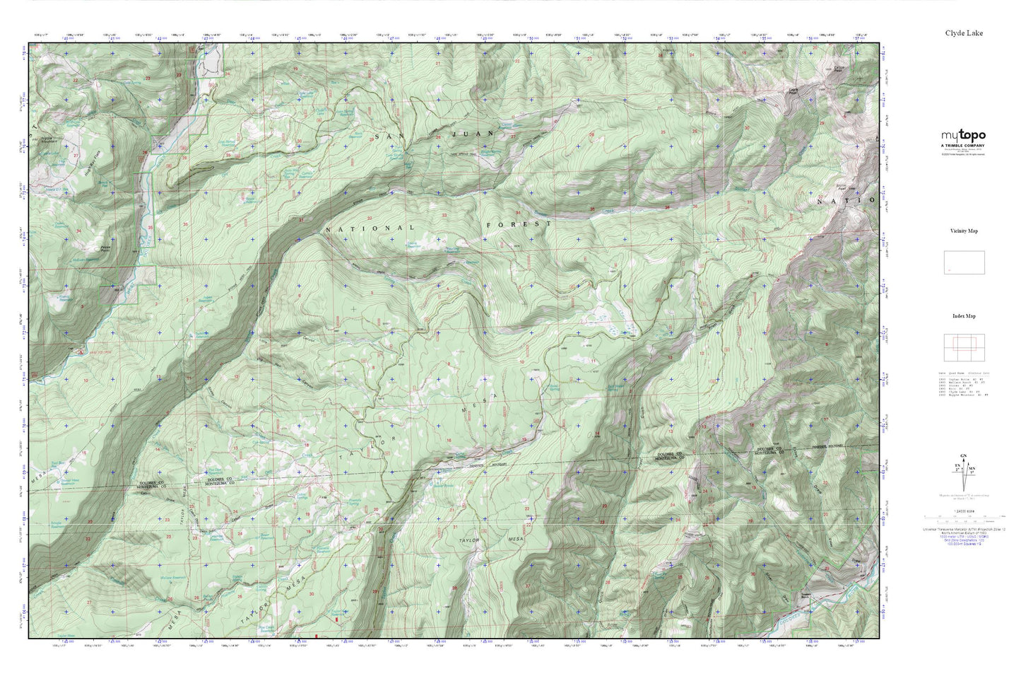
Clyde Lake MyTopo Explorer Series Map
Couldn't load pickup availability
Topographic map of Clyde Lake in the state of Colorado. From the MyTopo Explorer Series.
This topo map features shaded relief and comes with UTM / MGRS and Latitude/Longitude grids.
For more than two decades, MyTopo has provided maps to the most adventurous among us.. those who love to explore our nation’s remote wilderness areas, climb our highest peaks, and trek across our vast public lands. This map is part of a curated collection of the most popular places for which MyTopo customers have designed maps. It is a “bucket list” of the most amazing places to hike, hunt, and explore.
This map contains the following named places: 81323,Aspen Reservoir,Auto Way Spring Reservoir,Bauer Reservoir,Bench Reservoir,Big Hell Canyon,Cabin Draw,Cabin Spring,Calico Spring,Camp Spring,Cattail Reservoir,Corrals Reservoir,Cresto Reservoir,Cub Creek,Cub Spring,Dry Creek,Eagle Peak Trail,Fivemile Creek,Fivemile Reservoir,Fivemile Spring,Fox Den Creek,Fox Den Reservoir,Goble Creek,Greenlee Reservoir,Hap Reservoir,Hugh Ray Flats,Jose Spring Reservoir,Knight Spring Reservoir,Koeing Reservoir,Little Hell Canyon,McEwen Reservoir,Nipple Lake,Nipple Mountain,Palmetto Group Mine,Pease Point,Pease Point Reservoir,Pipe Creek Trail,Priest Gulch Trail,Road Spring,Rock Reservoir,Royce Reservoir,Seep Reservoir,Sheep Canyon,Siphon Spring,Soft Water Spring,Spring Creek,Spring Creek Trail,Stoner Mesa,Stoner Mesa Reservoir,Stoner Mesa Trail,Sunshine Reservoir,Swank Reservoir,Taylor Mesa,Twin Fir Spring,Twin Spring,Twin Spring Reservoir,Twin Spring Trail,West Dolores Campground,Yearling Reservoir