MyTopo
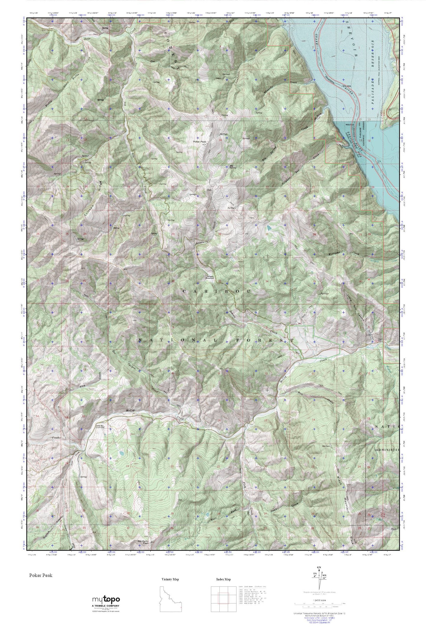
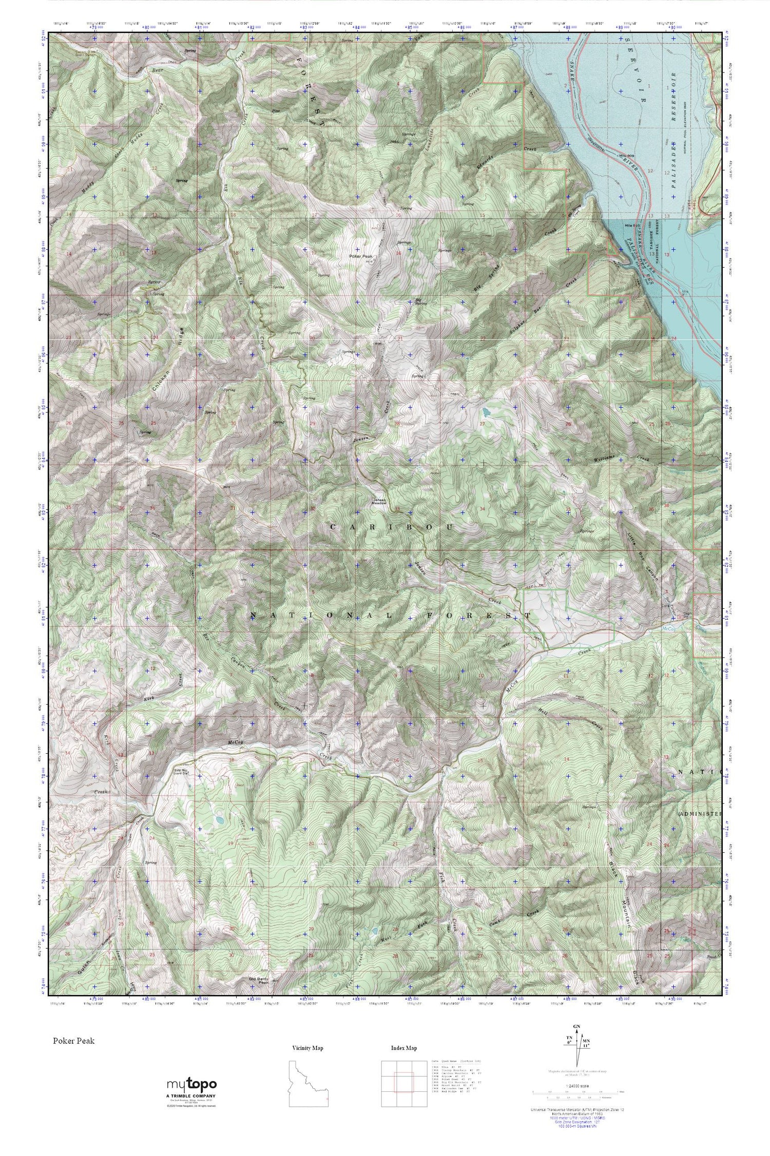
Poker Peak MyTopo Explorer Series Map
Couldn't load pickup availability
Topographic map of Poker Peak in the state of Idaho. From the MyTopo Explorer Series.
This topo map features shaded relief and comes with UTM / MGRS and Latitude/Longitude grids.
For more than two decades, MyTopo has provided maps to the most adventurous among us.. those who love to explore our nation’s remote wilderness areas, climb our highest peaks, and trek across our vast public lands. This map is part of a curated collection of the most popular places for which MyTopo customers have designed maps. It is a “bucket list” of the most amazing places to hike, hunt, and explore.
This map contains the following named places: Bald Mountain Guard Station,Big Spring,Big Spring Creek,Box Canyon Creek,Chicken Ridge,Edwards Creek,Edwards Ferry,Fish Creek,Hell Creek,Iowa Creek,Jensen Creek,Jensen Meadow,Kirk Creek,Lake Creek,Muddy Creek,Pine Creek,Poker Peak,Sulphur Bar Creek,West Fork Elk Creek,York Creek