MyTopo
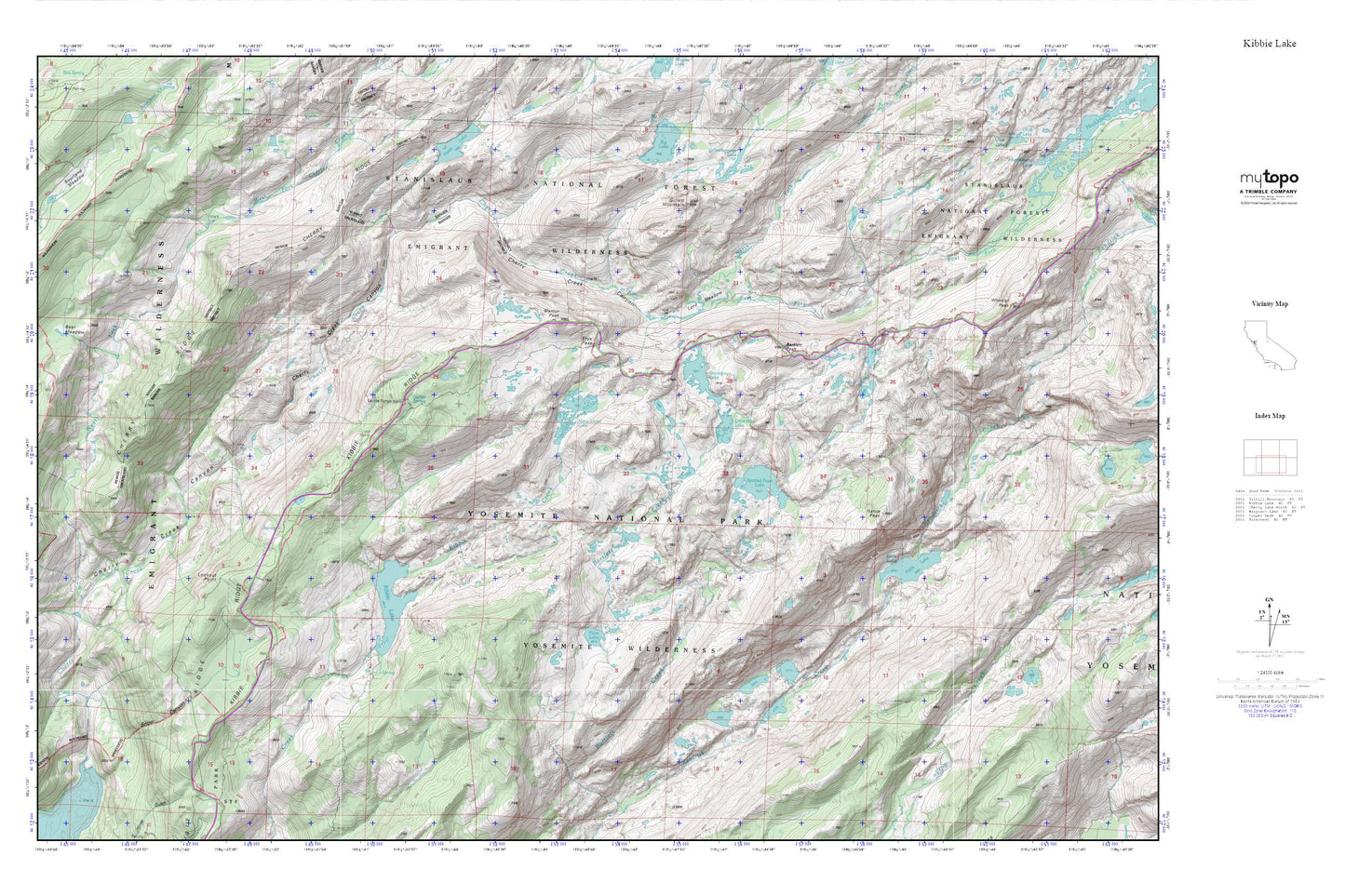
Kibbie Lake MyTopo Explorer Series Map
Couldn't load pickup availability
Topographic map of Kibbie Lake in the state of California. From the MyTopo Explorer Series.
This topo map features shaded relief and comes with UTM / MGRS and Latitude/Longitude grids.
For more than two decades, MyTopo has provided maps to the most adventurous among us.. those who love to explore our nation’s remote wilderness areas, climb our highest peaks, and trek across our vast public lands. This map is part of a curated collection of the most popular places for which MyTopo customers have designed maps. It is a “bucket list” of the most amazing places to hike, hunt, and explore.
This map contains the following named places: Bartlett Peak,Bear Meadow,Boundary Lake,Bourland Meadow,East Fork Cherry Creek,Edith Lake,Flora Lake,Gillett Mountain,Inferno Lakes,Kibbie Lake,Kibbie Ridge,Little Bear Lake,Lookout Point,Lord Meadow,Many Island Lake,Mercur Peak,Nance Peak,North Fork Cherry Creek,Pruett Lake,Sachse Spring,Snow Canyon,Spotted Fawn Lake,Stanislaus-Yosemite Division,Styx Pass,Twain Harte-Tuolumne City Division,West Fork Cherry Creek,Wheeler Peak,Yellowhammer Lake