
MyTopo
Mountain View Crest MyTopo Explorer Series Map
Couldn't load pickup availability
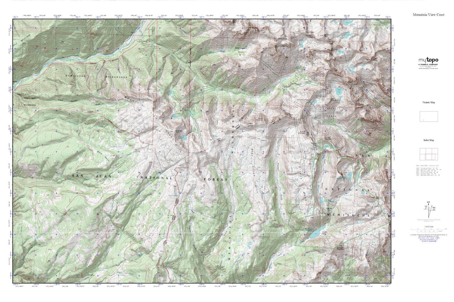
Topographic map of Mountain View Crest in the state of Colorado. From the MyTopo Explorer Series.
This topo map features shaded relief and comes with UTM / MGRS and Latitude/Longitude grids.
For more than two decades, MyTopo has provided maps to the most adventurous among us.. those who love to explore our nation’s remote wilderness areas, climb our highest peaks, and trek across our vast public lands. This map is part of a curated collection of the most popular places for which MyTopo customers have designed maps. It is a “bucket list” of the most amazing places to hike, hunt, and explore.
This map contains the following named places: Aetna Mine,Aztec Mountain,Brooklyn Mine,Bullion Mountain,Cascade,Chicago Basin,City Reservoir,Columbine Lake,Columbine Pass,Crazy Women Gulch,Crystal Valley,Dollar Lake,Durango Number 1 Dam,Durango Reservoir Number 1,Emerald Lake,Florida Mountain,Hazel Lake,Homestake Tunnel Mine,Hope Mountain,Jupiter Mountain,Lake Marie,Lillie Lake,Lime Mesa,Logtown,Lower Park,Mastodon Mine,Missouri Gulch,Mount Kennedy,Mount Valois,Mountain View Crest,New York Creek,Oliver Lakes,Overlook Point,Pear Lake,Pittsburg Mine,Poison Creek,Ruby Lake,Sheridan Mountain,Silver Mesa,Slipper Tunnel Mine,Stag Mesa,Tank Mesa,Trimble Pass,Upper Park,Vallecito Basin,Vallecito Group Mine,Webb Lake,West Silver Mesa,West Virginia Gulch


