MyTopo
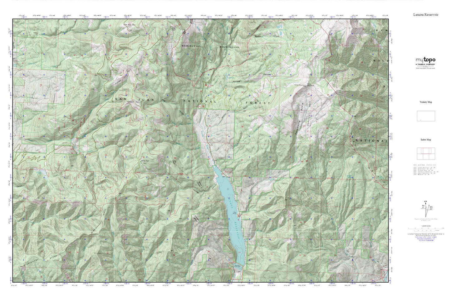
Lemon Reservoir MyTopo Explorer Series Map
Couldn't load pickup availability
Topographic map of Lemon Reservoir in the state of Colorado. From the MyTopo Explorer Series.
This topo map features shaded relief and comes with UTM / MGRS and Latitude/Longitude grids.
For more than two decades, MyTopo has provided maps to the most adventurous among us.. those who love to explore our nation’s remote wilderness areas, climb our highest peaks, and trek across our vast public lands. This map is part of a curated collection of the most popular places for which MyTopo customers have designed maps. It is a “bucket list” of the most amazing places to hike, hunt, and explore.
This map contains the following named places: Blodgett Creek,Carbonate Basin,Carson Creek,Florida Campground,Horse Thief Park,Kroeger Park,Lemon Dam Campground,Lemon Reservoir,Lone Tree Creek,Long Hollow,Lost Lake,McClure Canyon,McCoy Gulch,Middle Fork Coon Creek,Miller Creek,Miller Mountain,Missionary Ridge,North Fork Coon Creek,Pound Creek,Pretty Creek,Silver Pass,Smith Lake,South Burnt Timber Creek,South Fork Coon Creek,Spud Hill,Transfer Park Campground,Upper Lemon Picnic Area,Waldner Creek,Wallace Park,Willow Creek,Youngs Canyon