MyTopo
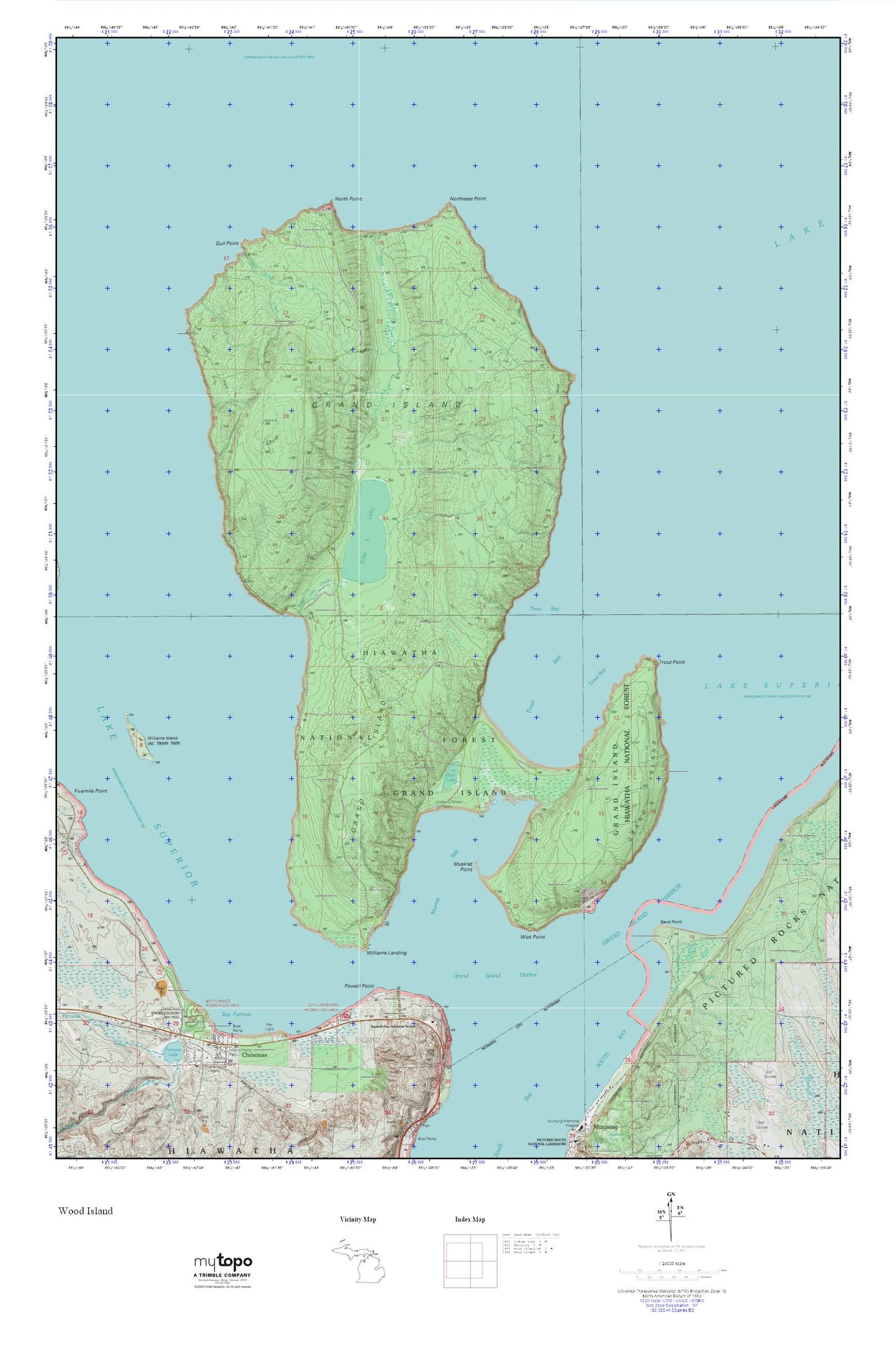
Grand Island MyTopo Explorer Series Map
Couldn't load pickup availability
Topographic map of Grand Island in the state of Michigan. From the MyTopo Explorer Series.
This topo map features shaded relief and comes with UTM / MGRS and Latitude/Longitude grids.
For more than two decades, MyTopo has provided maps to the most adventurous among us.. those who love to explore our nation’s remote wilderness areas, climb our highest peaks, and trek across our vast public lands. This map is part of a curated collection of the most popular places for which MyTopo customers have designed maps. It is a “bucket list” of the most amazing places to hike, hunt, and explore.
This map contains the following named places: Bay Furnace,Bay Furnace Lighthouse,Bay Furnace Recreation Area,Christmas,Coty Lakeshore Recreation Area,Duck Lake,Echo Lake,Echo Lake Creek,Gongeau Creek,Grand Island,Grand Island Harbor Bay,Grand Island Harbor Lighthouse,Gull Point,Gull Point Creek,Indian Cemetery,Murray Bay,Muskrat Point,North Light Creek,North Point,Northeast Point,Powell Point,Sand Point,Seventh-day Adventist School,Township of Grand Island,Trout Bay,Trout Point,Two Lakes,Wick Point,Williams Landing,Williams-Powell Cemetery