MyTopo
Arc Dome MyTopo Explorer Series Map
Couldn't load pickup availability
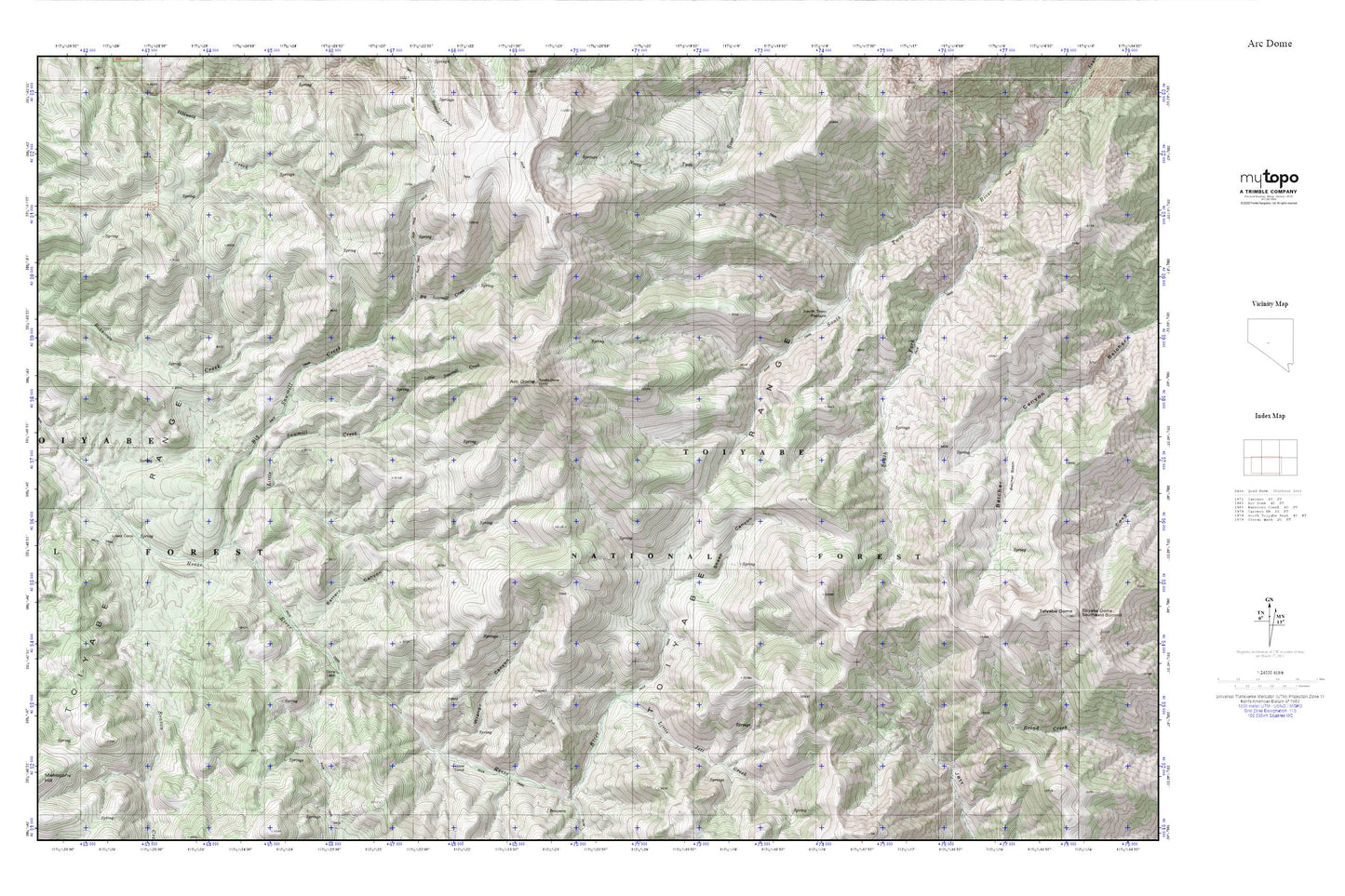
Topographic map of Arc Dome in the state of Nevada. From the MyTopo Explorer Series.
This topo map features shaded relief and comes with UTM / MGRS and Latitude/Longitude grids.
For more than two decades, MyTopo has provided maps to the most adventurous among us.. those who love to explore our nation’s remote wilderness areas, climb our highest peaks, and trek across our vast public lands. This map is part of a curated collection of the most popular places for which MyTopo customers have designed maps. It is a “bucket list” of the most amazing places to hike, hunt, and explore.
This map contains the following named places: Arc Dome,Arc Dome Wilderness,Battero Canyon,Beason Creek,Belcher Basin,Big Sawmill Creek,Cow Canyon Trailhead,Little Jett Creek,Little Sawmill Creek,Lower Corral,Mahogany Hill,Sheep Canyon,South Fork South Twin River,South Twin Pasture,South Twin Pasture Administrative Site,Southeast Summit,Stone Cabin,Stone Cabin Administrative Site,Upper Corral,Wrango Canyon