MyTopo
Hockett Peak MyTopo Explorer Series Map
Couldn't load pickup availability
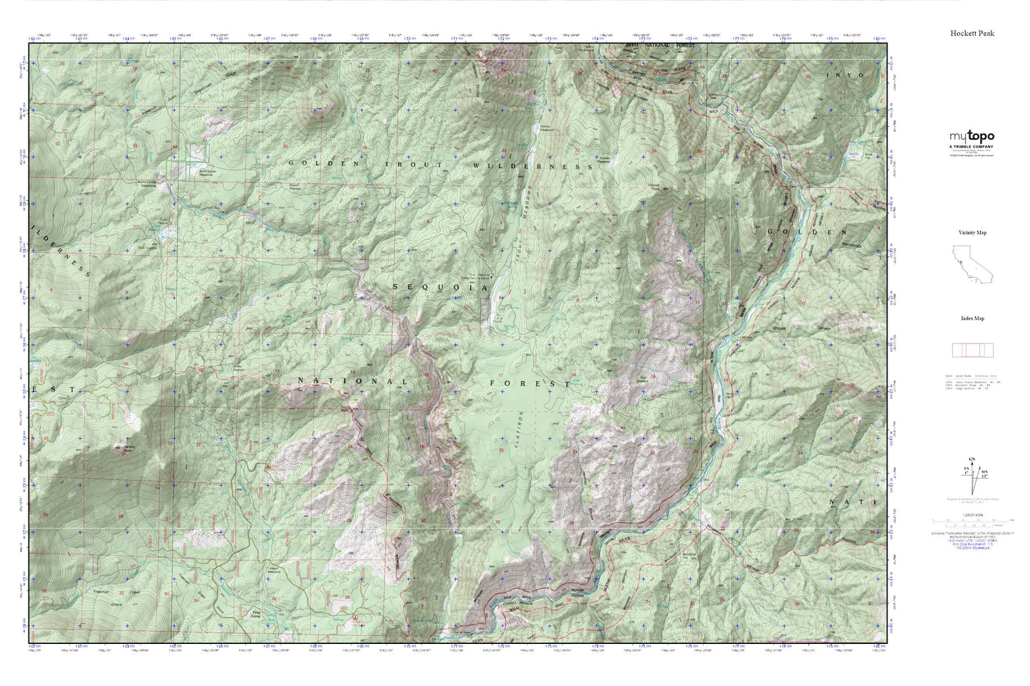
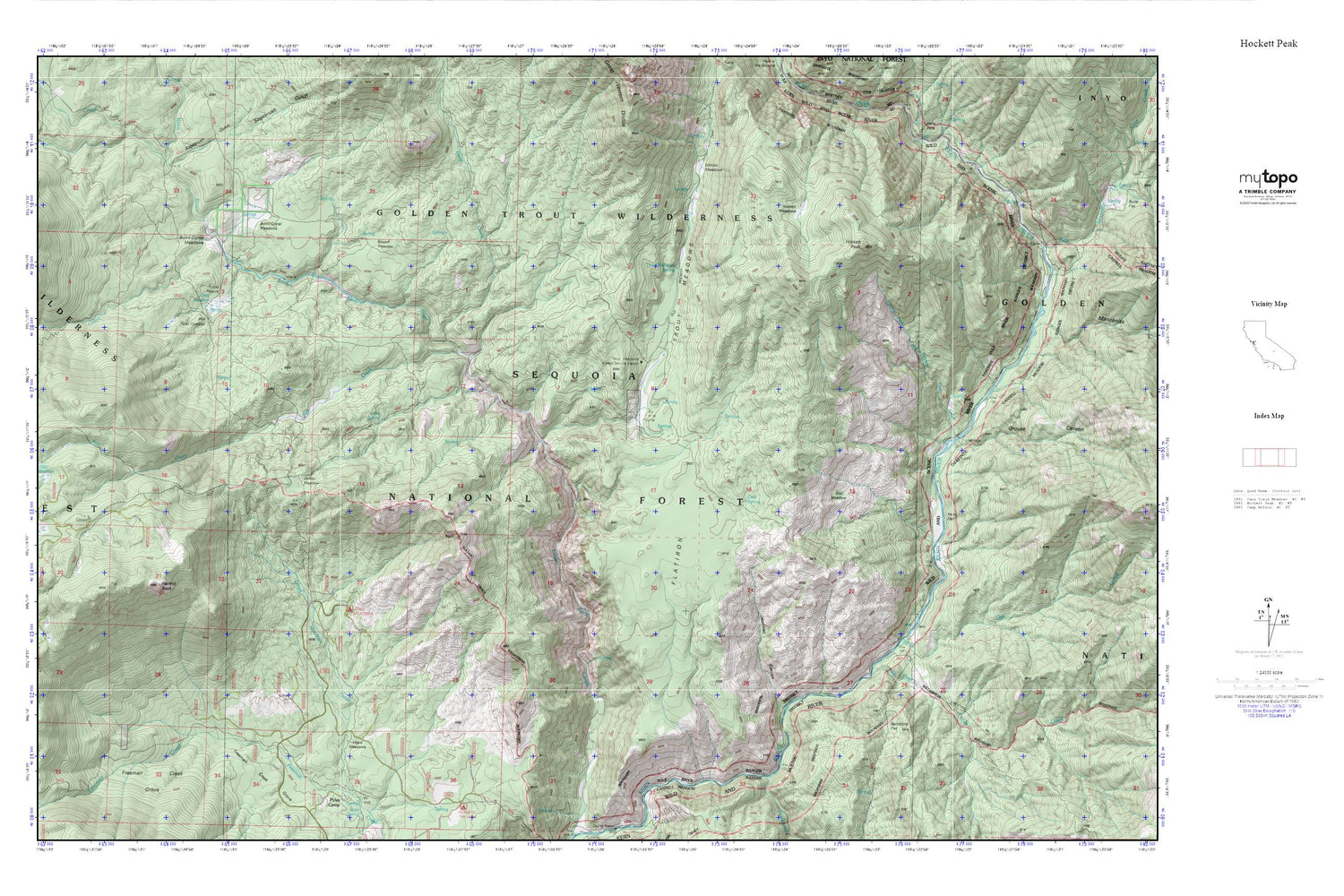
Topographic map of Hockett Peak in the state of California. From the MyTopo Explorer Series.
This topo map features shaded relief and comes with UTM / MGRS and Latitude/Longitude grids.
For more than two decades, MyTopo has provided maps to the most adventurous among us.. those who love to explore our nation’s remote wilderness areas, climb our highest peaks, and trek across our vast public lands. This map is part of a curated collection of the most popular places for which MyTopo customers have designed maps. It is a “bucket list” of the most amazing places to hike, hunt, and explore.
This map contains the following named places: Alpine Creek,Burnt Corral Meadows,Castle Rock,Clicks Creek,Cold Spring,Deadman Canyon,Deep Creek,Doe Meadow,Fish Creek,Flatiron,Grey Meadow,Grey Meadow Forest Service Station,Grouse Canyon,Hermit Rock,Hockett Meadows,Hockett Peak,Hockett Peak Creek,Jerkey Meadow,Jug Spring,Junction Meadow,Kern Flat,Kern Wild and Scenic River,Lloyd Meadows,Loggy Meadows,Lower Pylos Camp,North Fork Clicks Creek,Osa Creek,Rattlesnake Creek,Round Meadow,Sacratone Flat,Sagebrush Gulch,Soda Creek,Trout Meadows,Trout Meadows Forest Service Station,Trout Meadows Spring,Upper Pyles Camp,Willow Meadows,Willow Meadows Campground