MyTopo
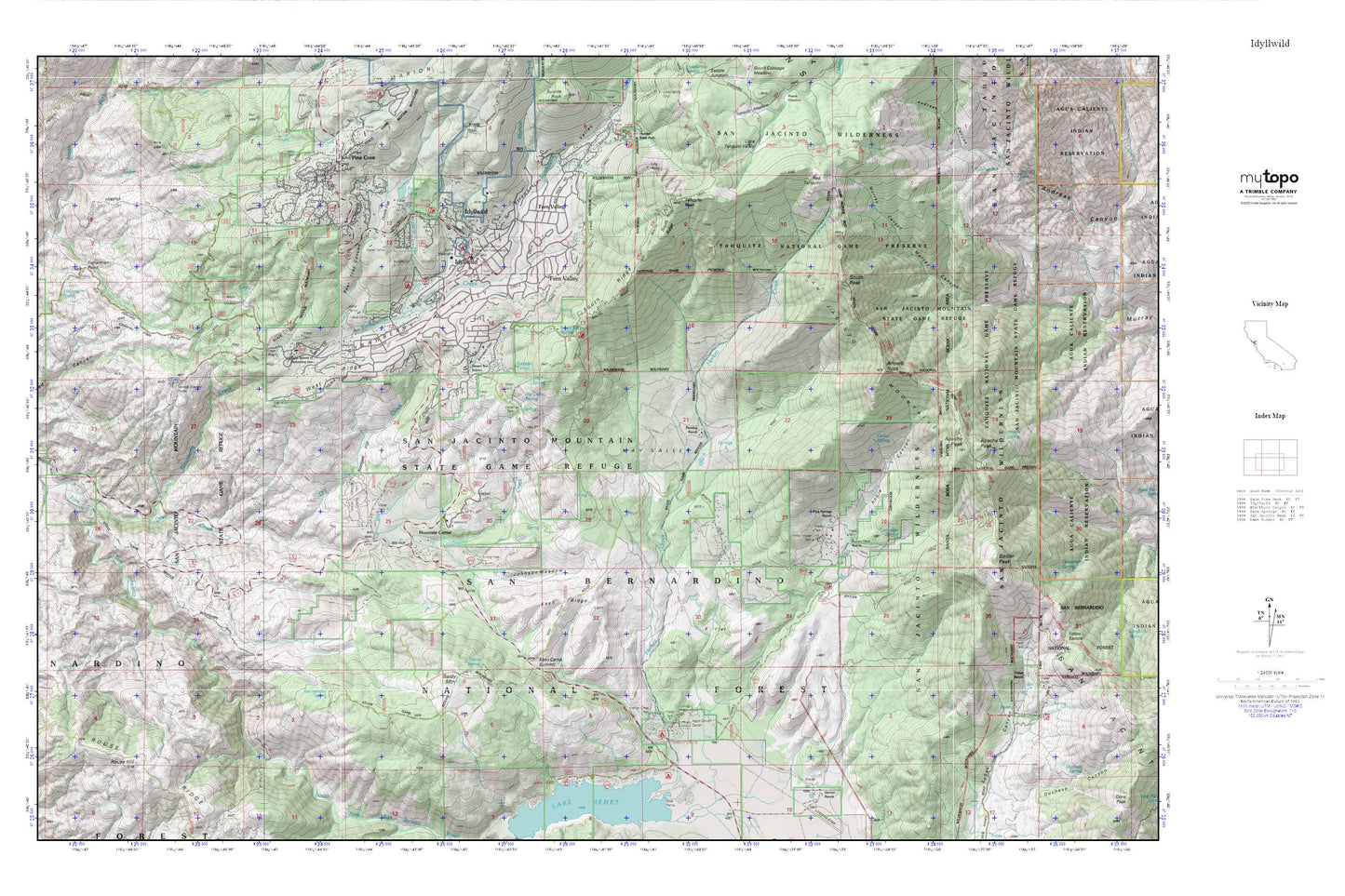
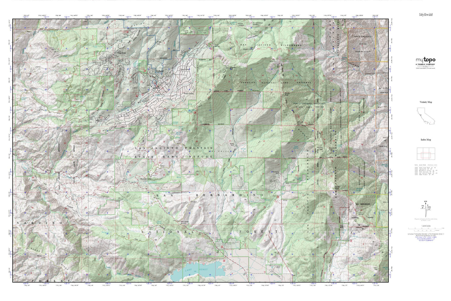
Idyllwild MyTopo Explorer Series Map
Couldn't load pickup availability
Topographic map of Idyllwild in the state of California. From the MyTopo Explorer Series.
This topo map features shaded relief and comes with UTM / MGRS and Latitude/Longitude grids.
For more than two decades, MyTopo has provided maps to the most adventurous among us.. those who love to explore our nation’s remote wilderness areas, climb our highest peaks, and trek across our vast public lands. This map is part of a curated collection of the most popular places for which MyTopo customers have designed maps. It is a “bucket list” of the most amazing places to hike, hunt, and explore.
This map contains the following named places: Alvin Meadows,Andreas Falls,Antsell Rock,Apache Peak,Apache Spring,Apple Canyon,Apple Canyon Campground,Apple Canyon Picnic Area,Baldy Mountain,Bear Trap Canyon,Big Cedar Spring,Blodgett Flat,Bonita Vista Ranch,Camp Emerson,Camp Maranatha,Camp Roosevelt,Camp Tahquitz Meadows,Cartridge Spring,Cedar Spring,Chalk Hill,Chimney Flats,Chinquapin Flat,Coldwater Creek,Desert Sun School,Dry Creek,Dutch Flat,Fern Valley,Fiesta Camp,Fisherman Point,Fleming Ranch,Fobes Ranch,Foster 827 Dam,Foster Lake,Garner Valley,Granite Spring,Halfway Spring,Hurkey Creek Campground,Hurkey Creek Park,Idyllwild,Idyllwild Branch Riverside City and County Public Library,Idyllwild Fire Protection District,Idyllwild K-8 School,Idyllwild Park,Idyllwild Park Visitors Center,Idyllwild Post Office,Idyllwild-Pine Cove Census Designated Place,Idyylwild Picnic Area,Inspiration Point,Johnston Meadow,K Flat,Keen Camp,Keen Camp Post Office,Keen Camp Station,Keen Camp Summit,Keen Ridge,Keenwild Station,Lake Hemet Campground,Lake Hemet Picnic Area,Lilly Creek,Lily Rock,Logan Creek,Marion Creek,May Valley,McCall Memorial Park,McCalls Horse Camp,Mount San Jacinto State Park Headquarters,Mountain Center,Mountain Center Census Designated Place,Nettle Spring,Pine Cove,Pine Springs Ranch,Rattlesnake Spring,Red Tahquitz,Redshank,Riverside County Fire Department Station 23 Pine Cove,Rouse Hill,San Jacinto Wilderness,Saunders Meadow,South Fork Campground,South Fork Trail,South Peak,South Ridge,South Ridge Spring,Spitler Peak,Strawberry Creek,Strawberry Valley,Sulphur Spring,Tahquitz Peak,Tahquitz Peak Lookout,University of Southern California-Idyllwild,Wassel Ranch,West Ridge,White Post Turn