MyTopo
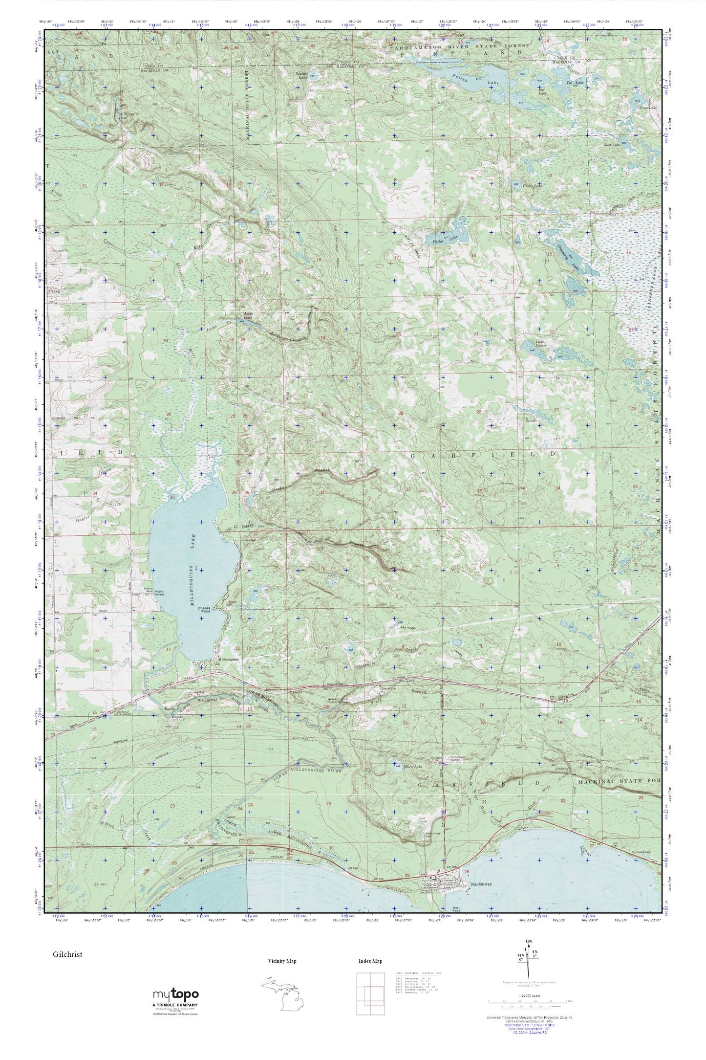
Hiawatha Sportsman s Club MyTopo Explorer Series Map
Couldn't load pickup availability
Topographic map of Hiawatha Sportsman s Club in the state of Michigan. From the MyTopo Explorer Series.
This topo map features shaded relief and comes with UTM / MGRS and Latitude/Longitude grids.
For more than two decades, MyTopo has provided maps to the most adventurous among us.. those who love to explore our nation’s remote wilderness areas, climb our highest peaks, and trek across our vast public lands. This map is part of a curated collection of the most popular places for which MyTopo customers have designed maps. It is a “bucket list” of the most amazing places to hike, hunt, and explore.
This map contains the following named places: Chases Point,Cold Creek,Cranberry Lake,Devine Lake,Dollar Lake,Ear Lake,Elbow Lake,Furlong Creek,Hagler Creek,Harris Creek,Hiawatha Golf Club,Jocko Creek,Jocko Pond,Lake Louise,Lucky Lake,Maloney Creek,Milk Creek,Millecoquins,Millecoquins Lake,Millecoquins Pond,North Branch Cold Creek,O'Niel Creek,Pullup Lake,South Branch Cold Creek,South Branch Three Mile Creek,Tee Lake,Threemile Creek,Township of Garfield,Upper Millecoquins River