MyTopo
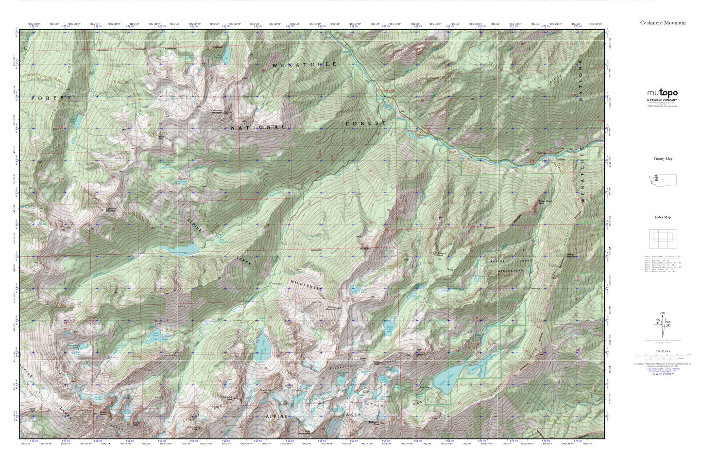
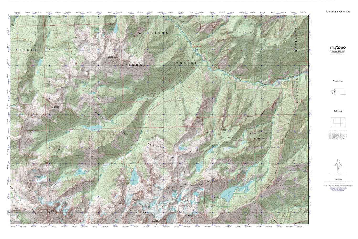
Cashmere Mountain MyTopo Explorer Series Map
Couldn't load pickup availability
Topographic map of Cashmere Mountain in the state of Washington. From the MyTopo Explorer Series.
This topo map features shaded relief and comes with UTM / MGRS and Latitude/Longitude grids.
For more than two decades, MyTopo has provided maps to the most adventurous among us.. those who love to explore our nation’s remote wilderness areas, climb our highest peaks, and trek across our vast public lands. This map is part of a curated collection of the most popular places for which MyTopo customers have designed maps. It is a “bucket list” of the most amazing places to hike, hunt, and explore.
This map contains the following named places: Bridge Creek,Bridge Creek Campground,Cannon Mountain,Cashmere Mountain,Colchuck Glacier,Colchuck Lake,Colchuck Lake Dam,Colchuck Pass,Colchuck Peak,Colchuck Trail,Coney Lake,Dragontail Peak,Earle Lake,Edward Peak,Eightmile Campground,Eightmile Creek,Eightmile Lake,Eightmile Lake Campground,Eightmile Lake Outlet Dam,Eightmile Mountain,Enchantment Basin,Enchantment Lakes,Enchantment Peaks,Gnome Tarn,Horseshoe Lake,Ice Cliff Glacier,Inspiration Lake,Isolation Lake,Jack Lake,Jack Ridge,Lake Caroline,Lake Stuart,Lake Stuart Trail,Lake Viviane,Leavenworth National Fish Hatchery,Leprechaun Lake,Lion Creek,Little Caroline Lake,Little Eightmile Lake,Lower Enchantment Lakes,Mesa Lake,Mount Stuart,Mountaineer Creek,Nada Lake,Perfection Lake,Pioneer Creek,Prusik Pass,Prusik Peak,Rat Creek,Shield Lake,Snow Lakes,Sprite Lake,Stuart Glacier,Stuart Range,Temple Lake,The Temple,Toketie Lake,Tranquil Lake,Trout Lake,Trout Lake Campground,Upper Enchantment Lakes,Windy Pass