
MyTopo
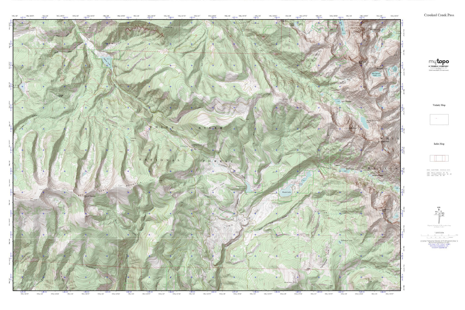
Crooked Creek Pass MyTopo Explorer Series Map
Couldn't load pickup availability
Topographic map of Crooked Creek Pass in the state of Colorado. From the MyTopo Explorer Series.
This topo map features shaded relief and comes with UTM / MGRS and Latitude/Longitude grids.
For more than two decades, MyTopo has provided maps to the most adventurous among us.. those who love to explore our nation’s remote wilderness areas, climb our highest peaks, and trek across our vast public lands. This map is part of a curated collection of the most popular places for which MyTopo customers have designed maps. It is a “bucket list” of the most amazing places to hike, hunt, and explore.
This map contains the following named places: Adam Campground,Antones Spring,Billings Spring,Corral Gulch,Crooked Creek,Crooked Creek Dam,Crooked Creek Park,Crooked Creek Pass,Crooked Creek Reservoir,Eagle Lake,East Jakeman Creek,Fools Peak,Gold Dust Basin,Ironedge Trail,Lake Charles,Lake Charles Trail,LEDE Dam,LEDE Reservoir,LEDE Reservoir Campground,Leeman Gulch,Leeman Lakes,Lime Park,Little Lime Creek,Middle Creek,Mount Thomas,Negro Basin,O-Z Dam,Red Table Mountain,Slim Jim Gulch,Sneve Gulch,Spine Creek,Sylvan Lake,Tellurium Lake,Tellurium Park,West Jakeman Creek,Woods Lake


