MyTopo
Mount Dana MyTopo Explorer Series Map
Couldn't load pickup availability
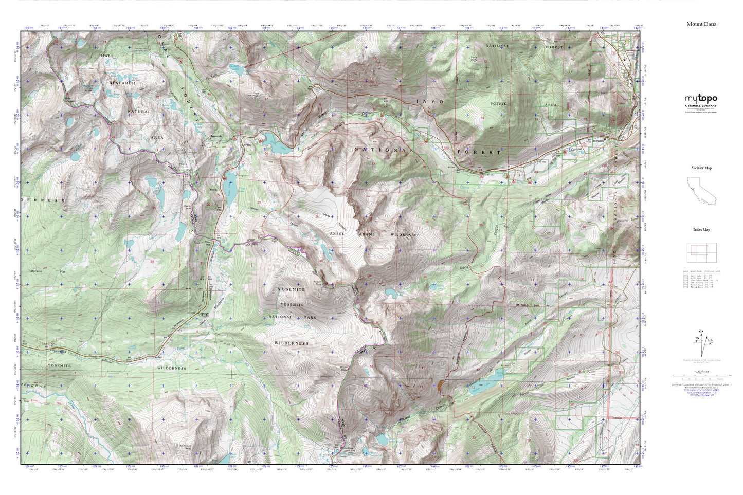
Topographic map of Mount Dana in the state of California. From the MyTopo Explorer Series.
This topo map features shaded relief and comes with UTM / MGRS and Latitude/Longitude grids.
For more than two decades, MyTopo has provided maps to the most adventurous among us.. those who love to explore our nation’s remote wilderness areas, climb our highest peaks, and trek across our vast public lands. This map is part of a curated collection of the most popular places for which MyTopo customers have designed maps. It is a “bucket list” of the most amazing places to hike, hunt, and explore.
This map contains the following named places: Aspen Campground,Beartrack Canyon,Bennettville,Bennetville Interpretive Site,Benneville Trailhead,Big Bend Campground,Big Horn Lake,Boulder Campground,Dana Lake,Dana Meadows,Dana Plateau,Ellery Campground,Ellery Lake,Ellery Lake Campground,Fantail Lake,Finger Lake,Gardisky Lake Trailhead,Gaylor Lakes,Gaylor Lakes Trail,Gaylor Peak,Gibbs Canyon,Gibbs Lake,Gibbs Lake Trailhead,Glacier Canyon,Granite Lakes,Great Sierra Mine,Green Treble Lake,Junction Campground,Kidney Lake,Lyell Canyon,Mine Creek,Moraine Campground,Moraine Flat,Mount Dana,Mount Gibbs,Nunatak-Tioga Tarns Trailhead,Parker Pass Creek,Rafferty Creek,Rhinedollar 104-041 Dam,Shell Lake,Skelton Lakes,Spuller Lake,Tioga Campground,Tioga Junction Campground,Tioga Lake,Tioga Lake 104-040 Dam,Tioga Lake Overlook,Tioga Pass,Tioga Pass Entrance,Tioga Pass Resort,Tioga Peak,Upper Gaylor Lake,Upper Horse Meadow,Walker Lake,Walker Lake 6-035 Dam,Walker Lake Trailhead,Warren Fork,White Mountain