
MyTopo
Crested Butte MyTopo Explorer Series Map
Couldn't load pickup availability
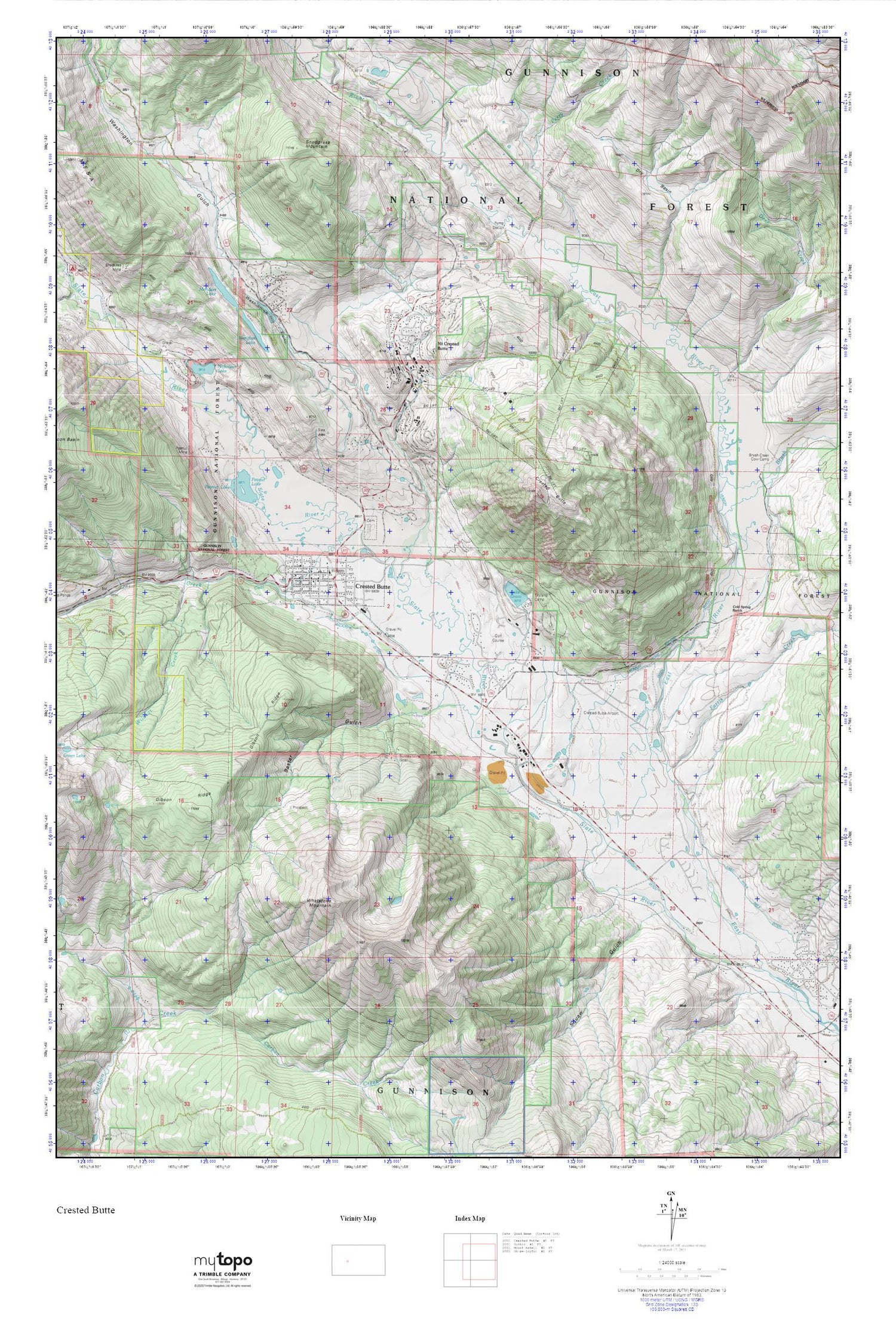
Topographic map of Crested Butte in the state of Colorado. From the MyTopo Explorer Series.
This topo map features shaded relief and comes with UTM / MGRS and Latitude/Longitude grids.
For more than two decades, MyTopo has provided maps to the most adventurous among us.. those who love to explore our nation’s remote wilderness areas, climb our highest peaks, and trek across our vast public lands. This map is part of a curated collection of the most popular places for which MyTopo customers have designed maps. It is a “bucket list” of the most amazing places to hike, hunt, and explore.
This map contains the following named places: 81224,Baxter Gulch,Brush Creek,Brush Creek Cow Camp,Buckhorn Ranch Airport,Buckley Mine,Bulkley Mine,Chamber of Commerce Visitor Center,Coal Creek,Cold Spring Ranch,Crested Butte,Crested Butte Cemetery,Crested Butte Division,Crested Butte Fire Protection District,Crested Butte High School,Crested Butte Marshal's Office,Crested Butte Mountain Heritage Museum,Crested Butte Post Office,Crested Butte Teen Center,Crested Butte Town Office,Crested Butte Town Park,Deer Creek,Dillsworth Ditch,Dry Basin,East River Number 2 Ditch,Emmon Mountain Mining and Milling Mine,Farris Creek,Gibson Ridge,Halazon Ditch,Horace Mine,KBUT-FM (Crested Butte),Lake Brennand Dam,Lake Grant,Meridan Lake Park Number 1 Dam,Meridian Lake,Mount Crested Butte,Mount Crested Butte Police Department,Nicholson Lake,Old Rock Community Library,Peanut Lake,Peanut Mine,Perry Creek,Queen of All Saints Catholic Church,Saint Patricks Catholic Church,Skyland Camp,Slate River,Smith Hill Mine,Snodgrass Mountain,Squaw Gulch,Totem Pole Park,Town of Crested Butte,Town of Crested Butte Marshalls Office-Stone Jail,Town of Mount Crested Butte,Union Congregational Church,Verzuh Ditch,Verzuh Young Bafand Ditch,Washington Gulch,Whetstone Mountain,Wildcat Creek


