MyTopo
Tuolumne Meadows MyTopo Explorer Series Map
Couldn't load pickup availability
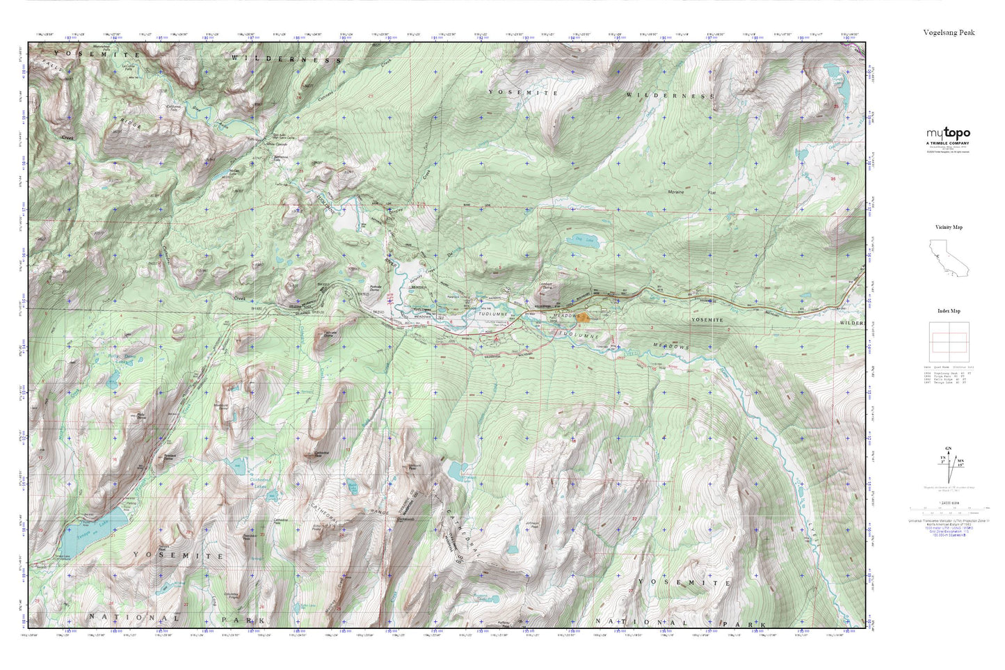
Topographic map of Tuolumne Meadows in the state of California. From the MyTopo Explorer Series.
This topo map features shaded relief and comes with UTM / MGRS and Latitude/Longitude grids.
For more than two decades, MyTopo has provided maps to the most adventurous among us.. those who love to explore our nation’s remote wilderness areas, climb our highest peaks, and trek across our vast public lands. This map is part of a curated collection of the most popular places for which MyTopo customers have designed maps. It is a “bucket list” of the most amazing places to hike, hunt, and explore.
This map contains the following named places: Budd Creek,Budd Lake,Cathedral Lakes,Cathedral Pass,Cathedral Peak,Cockscomb,Cold Canyon,Conness Creek,Dana Fork,Delaney Creek,Dingley Creek,Dog Lake,Echo Peaks,Elizabeth Lake,Fairview Dome,Falls Ridge,Glen Aulin,Glen Aulin High Sierra Camp,Johnson Peak,Lembert Dome,Lyell Canyon,Lyell Fork,Matthes Crest,McGee Lake,Medlicott Dome,Moraine Flat,Murphy Creek,Parsons Memorial Lodge,Polly Dome,Polly Dome Lakes,Pothole Dome,Puppy Dome,Pywiack Dome,Rafferty Creek,Soda Springs,Tenaya Lake,Tenaya Lake Campground,Tenaya Peak,Tresidder Peak,Tuolumne Falls,Tuolumne Meadows,Tuolumne Meadows Campground,Tuolumne Meadows Lodge,Tuolumne Meadows Ranger Station,Unicorn Creek,Unicorn Peak,White Cascade