MyTopo
Irish Wilderness MyTopo Explorer Series Map
Couldn't load pickup availability
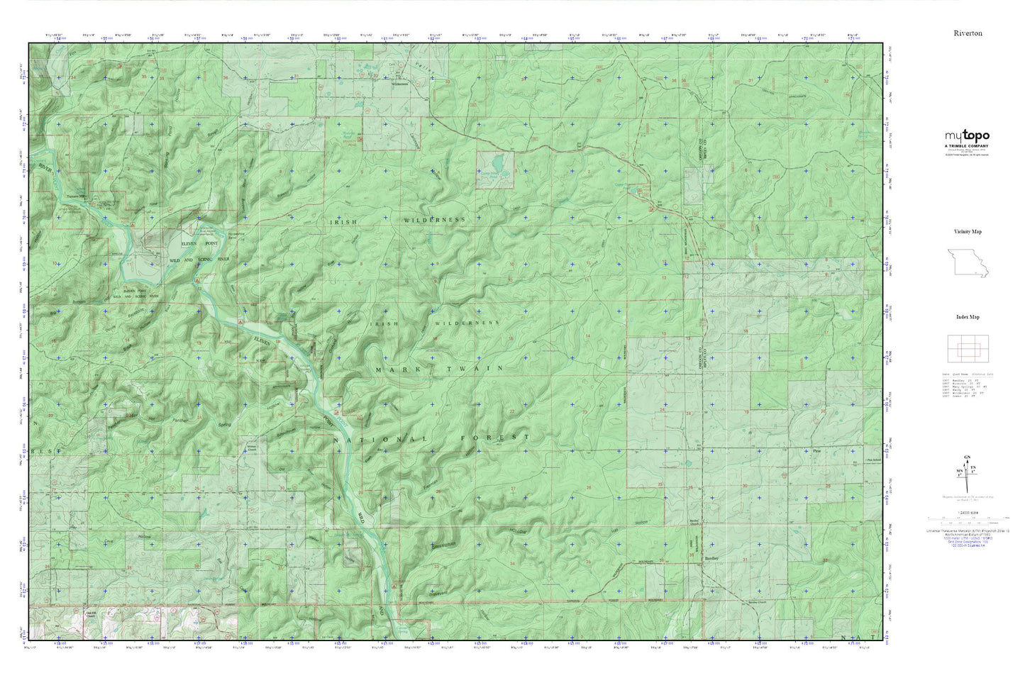
Topographic map of Irish Wilderness in the state of Missouri. From the MyTopo Explorer Series.
This topo map features shaded relief and comes with UTM / MGRS and Latitude/Longitude grids.
For more than two decades, MyTopo has provided maps to the most adventurous among us.. those who love to explore our nation’s remote wilderness areas, climb our highest peaks, and trek across our vast public lands. This map is part of a curated collection of the most popular places for which MyTopo customers have designed maps. It is a “bucket list” of the most amazing places to hike, hunt, and explore.
This map contains the following named places: Bardley,Bardley Cemetery,Bardley Church,Barn Hollow,Barn Hollow Float Camp,Big Bottom Hollow,Bill Deckard Hollow,Black Hollow,Bliss Hollow,Bliss Spring,Bliss Spring Campground,Brawley Hollow,Brawley Pond,Buck Bay Hollow,C C C Camp,Camp Five Pond,Camp Nine Pond,Charter Oak School,Coin,Coin Post Office,Conner Hill,Devils Backbone,Dry Prong,Eleven Point Wild and Scenic River,Fiddler Spring,Freeman Hollow,Greenbriar Float Camp,Greenbriar Hollow,Hay Hollow,Horseshoe Bend,Hurricane Creek,Irish Wilderness,Jones Spring,Larimore Hollow,Lime Kiln Hollow,Lost Pond,Mary Deckard Shoals,McFry Ford,Old River Hollow,Orchard Hollow,Panther Spring,Panther Spring Hollow,Powder Mill Spring,Rough Hollow,Schoolhouse Hollow,Slash Bay Hollow,Stillhouse Hollow,Stinking Pond Float Camp,Stinking Pond Hollow,Surprise School,Tater Hill,Taylor Lake Dam,Township of Goebel,Township of King,Tumbling Shoal Hollow,Turners Mill,Turners Mill North Access,Turners Mill South Access,Turners Spring,Walker Hollow,Whites Creek,Whites Creek Float Camp,Whitten Access,Whitten Church,Whitten School,Windy Lookout Tower