MyTopo
BEAR HOLLOW MyTopo Explorer Series Map
Couldn't load pickup availability
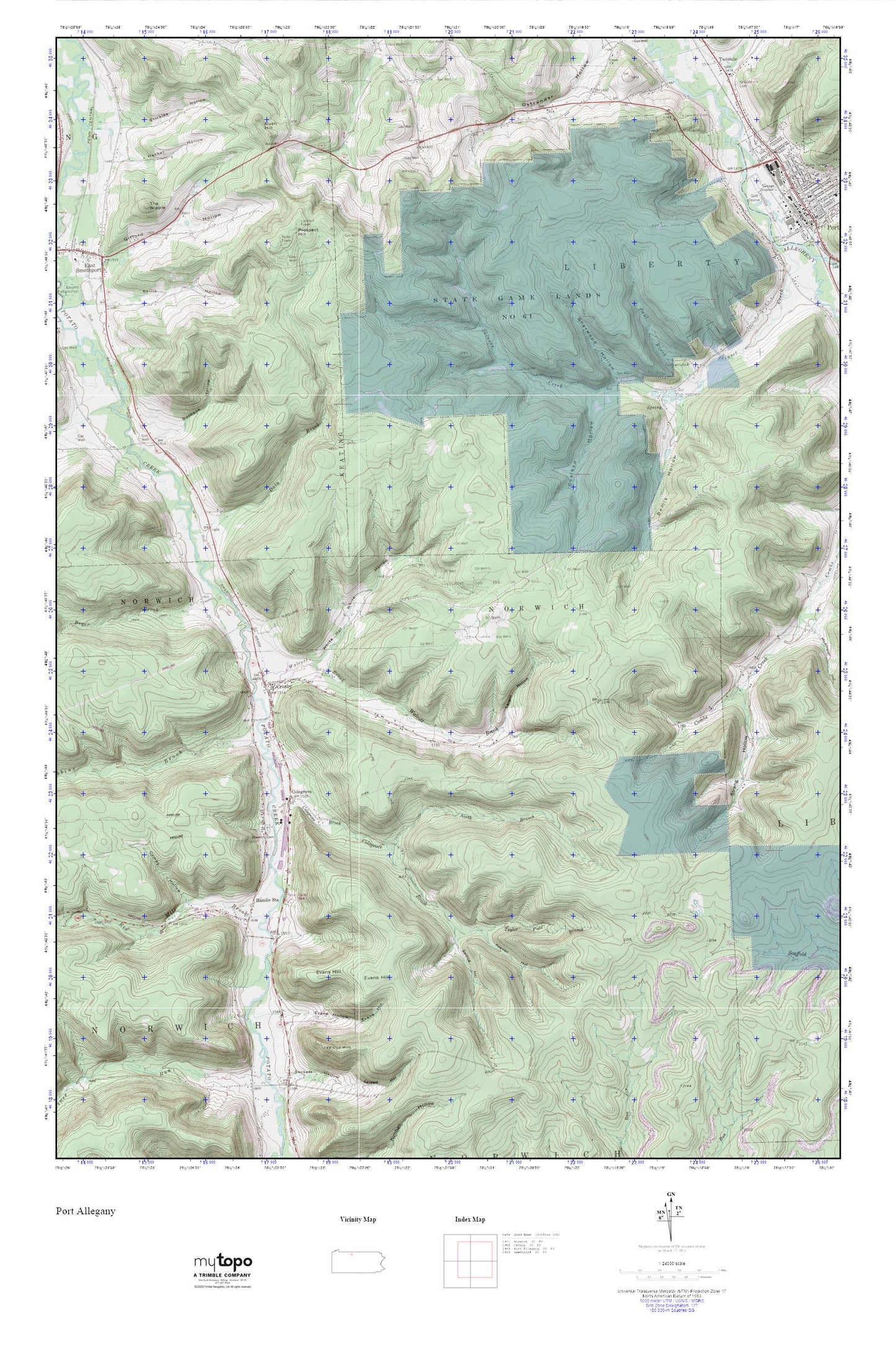
Topographic map of BEAR HOLLOW in the state of Pennsylvania. From the MyTopo Explorer Series.
This topo map features shaded relief and comes with UTM / MGRS and Latitude/Longitude grids.
For more than two decades, MyTopo has provided maps to the most adventurous among us.. those who love to explore our nation’s remote wilderness areas, climb our highest peaks, and trek across our vast public lands. This map is part of a curated collection of the most popular places for which MyTopo customers have designed maps. It is a “bucket list” of the most amazing places to hike, hunt, and explore.
This map contains the following named places: 16724,Bemis Hollow,Boyer Brook,Burbank Hollow,Bush Hill,Bush Hill School,Coalbed Hollow,Colegrove,Colegrove Brook,Colegrove Gas and Oil Field,Combs Hollow,Crosby,Crosby Post Office,Daly Brook,Evans Hill,Evans Hollow,Hacket Hollow,Hamlin Station,Keesler Hollow,Larson Hollow,Lewis Hill Cemetery,Lower Open Brook School,North Branch Colegrove Brook,Norwich Cemetery,Norwich Township Volunteer Fire Department - Station 12,Paul Brook,Pospect Hill Lookout Tower,Prospect Hill,Red Mill Brook,Robbins Brook,Saint Gabriels Cemetery,Saltlog Hollow,Sherwood Hollow,Skinner Creek,State Game Lands Number 61,Stickles Hollow,Strang Hollow,Susquehanna State Forest,Taylor Field Branch,The Nipple,Twomile,Twomile Creek,Twomile School,Upper Open Brook School,Walcott Brook,White Hollow