
MyTopo
Loon Lake MyTopo Explorer Series Map
Couldn't load pickup availability
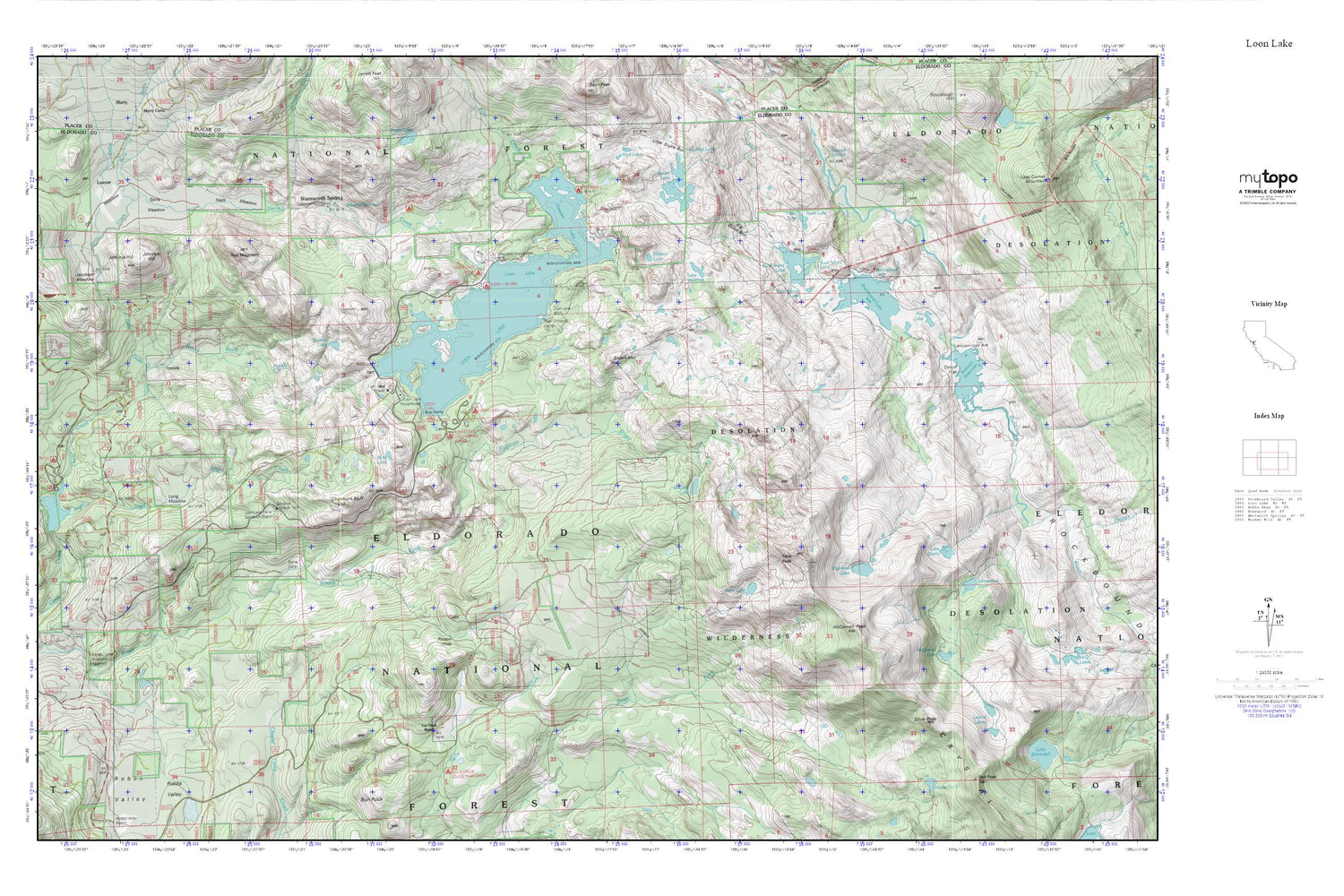
Topographic map of Loon Lake in the state of California. From the MyTopo Explorer Series.
This topo map features shaded relief and comes with UTM / MGRS and Latitude/Longitude grids.
For more than two decades, MyTopo has provided maps to the most adventurous among us.. those who love to explore our nation’s remote wilderness areas, climb our highest peaks, and trek across our vast public lands. This map is part of a curated collection of the most popular places for which MyTopo customers have designed maps. It is a “bucket list” of the most amazing places to hike, hunt, and explore.
This map contains the following named places: Angel Creek,Barts Creek,Berts Lake,Big Sluice Box,Brown Mountain,Buck Island 1009-008 Dam,Buck Island Lake,Chipmunk Bluff,Dellar Creek,Ditch Camp,Ellis Creek,Fawn Lake,Forni Lake,Fox Lake,Francis Cow Camp,Francis Lake,Gerle,Gerle 1009-005 Dam,Gerle Creek Campground,Gerle Creek Divide Reservoir,Gerle Meadow,Hidden Lake,Highland Lake,Highland Lake 1-031 Dam,Highland Trail,Horseshoe Lake,Jacobsen,Jacobsen Meadow,Jerrett Creek,Johnnys Hill,Lake Winifred,Lake Zitella,Lawyer Cow Camp,Leland Lakes,Long Meadow,Loon Lake,Loon Lake 1009-007 Dam,Loon Lake Camp,Loon Lake Campground,Loon Lake Trail,McConnell Lake,McConnell Peak,Mineral Springs,Mud Lake,Mud Lakes,Neck Meadow,Onion Flat,Pleasant Boat-In Campground,Poison Hole,Poison Hole Trail,Red Mountain,Red Peak Trail,Robbs Peak 1009-006 Dam,Robbs Valley,Rockbound Lake,Rockbound Valley,Rocky Basin Creek,Rubicon 1009-009 Dam,Rubicon Reservoir,Rubicon Springs,Schlein Ranger Station,Shadow Lake,Silver Peak,Spider Lake,Stone Cellar,Tells Peak,Van Vleck Ranch,Van Vleck Tells Peak Airport,Wentworth Springs,Wentworth Springs Campground


