MyTopo
Tower Peak MyTopo Explorer Series Map
Couldn't load pickup availability
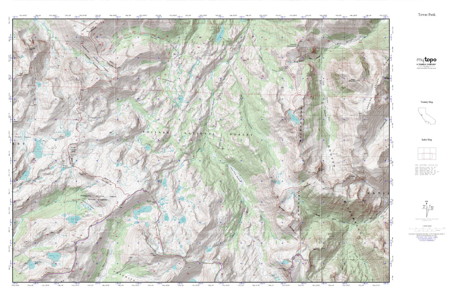
Topographic map of Tower Peak in the state of California. From the MyTopo Explorer Series.
This topo map features shaded relief and comes with UTM / MGRS and Latitude/Longitude grids.
For more than two decades, MyTopo has provided maps to the most adventurous among us.. those who love to explore our nation’s remote wilderness areas, climb our highest peaks, and trek across our vast public lands. This map is part of a curated collection of the most popular places for which MyTopo customers have designed maps. It is a “bucket list” of the most amazing places to hike, hunt, and explore.
This map contains the following named places: Anna Lake,Beartrap Lake,Bigelow Lake,Bigelow Lake 1-026 Dam,Bond Pass,Bonnie Lake,Cascade Creek,Cascade Falls,Chain of Lakes,Cinko Lake,Cora Lake,Dorothy Lake,Dorothy Lake Pass,Emigrant Meadow,Emigrant Meadow Lake,Emigrant Pass,Flatiron Butte,Forsyth Peak,Grizzly Lake,Grizzly Meadow,Grizzly Peak,Grouse Mountain,Hanna Mountain,High Emigrant Lake,High Emigrant Lake 1-027 Dam,Horse Meadow,Horse Meadow Reservoir,Kennedy Canyon,Kennedy Peak,Kirkwood Creek,Kirkwood Lake,Lake Harriet,Lake Helen,Lake Ruth,Long Canyon,Lost Lake,Lower Long Lake,Lower Piute Meadows,Middle Emigrant Dam,Middle Emigrant Lake,Molo Mountain,Montezuma Mine,Piute Cabin,Piute Canyon,Piute Pass,Snow Lake,Snowlake Dam,Snowlake Reservoir,Stella Lake,Summit Meadow,Tower Canyon,Tower Lake,Upper Long Lake,Upper Piute Meadows,Walker Meadows