MyTopo
Banff MyTopo Explorer Series Map
Couldn't load pickup availability
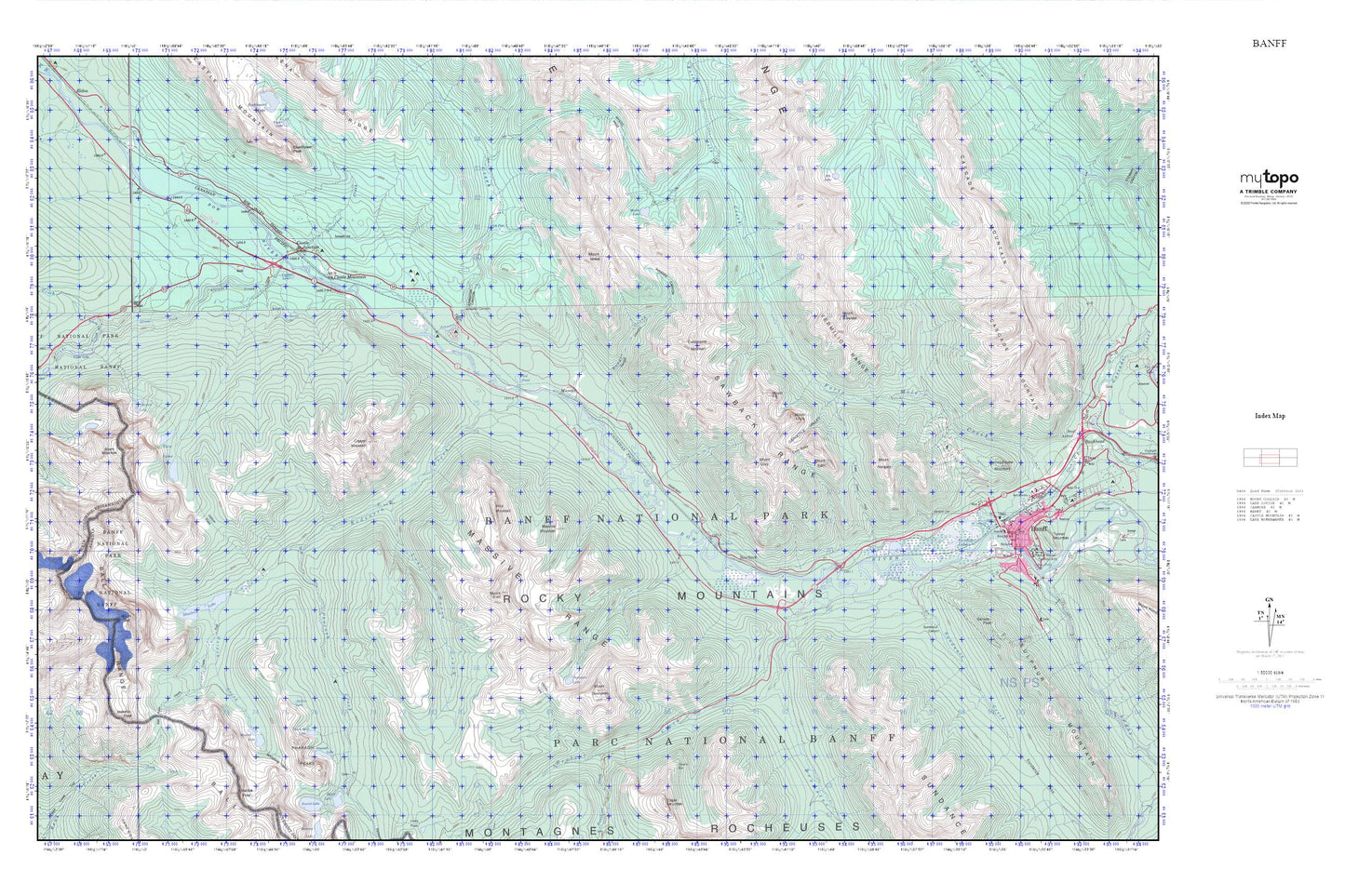
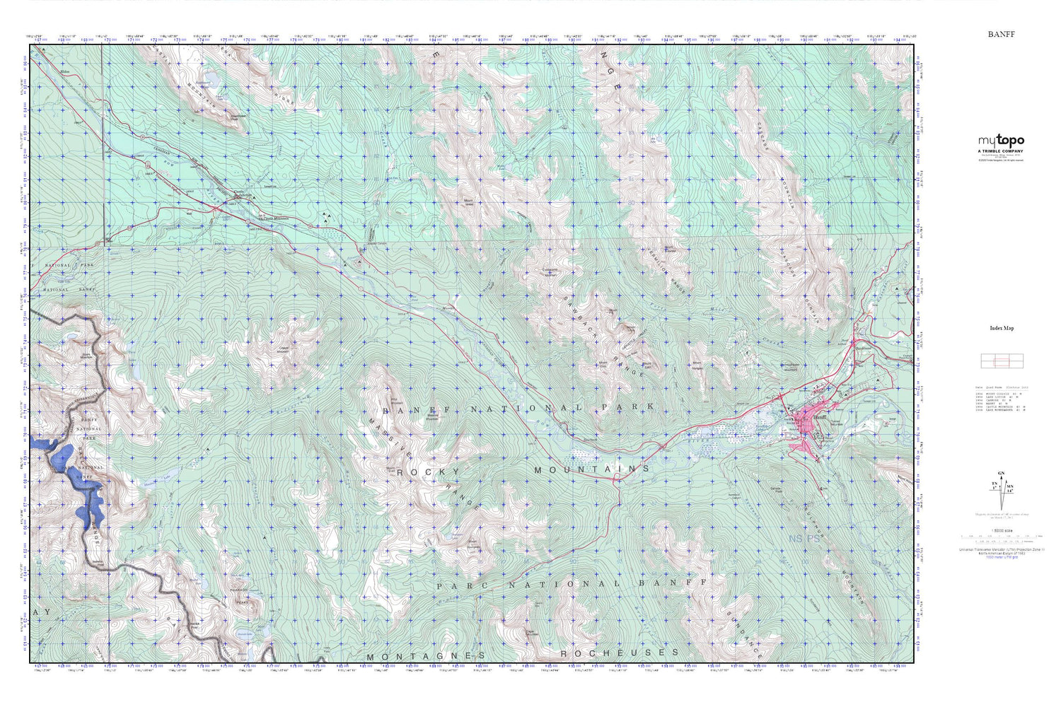
Topographic map of Banff in the Canadian province of Alberta. From the MyTopo Explorer Series.
This topo map features shaded relief and comes with UTM / MGRS and Latitude/Longitude grids.
For more than two decades, MyTopo has provided maps to the most adventurous among us.. those who love to explore our nation’s remote wilderness areas, climb our highest peaks, and trek across our vast public lands. This map is part of a curated collection of the most popular places for which MyTopo customers have designed maps. It is a “bucket list” of the most amazing places to hike, hunt, and explore.
This map contains the following named places: Altrude Creek,Black Rock Lake,Bourgeau Lake,Brewster Creek,Camp's Head,Castle Junction,Castle Mountain,Cockscomb Mountain,Copper Lake,Copper Mountain,Cory Pass,Elk Lake,Gargoyle Valley,Gibbon Pass,Goat's Eye,Haiduk Creek,Haiduk Lake,Harvey Pass,Healy Creek,Ink Pots,Johnston Canyon,Johnston Creek,Lost Horse Creek,Massive,Massive Mountain,Massive Range,Mount Bourgeau,Mount Brett,Mount Brewster,Mount Cory,Mount Edith,Mount Fifi,Mount Ishbel,Mount Louis,Mount Norquay,Mule Shoe Lake,Mystic Lake,Pharaoh Creek,Pharaoh Lake,Pharaoh Peaks,Pilot Mountain,Pilot Pond,Ranger Canyon,Ranger Creek,Redearth Creek,Sawback,Shadow Lake,Silverton Creek,Smith Lake,Sphinx Lake,Sundance Creek,Sunshine Creek,Twin Lakes,Whistling Valley