MyTopo
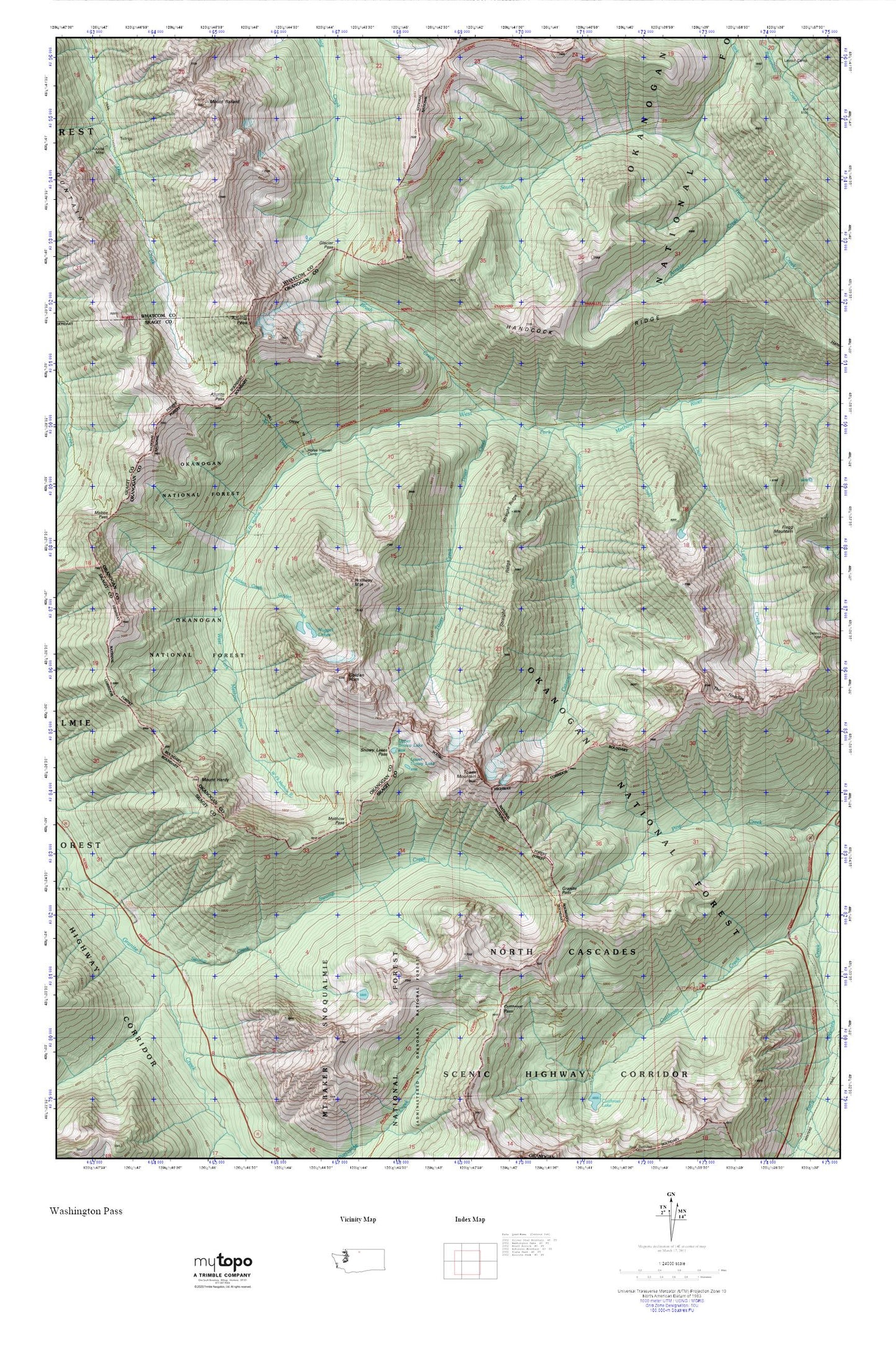
Cutthroat Pass_The PCT MyTopo Explorer Series Map
Couldn't load pickup availability
Topographic map of Cutthroat Pass_The PCT in the state of Washington. From the MyTopo Explorer Series.
This topo map features shaded relief and comes with UTM / MGRS and Latitude/Longitude grids.
For more than two decades, MyTopo has provided maps to the most adventurous among us.. those who love to explore our nation’s remote wilderness areas, climb our highest peaks, and trek across our vast public lands. This map is part of a curated collection of the most popular places for which MyTopo customers have designed maps. It is a “bucket list” of the most amazing places to hike, hunt, and explore.
This map contains the following named places: Azurite Pass,Azurite Peak,Brush Creek,Cataract Creek,Cutthroat Pass,Glacier Pass,Golden Creek,Golden Horn,Granite Pass,Grasshopper Pass,Handcock Ridge,Holliway Mountain,Horse Heaven,Horse Heaven Camp,Jet Creek,Leap Creek,Lower Snowy Lake,Methow Pass,Mount Ballard,Mount Hardy,Needle Creek,North Fork Trout Creek,Nugget Lakes,Snowy Lakes,Snowy Lakes Pass,South Fork Trout Creek,Straight Ridge,The Needles,Tower Creek,Tower Mountain,Upper Snowy Lake,West Fork Methow River,West Fork Methow Trail