MyTopo
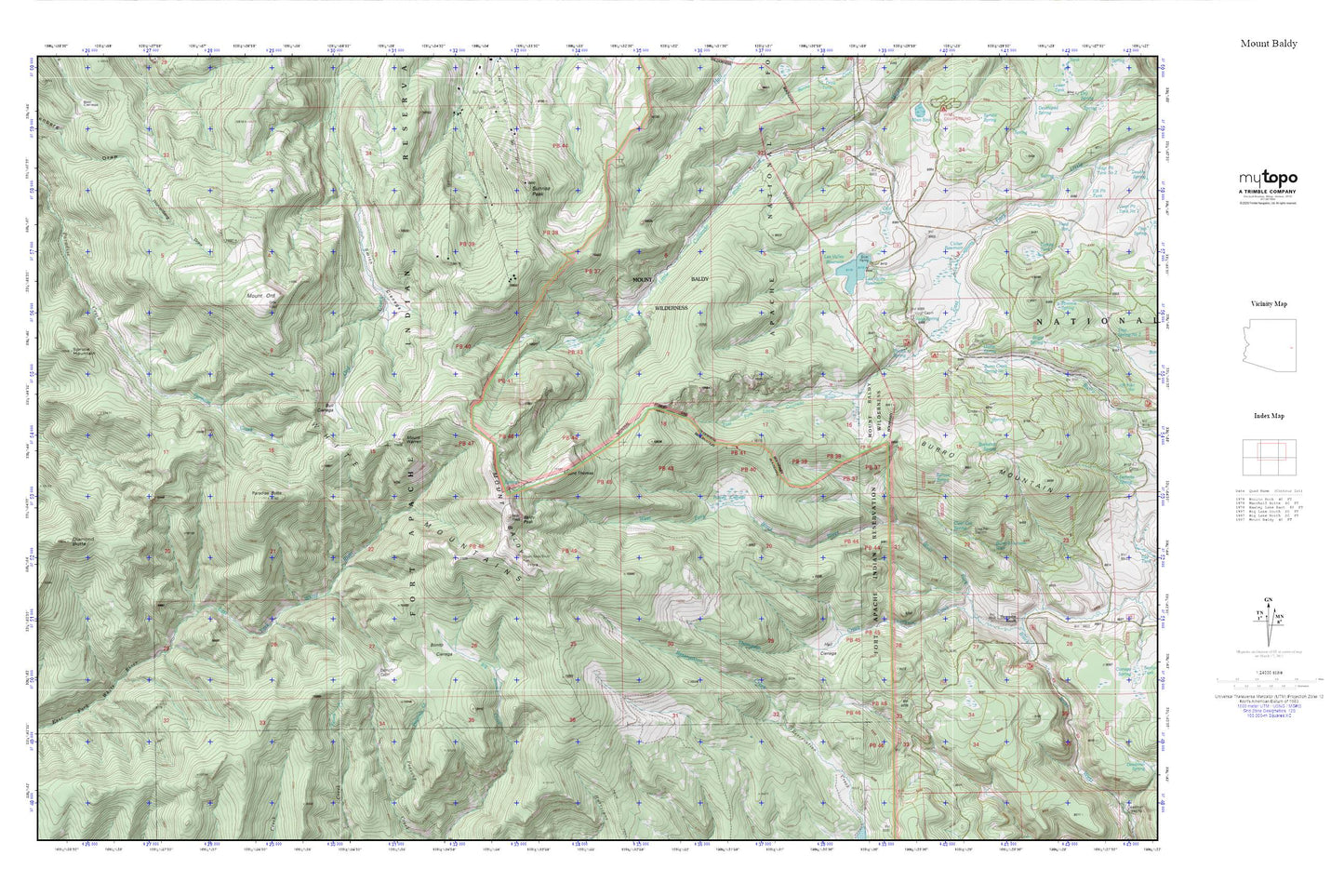
Mount Baldy MyTopo Explorer Series Map
Couldn't load pickup availability
Topographic map of Mount Baldy in the state of Arizona. From the MyTopo Explorer Series.
This topo map features shaded relief and comes with UTM / MGRS and Latitude/Longitude grids.
For more than two decades, MyTopo has provided maps to the most adventurous among us.. those who love to explore our nation’s remote wilderness areas, climb our highest peaks, and trek across our vast public lands. This map is part of a curated collection of the most popular places for which MyTopo customers have designed maps. It is a “bucket list” of the most amazing places to hike, hunt, and explore.
This map contains the following named places: Baldy Peak,Bonito Cienega,Buckshot Spring,Bull Cienega,Burro Creek,Burro Creek Spring Number 1,Burro Mountain,Burro Mountain Weir,Clear Cut Spring,Cold Spring,Colter Reservoir,Damoff Cabin,Diamond Butte,Dump Spring,Gabaldon Campground,Hall Cienega,Lee Valley Dam,Lee Valley Reservoir,Lee Valley Reservoir Boat Launch,Mount Baldy,Mount Baldy Wilderness,Mount Ord,Mount Thomas,Mount Warren,Paradise Butte,Phelps Fire Station,Phelps Forest Service Facility,Phelps Ranch,Phelps Spring,Purcell Cienega,River Number One Dam,Sheep Crossing Campground,Sheep Crossing/Baldy Ninetyfour Trail,Smith Cienega,Spruce Mountain,Spruce Spring,Sunrise Peak,Thompson Creek,Thompson Ranch,Voigt Ranch,Voigt Spring,White Mountains