
MyTopo
Cobham MyTopo Explorer Series Map
Couldn't load pickup availability
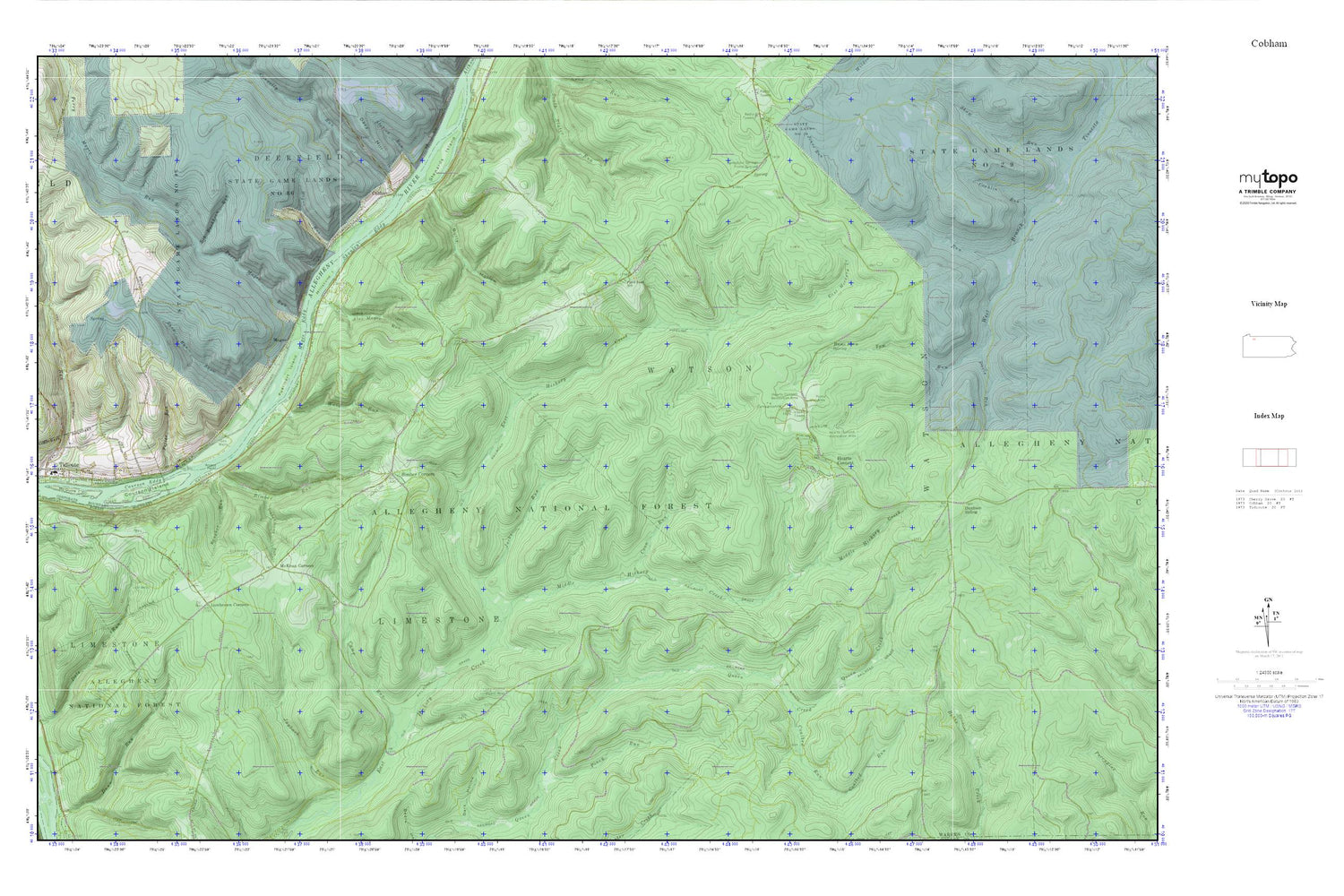
Topographic map of Cobham in the state of Pennsylvania. From the MyTopo Explorer Series.
This topo map features shaded relief and comes with UTM / MGRS and Latitude/Longitude grids.
For more than two decades, MyTopo has provided maps to the most adventurous among us.. those who love to explore our nation’s remote wilderness areas, climb our highest peaks, and trek across our vast public lands. This map is part of a curated collection of the most popular places for which MyTopo customers have designed maps. It is a “bucket list” of the most amazing places to hike, hunt, and explore.
This map contains the following named places: 16351,Access Point,Alex Magee Run,Baugher Run,Big Buckhorn Run,Bimber Corners,Bimber Run,Borough of Tidioute,Bully Hollow,Camp Run,Coalbed Run,Cobham,Cobham School,Connelly Run,Coon Run,Courson Eddy,Courson Island,Davis Run,Dunham Siding,Dutchmans Run,Economite Hill,Fuellhart Island,Gillis,Hague Run,Hearts Content,Hearts Content Recreation Site,Hickory Creek Trail,Hickory Creek Wilderness,Izenbrown Corners,Jacks Run,Jacks Trail,Limestone Cemetery,Long Hollow Picnic Area,Magee,Magee Eddy,Magee Trail,McGuire School,McKean Corners,McKean School,Middle Hickory Creek,Millstone Island,Perry Magee Run,Piney Run,Plank Road School,Potter Run,Rams Horn Spring,Russian Houses,Sandstone Springs,Sandstone Springs Picnic Ground,Shanley Eddy,Snow Run,State Game Lands Number 86,Station Run,Stewards Island,Tanbark Trail,Tidioute Airport,Tidioute Overlook,Tom Run,Township of Limestone,Township of Watson,Waid Run,Watson School,Wheeler Fire Tower


