
MyTopo
Black Moshannon MyTopo Explorer Series Map
Couldn't load pickup availability
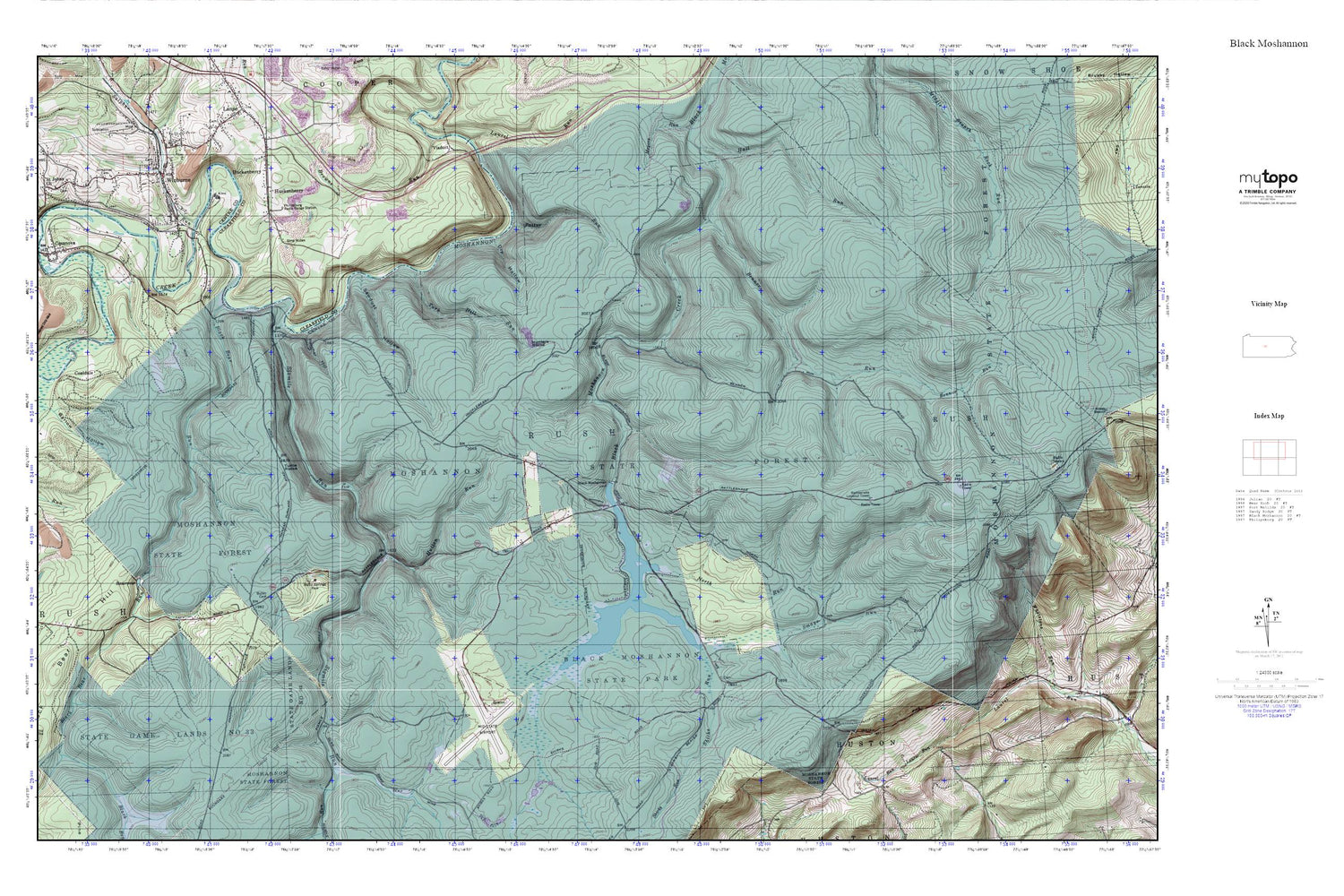
Topographic map of Black Moshannon in the state of Pennsylvania. From the MyTopo Explorer Series.
This topo map features shaded relief and comes with UTM / MGRS and Latitude/Longitude grids.
For more than two decades, MyTopo has provided maps to the most adventurous among us.. those who love to explore our nation’s remote wilderness areas, climb our highest peaks, and trek across our vast public lands. This map is part of a curated collection of the most popular places for which MyTopo customers have designed maps. It is a “bucket list” of the most amazing places to hike, hunt, and explore.
This map contains the following named places: 16849,Antes,Arctic Springs,Arctic Springs Park,Barlow Hollow,Beaver Mills,Beaver Mills Cemetery,Benner Run,Black Bear Run,Black Bear Trail,Black Moshannon Dam,Black Moshannon Lake,Black Moshannon State Park,Boy Scouts of America Camp,Butler Cemetery,Casanova,Casanova Census Designated Place,Coaldale,Dry Hollow,Dry Hollow Trail,Forest Baptist Cemetery,Groe Run,Hall Run,Huckenberry,Hunters Rocks,Hutton Run,Immanuel Cemetery,Kephart Dam,Mid-State Airport,Moshannon State Forest,North Run,North Run Trail,Old Huckleberry Trail,Panther Hollow,Philipsburg Radio Range Station,Potter Run,Rattlesnake Lookout Tower,Rattlesnake Trail,Rusnak Mine,Saint Johns Church,Sawdust Hollow,Shirks Run,Short Trail,Sixmile Run,Smays Run,Smays Trail,Sulphur Run,Tark Hill Run,Turtle Rocks,Unknown Catholic Cemetery,Unknown Cemetery,Wilburne Station,Winburne,Winburne Post Office,Winburne Volunteer Fire Company Station 18


