MyTopo
Parmachenee Lake MyTopo Explorer Series Map
Couldn't load pickup availability
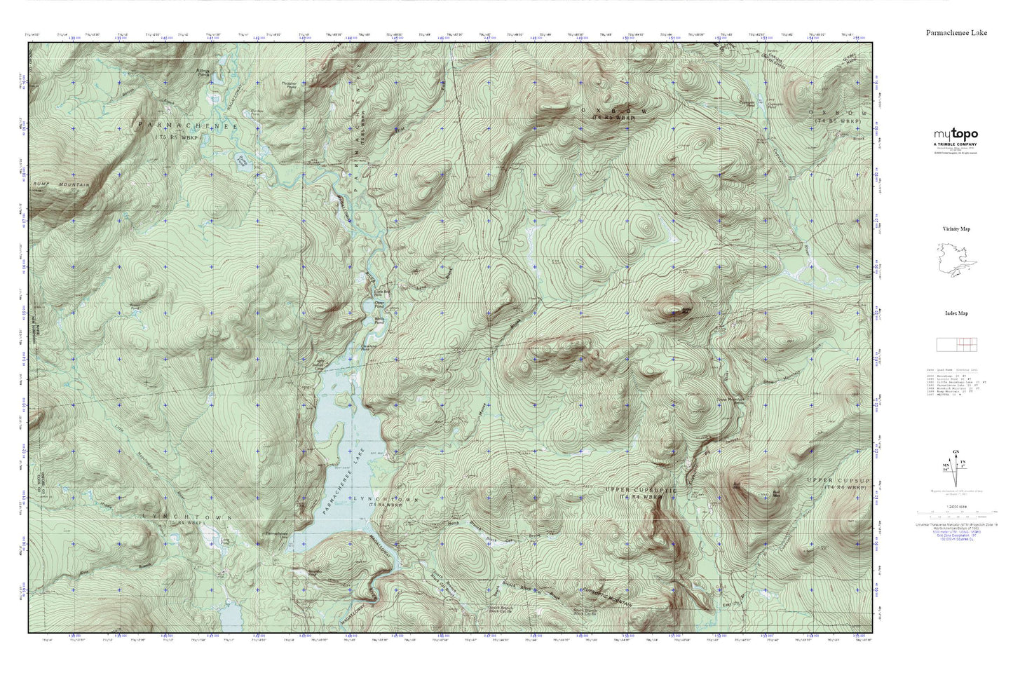
Topographic map of Parmachenee Lake in the state of Maine. From the MyTopo Explorer Series.
This topo map features shaded relief and comes with UTM / MGRS and Latitude/Longitude grids.
For more than two decades, MyTopo has provided maps to the most adventurous among us.. those who love to explore our nation’s remote wilderness areas, climb our highest peaks, and trek across our vast public lands. This map is part of a curated collection of the most popular places for which MyTopo customers have designed maps. It is a “bucket list” of the most amazing places to hike, hunt, and explore.
This map contains the following named places: Beaver Pond,Bereau Brook,Big Canyon,Black Cat Brook,Bottle Mountain,Caribou Pond,Cleveland Pond,Depot Camp,First East Branch Magalloway River,Indian Cove,Little Boy Falls,Long Pond,Lynx Brook,Middle Branch Little Magalloway River,Moose Brook,Moose Brook Camp,North Branch Black Cat Brook,Number Two Camp,Otter Pond,Oxbow Township,Parmachenee Club,Parmachenee Lake,Rump Pond,Saturday Pond,South Branch Black Cat Brook,Township of Parmachenee,Trestle Brook,Wells Pond,West Branch Little Magalloway River