
MyTopo
Steamboat Lake MyTopo Explorer Series Map
Couldn't load pickup availability
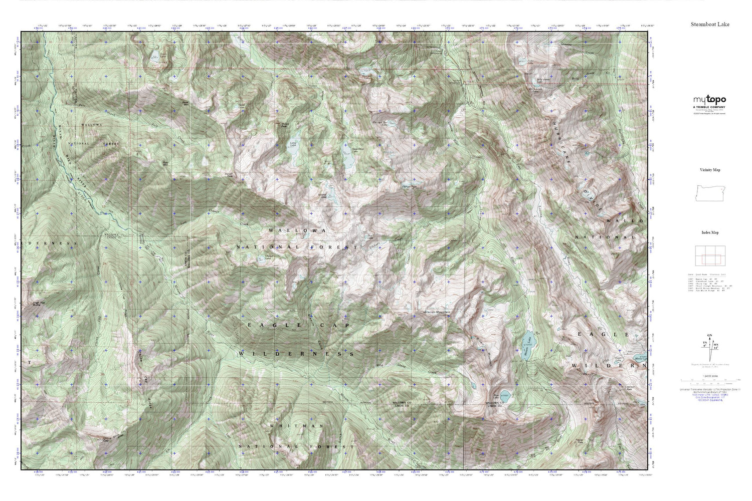
Topographic map of Steamboat Lake in the state of Oregon. From the MyTopo Explorer Series.
This topo map features shaded relief and comes with UTM / MGRS and Latitude/Longitude grids.
For more than two decades, MyTopo has provided maps to the most adventurous among us.. those who love to explore our nation’s remote wilderness areas, climb our highest peaks, and trek across our vast public lands. This map is part of a curated collection of the most popular places for which MyTopo customers have designed maps. It is a “bucket list” of the most amazing places to hike, hunt, and explore.
This map contains the following named places: Big Minam Guard Station,Blue Lake,Brown Mountain,Catched Two Lake,Cheval Lake,China Cap Creek,Copper Creek,Copper Creek Trail,Eagle Cap Wilderness,East Fork Elk Creek,East Lostine River,Elk Creek,Elkhorn Creek,Elkhorn Peak,Glacier Mountain,Granite Gulch,Hazel Lake,Hazel Mountain,Katy Mountain,Lackey Creek,Last Chance Creek,Long Lake,Lowry Gulch,Minam Lake,Minam Lake Dam,Minam Peak,Pole Creek,Pot Creek,Rock Creek,Sky Lake,Steamboat Lake,Sturgill Peak,Swamp Lake,Two Pan Trailhead,Wild Sheep Creek


