MyTopo
Hunter Mesa MyTopo Explorer Series Map
Couldn't load pickup availability
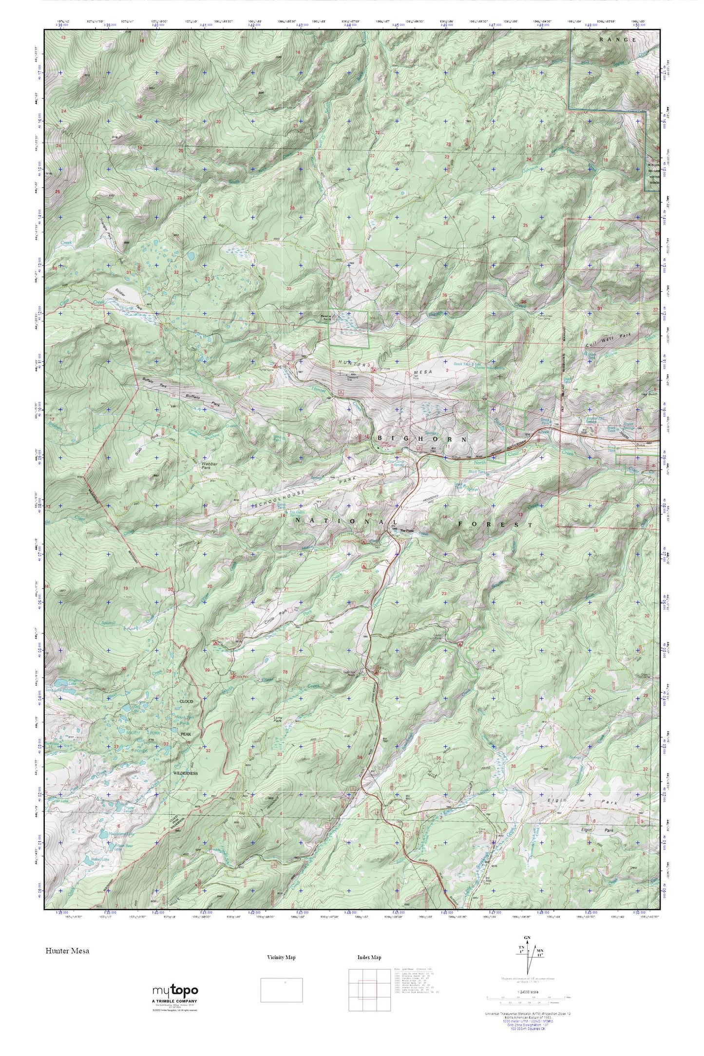
Topographic map of Hunter Mesa in the state of Wyoming. From the MyTopo Explorer Series.
This topo map features shaded relief and comes with UTM / MGRS and Latitude/Longitude grids.
For more than two decades, MyTopo has provided maps to the most adventurous among us.. those who love to explore our nation’s remote wilderness areas, climb our highest peaks, and trek across our vast public lands. This map is part of a curated collection of the most popular places for which MyTopo customers have designed maps. It is a “bucket list” of the most amazing places to hike, hunt, and explore.
This map contains the following named places: Buffalo Park,Circle Park,Circle Park Campground,Circle Park Creek,County Youth Camp,Cow Camp Spring,Duck Creek,East Hunter Mesa Spring,Foot Creek,Fox Cabin Spring,French Creek Cow Camp,Hettinger Picnic Area,Hondo Creek,Hospital Hill Springs,Hunter Corral,Hunter Creek,Hunter Mesa,Hunter Ranger Station,Keno Creek,Little Sourdough Creek,Lucasta Camp,Lynx Park,Middle Clear Creek,Middle Fork Campground,North Fork Picnic Area,Oliver Creek,Paradise Ranch,Rabbit Creek,Sawmill Creek,Schoolhouse Park,Seven Brothers Creek,Sherd Lake,Slab Park,Soldier Park,Soldier Park Cemetery,Sourdough Campground,Sourdough Creek,South Fork Campground,South Fork Pond Dam,South Fork Ponds,The Pines,Tie Hack Campground,Trigger Lake,Webber Park