MyTopo
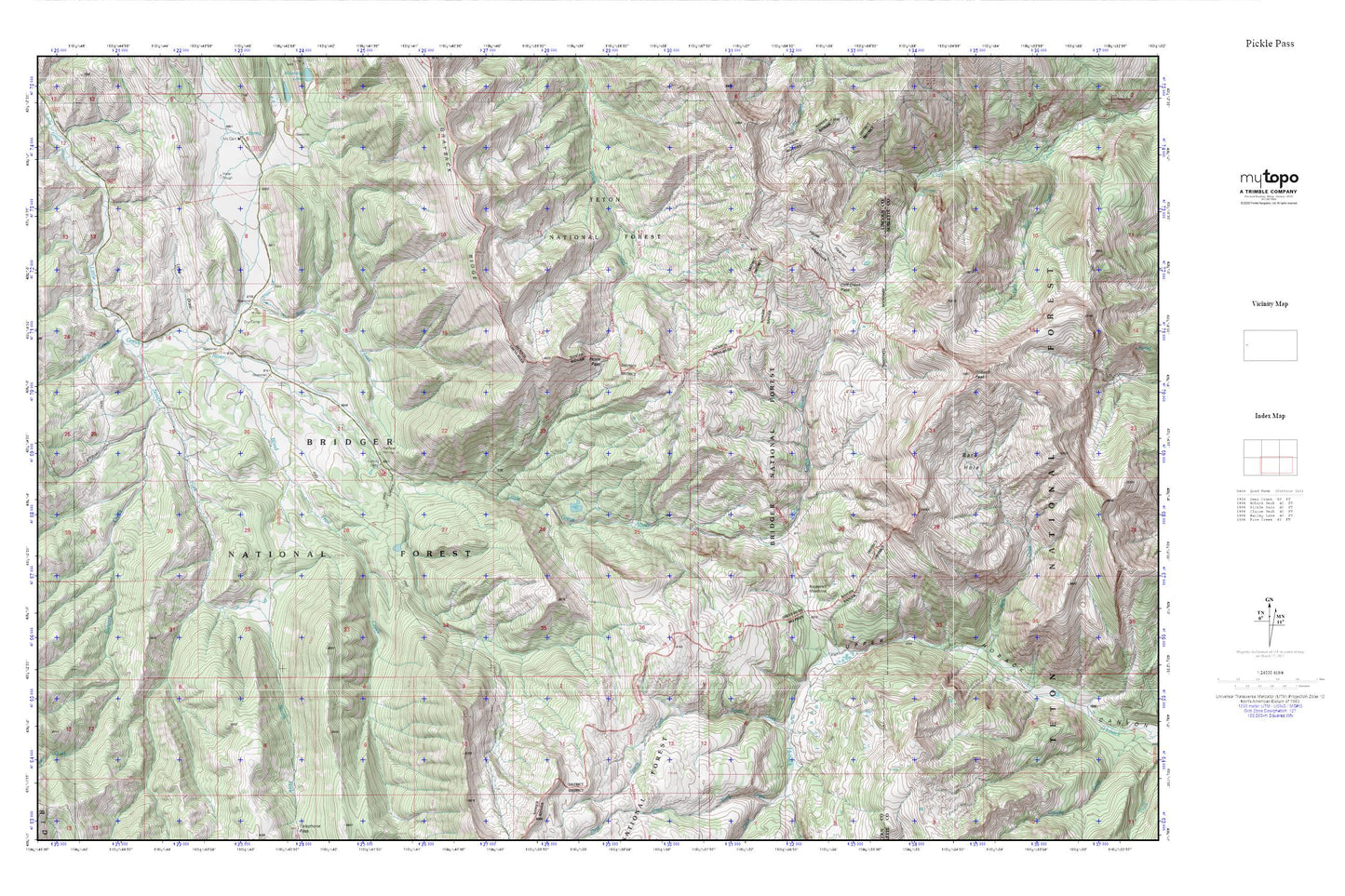
Pickle Pass MyTopo Explorer Series Map
Couldn't load pickup availability
Topographic map of Pickle Pass in the state of Wyoming. From the MyTopo Explorer Series.
This topo map features shaded relief and comes with UTM / MGRS and Latitude/Longitude grids.
For more than two decades, MyTopo has provided maps to the most adventurous among us.. those who love to explore our nation’s remote wilderness areas, climb our highest peaks, and trek across our vast public lands. This map is part of a curated collection of the most popular places for which MyTopo customers have designed maps. It is a “bucket list” of the most amazing places to hike, hunt, and explore.
This map contains the following named places: 83128,Alpine Mine,Bare Hole,Blind Trail Creek,Cliff Creek Falls,Cliff Creek Pass,Fourth Creek,Grayback Ridge,Hoback Peak,Horse Heaven Meadows,Long Draw,Middle Creek,Pickle Pass,Roosevelt Meadows,South Fork Little Greys River,Steer Creek,Stewart Creek