MyTopo
Sand Lake MyTopo Explorer Series Map
Couldn't load pickup availability
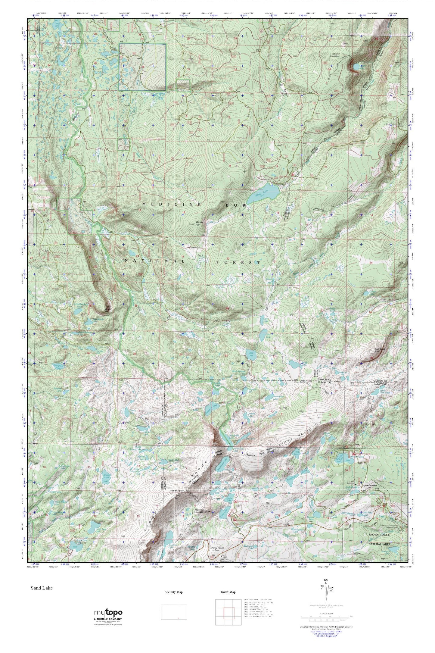
Topographic map of Sand Lake in the state of Wyoming. From the MyTopo Explorer Series.
This topo map features shaded relief and comes with UTM / MGRS and Latitude/Longitude grids.
For more than two decades, MyTopo has provided maps to the most adventurous among us.. those who love to explore our nation’s remote wilderness areas, climb our highest peaks, and trek across our vast public lands. This map is part of a curated collection of the most popular places for which MyTopo customers have designed maps. It is a “bucket list” of the most amazing places to hike, hunt, and explore.
This map contains the following named places: Arrowhead Lake,Black Spotted Lake,Bow River Observation Site,Bow River Overlook,Brady Lake,Brooklyn Lake,Brooklyn Lake Campground,Brooklyn Lake Guard Station,Browns Peak,Campbell Lake,Carlson Park,Carlson Park Guard Station,Cascade Lake,Circle Trail,Class Lake,Corral Lake,Crater Lake,Crescent Lake,Cutthoat Lake,Deep Creek Campground,Deep Lake,Dipper Lake,Drillers Lake,East Banner Lake,Edwards Lake,First Enlargement of Wiant Dam,Fishhook Lake,Glacier Lakes,Golden Crown Mining Syndicate Mine,Golden Lake,Grassy Lake,Hatchet Lake,Heart Lake,Jeff Lake,Johnson Park,Klondike Lake,Lewis Lake,Lewis Lake Campground,Little Brooklyn Lake,Little Brooklyn Lake Dam,Little Long Lake,Lookout Mountain,Lost Lake,Meadows Lakes,Medicine Bow Peak,Middle Long Lake,Mutt Lake,North Banner Lake,North Gap Lake,Open Air Chapel,Pinchot Lake,Pine Butte,Quealy Lake,Reservoir Lake,Rock Creek Knoll,Round Lake,Sand Lake,Sand Lake Lodge,Sandy Lake,Scott Lake,Sheep Lake,Shelf Lakes,Silverman Lake,Snow Bank Lake,Snowy Range,South Banner Lake,South Gap Lake,Stillwater Park,Telephone Lakes,Upper Long Lake,Vagner Lake,Vosseller Lake,Waterloo Prospect,Wheatland Reservoir Dam,Wiant Number 2 Dam,Wiant Reservoir,Windy Hill


