
MyTopo
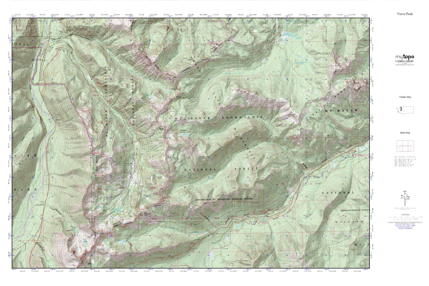
Norse Peak MyTopo Explorer Series Map
Couldn't load pickup availability
Topographic map of Norse Peak in the state of Washington. From the MyTopo Explorer Series.
This topo map features shaded relief and comes with UTM / MGRS and Latitude/Longitude grids.
For more than two decades, MyTopo has provided maps to the most adventurous among us.. those who love to explore our nation’s remote wilderness areas, climb our highest peaks, and trek across our vast public lands. This map is part of a curated collection of the most popular places for which MyTopo customers have designed maps. It is a “bucket list” of the most amazing places to hike, hunt, and explore.
This map contains the following named places: Barnard Saddle,Basin Lake,Bear Gap,Big Crow Basin,Blue Bell Pass,Bullion Basin,Castle Mountain,Cement Basin,Cement Creek,Crown Point,Crystal Creek,Crystal Lake,Crystal Mountain,Crystal Mountain Area,Crystal Mountain Ski Resort,Elizabeth Creek,Elizabeth Lake,Fidelity,Goat Lake,Gold Hill,Hayden Pass,Hen Skin Lake,Lake Basin,Little Crow Basin,Lodgepole Campground,Lower Crystal Lake,Martinson Gap,Mesatchee Creek,Miners Lakes,Morse Creek,Morse Creek Campground,Norse Peak,North Fork Union Creek,Pickhandle Basin,Pickhandle Gap,Pickhandle Point,Pickhandle Ridge,Pierce County Fire District 25 Crystal Mountain Station,Placer Lake,Placer Lake Dam,Reese Lake,Sand Flats,Scout Pass,Sheepherder Lake,Silver Creek Guard Station,Sourdough Gap,Sunrise Creek,Timber Creek,Union Creek Falls,Union Creek Trail


