MyTopo
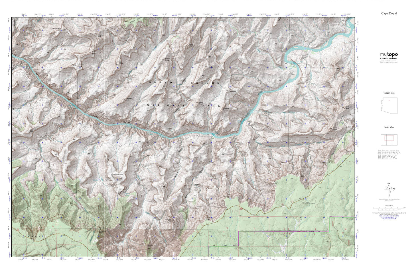
Cape Royal MyTopo Explorer Series Map
Couldn't load pickup availability
Topographic map of Cape Royal in the state of Arizona. From the MyTopo Explorer Series.
This topo map features shaded relief and comes with UTM / MGRS and Latitude/Longitude grids.
For more than two decades, MyTopo has provided maps to the most adventurous among us.. those who love to explore our nation’s remote wilderness areas, climb our highest peaks, and trek across our vast public lands. This map is part of a curated collection of the most popular places for which MyTopo customers have designed maps. It is a “bucket list” of the most amazing places to hike, hunt, and explore.
This map contains the following named places: 86023,Asbestos Canyon,Ayer Point,Berry Butte,Boulder Creek,Cardenas Canyon,Cardenas Creek,Clear Creek,Coronado Butte,Cottonwood Creek,Dunn Butte,Eightythree Mile Rapids,Escalante Creek,Grandview Point,Grandview Trail,Grapevine Creek,Grapevine Rapids,Hall Butte,Hance Canyon,Hance Creek,Hance Mine,Hance Rapids,Hance Trail,Hawkins Butte,Hollenback Point,Horseshoe Mesa,Krishna Shrine,Last Chance Mine,Lonetree Canyon,Lyell Butte,Mineral Canyon,Moran Point,Nevills Rapids,Newberry Butte,O'Neill Spring,Page Spring,Papago Creek,Pinal Point,Rama Shrine,Red Canyon,Seventyfive Mile Creek,Seventy-Five Mile Rapids,Sheba Temple,Sockdolager Rapids,Solomon Temple,The Tabernacle,Unkar Creek,Unkar Creek Rapids,Vishnu Creek,Zuni Point