MyTopo
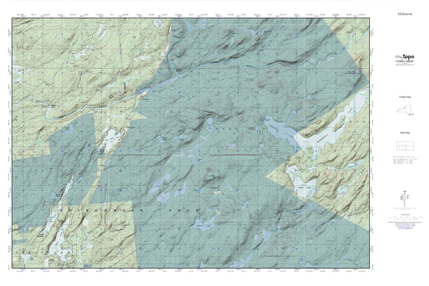
McKeever MyTopo Explorer Series Map
Couldn't load pickup availability
Topographic map of McKeever in the state of New York. From the MyTopo Explorer Series.
This topo map features shaded relief and comes with UTM / MGRS and Latitude/Longitude grids.
For more than two decades, MyTopo has provided maps to the most adventurous among us.. those who love to explore our nation’s remote wilderness areas, climb our highest peaks, and trek across our vast public lands. This map is part of a curated collection of the most popular places for which MyTopo customers have designed maps. It is a “bucket list” of the most amazing places to hike, hunt, and explore.
This map contains the following named places: Bear Lake,Bloodsucker Pond,Brandy Lake,Brewer Lake,Brooktrout Point,Camp Nazareth,Coleman Dam,Granny Marsh,Grindstone Creek,Gull Lake,Holiday House,Long Lake,Lost Pond,McKeever,Middle Branch Moose River,Mill Brook,Moose River Road Extension Bridge,Neejer Hill,Nicks Creek,Otter Lake,Otter Lake Census Designated Place,Otter Lake Fire Department,Otter Lake Outlet,Purgatory Creek,Remson Point,Round Pond,Sand Lake,Silver Creek,South Branch Moose River,Squirrel Ponds,White Lake,Wolf Lake Landing