MyTopo
Carson City MyTopo Explorer Series Map
Couldn't load pickup availability
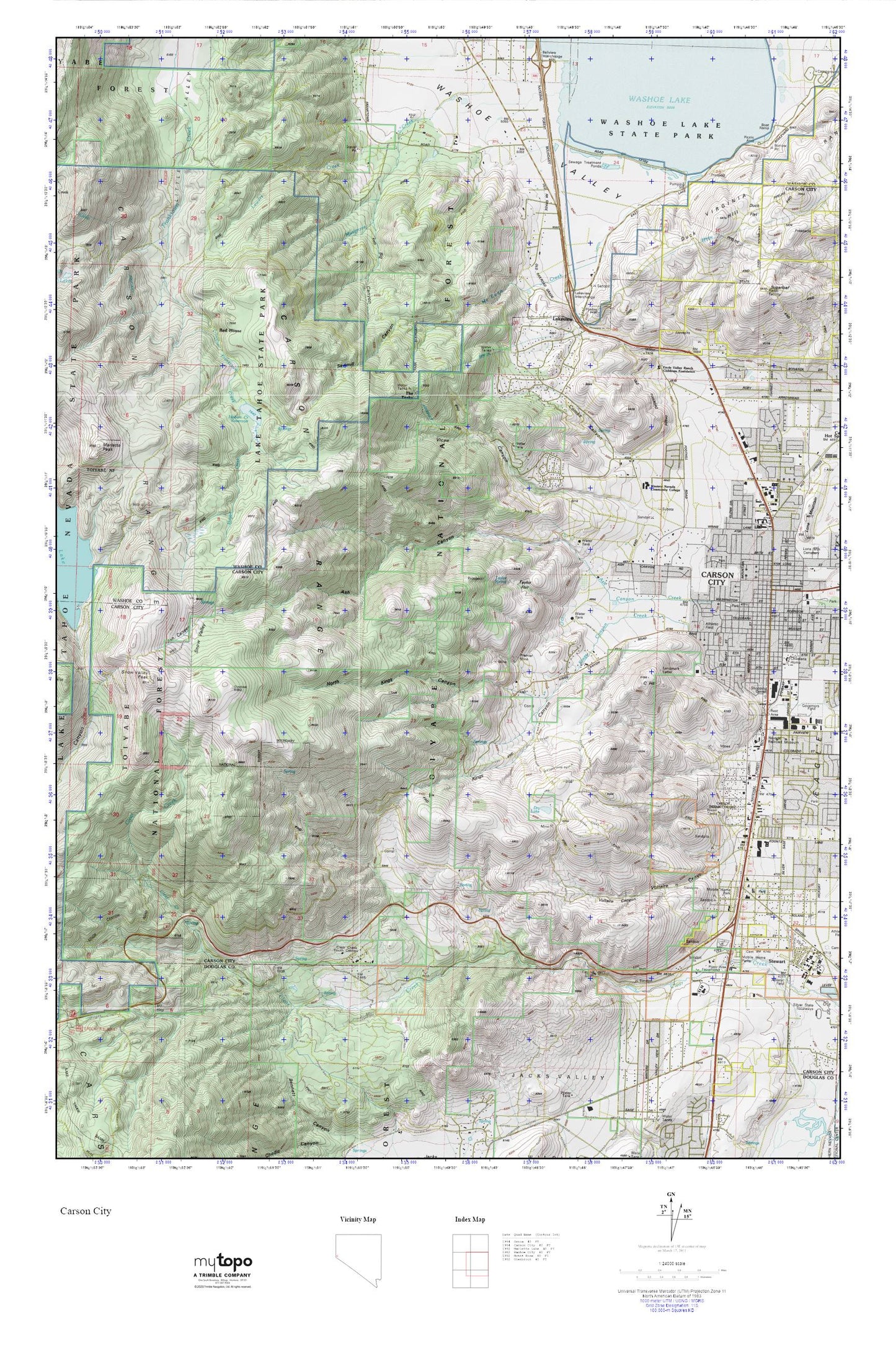
Topographic map of Carson City in the state of Nevada. From the MyTopo Explorer Series.
This topo map features shaded relief and comes with UTM / MGRS and Latitude/Longitude grids.
For more than two decades, MyTopo has provided maps to the most adventurous among us.. those who love to explore our nation’s remote wilderness areas, climb our highest peaks, and trek across our vast public lands. This map is part of a curated collection of the most popular places for which MyTopo customers have designed maps. It is a “bucket list” of the most amazing places to hike, hunt, and explore.
This map contains the following named places: 89703,89705,Ash Canyon,Ash Canyon Creek,Ashs Sawmill,Athens Mine,Backcountry Management Area,Barrett Mill,Bethlehem Lutheran School,Big Canyon,Bordewich Bray Elementary School,C Hill,Camp Nye,Carson Black Lead Mine,Carson City,Carson City Fire Department Station 53,Carson City Post Office,Carson City Seventh Day Adventist School,Carson Colony,Carson Mall,Carson Middle School,Carson Mine,Carson Ranger Station,Carson Recreation Area,Carson Rest Area,Carson Shopping Center,Carson Tahoe Regional Medical Center,Carson-Tahoe Hospital Heliport,Clear Creek Campground,Clear Creek Canyon,Clear Creek Station,Clear Creek Youth Center,Combs Canyon,Dry Lake,Duck Flat,Duck Hill Summit,Eagle Station,Eagle Station Shopping Center,Eagle Valley Ranch Childrens Foundation,Evergreen Carson City Hospital,Evergreen Mountain View Health Center,Fritsch Elementary School,Frontier Plaza,Fuji Park,Golden Eagle Mine,Gregorys Mill,Haskells Mill,Hobart Creek,Hobart Creek Dam,Hobart Creek Reservoir,Kings Canyon,Kings Canyon Creek,Lake View Post Office,Lakeview,Lakeview Summit,Landmark Letter,Lewers Creek,Lighting W Ranch,List Ranch,Little Valley Mine,Lucky Strike Mine,Market Spot Shopping Center,Martha Gleason Elementary School,McEwen Creek,Mill Creek Settlement,Montreal Mine,Musgrove Creek,Nevada Division of Forestry Western Area Station,Nevada Governor Mansion,Nevada State Capitol,North Kings Canyon,Ohio Mine,Ormsby County Farm,Panama Canal Mine,Pioneer High School,Premier Mine,Red House,Rose Canyon,Ross Gold Park,Saint Teresa of Avila Catholic School,San Antonio Ranch,Sawmill Canyon,Sierra Surgery Hospital,Silver State High School,Snow Valley,Snow Valley Peak,Snyder Meadows State Park,South Beach,Spooner Summit Recreation Site,Sugarloaf,Swifts Station,Taylor Flat,Taylor Spring,The Mallard Center,The Tanks,Thornton,Vicee Canyon,Voltaire Canyon,Voltaire Mine,Voltaire Mining District,Washoe Pines Ranch,Washoe Tribal Police Department,Western Nevada College,Woods Ranch