MyTopo
Mooresville West MyTopo Explorer Series Map
Couldn't load pickup availability
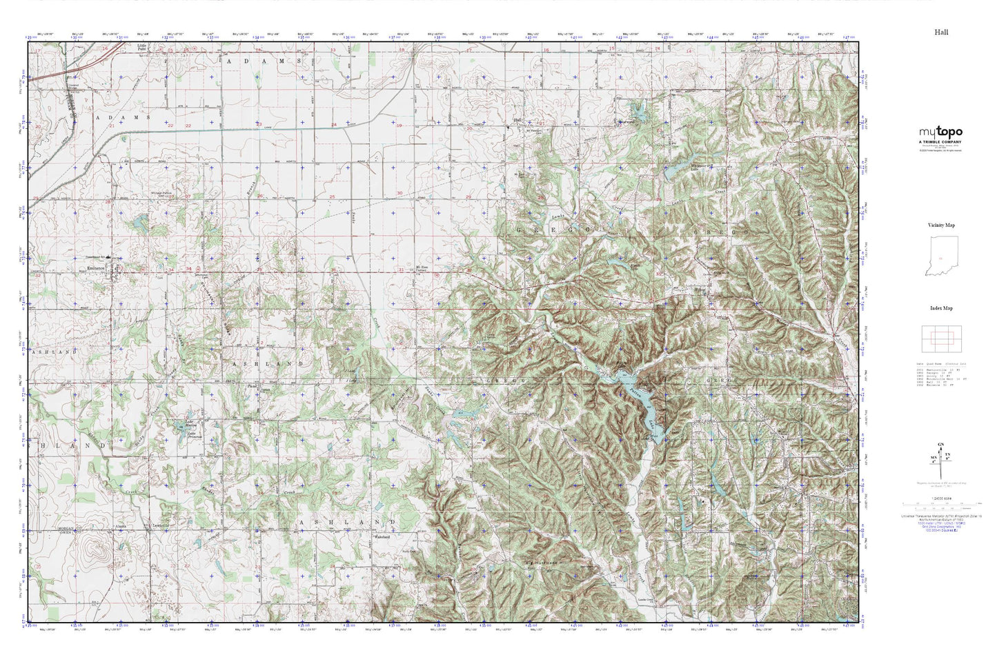
Topographic map of Mooresville West in the state of Indiana. From the MyTopo Explorer Series.
This topo map features shaded relief and comes with UTM / MGRS and Latitude/Longitude grids.
For more than two decades, MyTopo has provided maps to the most adventurous among us.. those who love to explore our nation’s remote wilderness areas, climb our highest peaks, and trek across our vast public lands. This map is part of a curated collection of the most popular places for which MyTopo customers have designed maps. It is a “bucket list” of the most amazing places to hike, hunt, and explore.
This map contains the following named places: 46125,A and A Township Fire Station 11,A and A Township Volunteer Fire Department,A and A Township Volunteer Fire Department Station 2,Alaska,Amy Lake,Amy Lake Dam,Bethlehem Cemetery,Big Hurricane Hill,Briarwood,Briarwood Lake Dam,Camp Berean,Corinth Church,Eminence,Eminence Consolidated School,Eminence Post Office,Gash Branch,Gregg Township Fire Department,Hall,Hall Elementary School,Herbamount,J Lake,Jakes Butte,Kivett Lake,Lahr Lake Dam,Lake Ditch,Lake Maxine,Lake Primrose,Lewisville,Little Hurricane Hill,Maxine Lake Dam,Mount Pleasant Cemetery,Mount Zion Cemetery,Mount Zion Corner,Patton Dam,Patton Lake,Plano,Poplar Grove Church,Ratts Cemetery,Sandy Branch,Shearer Airport,Shumaker Cemetery,Shumaker Hill,Shumaker Ridge,Smith Lake,Smith Lake Dam,Snake Creek,Township of Ashland,Township of Gregg,Wakeland,Whippoorwill Lake,Whippoorwill Lake Dam,Whispering Wind Lake,Whispering Wind Lake Dam,Whitaker - Patrick Cemetery,Wilbur,Winters Airport