MyTopo
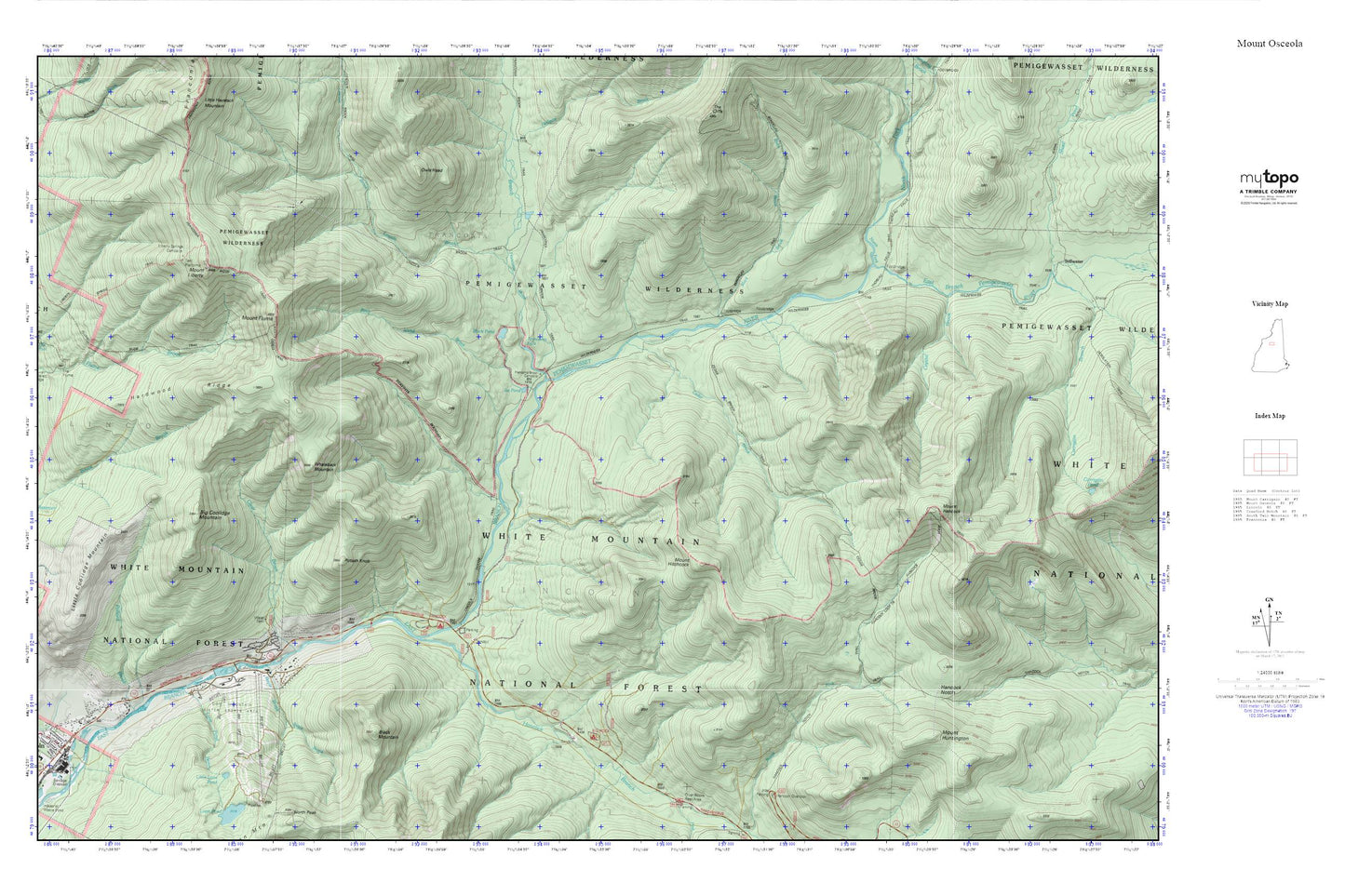
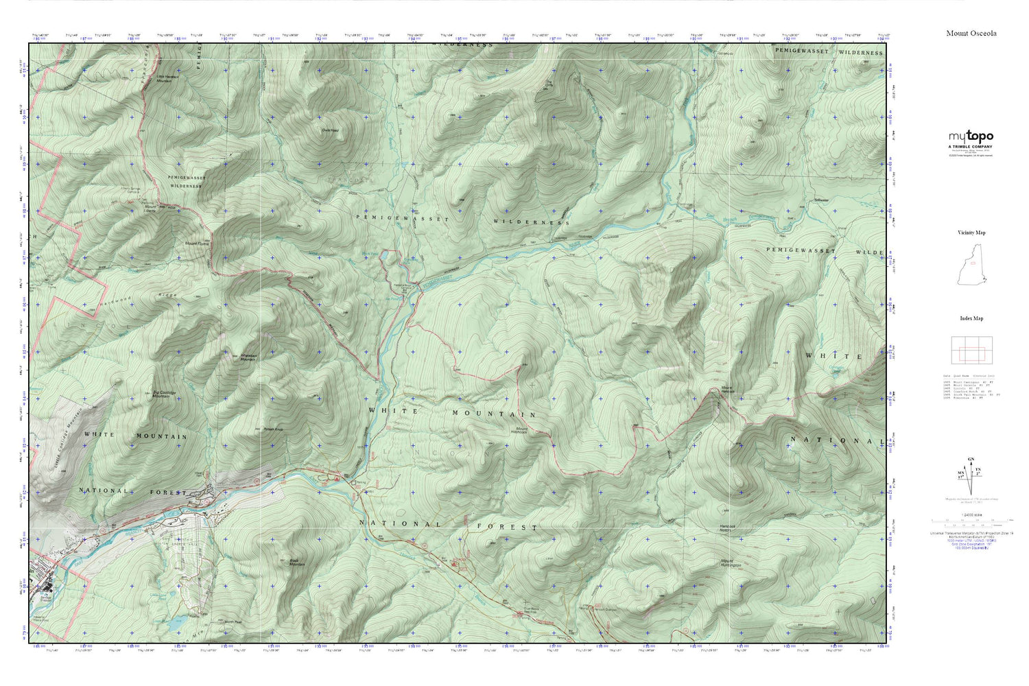
Mount Osceola MyTopo Explorer Series Map
Couldn't load pickup availability
Topographic map of Mount Osceola in the state of New Hampshire. From the MyTopo Explorer Series.
This topo map features shaded relief and comes with UTM / MGRS and Latitude/Longitude grids.
For more than two decades, MyTopo has provided maps to the most adventurous among us.. those who love to explore our nation’s remote wilderness areas, climb our highest peaks, and trek across our vast public lands. This map is part of a curated collection of the most popular places for which MyTopo customers have designed maps. It is a “bucket list” of the most amazing places to hike, hunt, and explore.
This map contains the following named places: 03251,Big Coolidge Mountain,Big Rock Campground,Birch Island Brook,Black Brook,Black Mountain,Black Pond,Bondcliff Trail,Boyle Brook,Camp 16 Shelter,Camp 9 Shelter,Camp Nine Shelter,Cedar Brook,Ceder Brook Trail,Clear Brook,Crystal Brook,Franconia Branch,Franconia Brook Campsite,Franconia Falls,Franconia Shelter,Hancock Branch,Hancock Campground,Hancock Loop Trail,Hancock Notch,Hardwood Ridge,Ice Pond,Liberty Spring Trail,Liberty Springs Campsite AMC,Lincoln Brook,Little Coolidge Mountain,Loon Mountain Park,Loon Mountain Ski Area,Loon Mountain Winter Sports Area,Loon Pond Brook,Mount Flume,Mount Hancock,Mount Hitchcock,Mount Huntington,Mount Liberty,North Fork East Branch Pemigewasset River,Osseo Trail,Owls Head,Pemigewasset Wilderness,Pollard Brook,Potash Knob,The Depot Retail Center Shopping Center,The Village of Loon Mountain,Town of Lincoln,Whaleback Mountain,Wilderness Trail