MyTopo
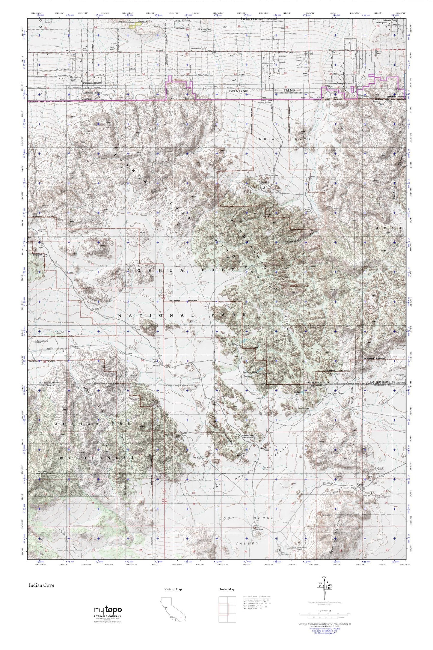
Indian Cove_Queen Mt. MyTopo Explorer Series Map
Couldn't load pickup availability
Topographic map of Indian Cove_Queen Mt. in the state of California. From the MyTopo Explorer Series.
This topo map features shaded relief and comes with UTM / MGRS and Latitude/Longitude grids.
For more than two decades, MyTopo has provided maps to the most adventurous among us.. those who love to explore our nation’s remote wilderness areas, climb our highest peaks, and trek across our vast public lands. This map is part of a curated collection of the most popular places for which MyTopo customers have designed maps. It is a “bucket list” of the most amazing places to hike, hunt, and explore.
This map contains the following named places: Barker Dam,Cow Camp Dam,Desert Queen Well,Hidden Valley,Hidden Valley Campground,Indian Cove,Indian Cove Campground,Indian Cove Ranger Station,Johnny Lang Canyon,Johnson Spring,KDHI-AM (Twentynine Palms),Keys Ranch,Lang Mine,Lost Horse Ranger Station,Lost Horse Valley,Mount Minerva Hoyt,Panorama Heights,Rattlesnake Canyon,Ryan Mountain Trail,San Bernardino County Fire Department Station 35 Panorama Heights,Sheep Pass,Sheep Pass Campground,Sheep Pass Group Campground,Sneakeye Spring,Wall Street Mill,Willow Hole,Wonderland of Rocks,Wonderland Ranch Wash