MyTopo
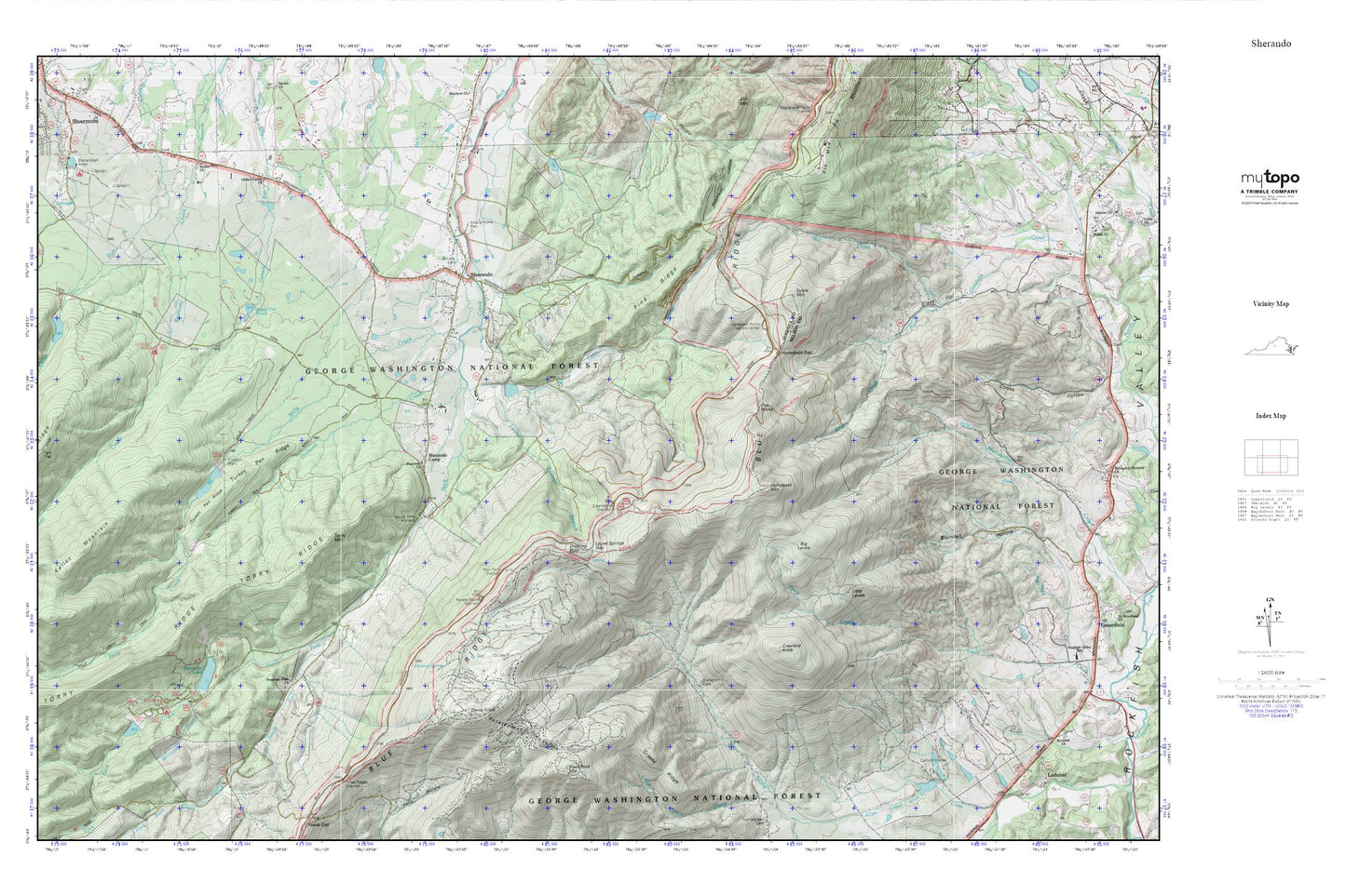
Sherando MyTopo Explorer Series Map
Couldn't load pickup availability
Topographic map of Sherando in the state of Virginia. From the MyTopo Explorer Series.
This topo map features shaded relief and comes with UTM / MGRS and Latitude/Longitude grids.
For more than two decades, MyTopo has provided maps to the most adventurous among us.. those who love to explore our nation’s remote wilderness areas, climb our highest peaks, and trek across our vast public lands. This map is part of a curated collection of the most popular places for which MyTopo customers have designed maps. It is a “bucket list” of the most amazing places to hike, hunt, and explore.
This map contains the following named places: 22952,Big Levels,Black Rock Mountain,Blue Ridge Parkway Visitors Center,Camp Monocan,Coles Run Dam,Coles Run Reservoir,Crawford Knob,Devils Knob,Diamond Hill Cemetery,Dobie Mountain,Dripping Rock,Falling Rocks Lake,Glass Hollow,Grassy Ridge,Greenstone Overlook,Happy Hollow Lake,Hickory Spring,Humpback Gap,Humpback Mountain,Humpback Rocks Visitors Center,Kelley Mountain,Kennedy Fields Campgrounds,Kennedy Mine,Kennedy Ridge Trail,Lake Wilda,Laurel Springs Branch,Laurel Springs Gap,Little Country Church,Little Levels,Maple Flat Ponds,Mill Creek,Mills Creek,Mills Creek Trail,Mount Torry Furnace,Mountain Lake,Mountain View Church,Nellysford Census Designated Place,North Fork Back Creek,Orebank Creek,Pine Ridge,Potatopatch Mountain,Proffit Chapel,Rankin Church,Rankin Run,Ravens Roost Overlook,Rock Point Overlook,Rockfish District,Rodes Creek,Shenandoah Acres,Sherando,Sherando Camp,Sherando Census Designated Place,Sherando Church,Sherando Dam,Sherando Lake,Sherando Lake Campground,South Fork Back Creek,South River District,South River Number 10a Dam,South River Number 11 Dam,South River Number 24 Dam,South River Number 25 Dam,South River Number 27 Dam,The Rocks,Three Ridges Overlook,Toms Branch,Torry Mountain,Turkey Pen Ridge,Turkey Pen Ridge Trail,Upper Sherando Lake,Williams Branch,Wintergreen Census Designated Place,Wintergreen Fire and Rescue Station 1