MyTopo
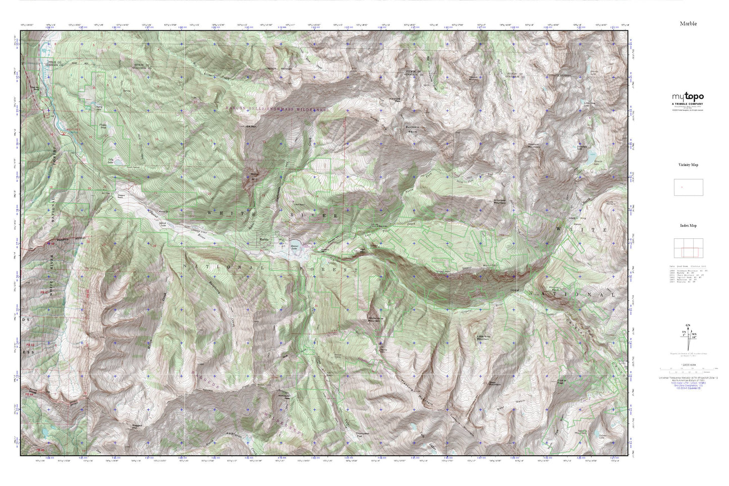
Marble MyTopo Explorer Series Map
Couldn't load pickup availability
Topographic map of Marble in the state of Colorado. From the MyTopo Explorer Series.
This topo map features shaded relief and comes with UTM / MGRS and Latitude/Longitude grids.
For more than two decades, MyTopo has provided maps to the most adventurous among us.. those who love to explore our nation’s remote wilderness areas, climb our highest peaks, and trek across our vast public lands. This map is part of a curated collection of the most popular places for which MyTopo customers have designed maps. It is a “bucket list” of the most amazing places to hike, hunt, and explore.
This map contains the following named places: Anthracite Pass,Arkansas Mountain,Avalanche Pass,Bear Basin,Bear Mountain,Beaver Lake,Beaver Lake Dam,Black Queen Shaft,Blair Ranch,Bogan Flats Campground,Brooklyn Mine,Buckskin Basin,Carbonate Creek,Carbondale and Rural Fire Protection District Station 83 Marble,Catalpa Mine,Chair Creek,Chair Creek Tunnel Mine,Chair Mountain Ranch,Chimneys of Treasure Mountain,Colorado Outward Bound School,Crystal,Crystal Canyon,Daniels Hill,Elk Mountain,Flogus Pond,Gallo Hill,Genter Mine,Hat Mountain,Island Lake,Lands End Overlook Picnic Ground,Lily Lake,Lily Lake Forest Service Facility,Little Bear Mountain,Lizard Lake,Lost Trail Creek,Lucky Boy Mine,Marble,Marble Cemetery,Marble Charter School,Marble Community Church,Marble Mill Site Park,Marble Museum,McVey Tunnel Mine,Meadow Mountain,Milton Creek,Mount Daly,Mud Gulch,North Fork Crystal River,North Fork Lost Trail Creek,Perry Pond,Prospect Ranch,Rapid Creek,Rapid Creek Mine,Raspberry Creek,Sheep Mountain,Sheep Mountain Tunnel Mine,Skyline Mine,Slate Creek,Snowshoe Ranch,South Fork Crystal River,State of Colorado Standard School,Strauss Quarry,Town of Marble,Treasure Mountain,Tuscarora Mine,Whitehouse Mountain,Yule Creek,Yule Quarry