MyTopo
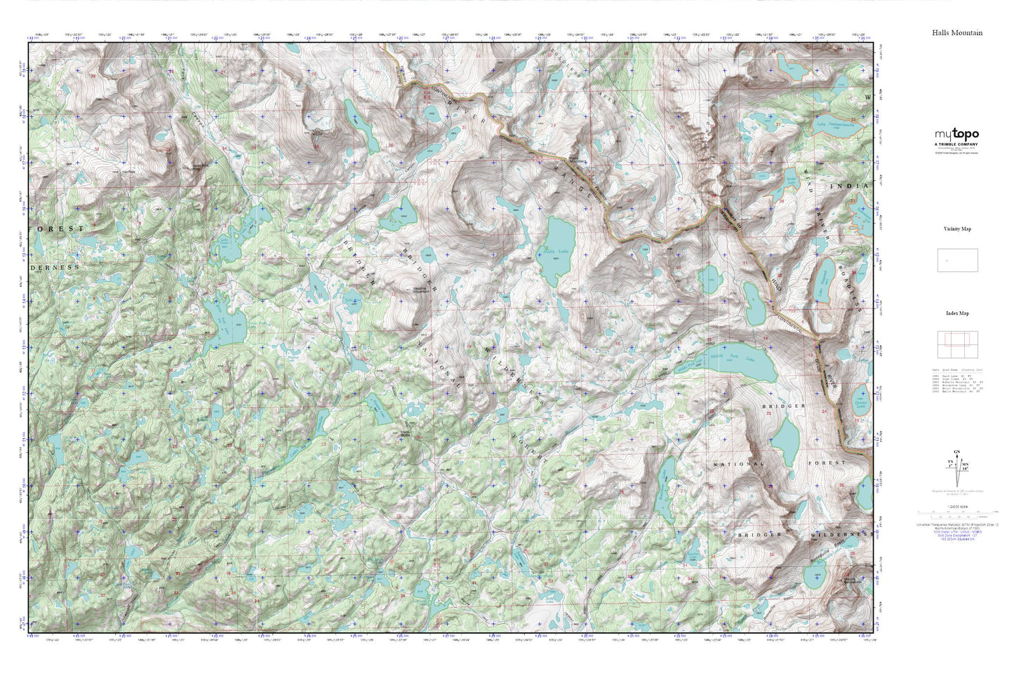
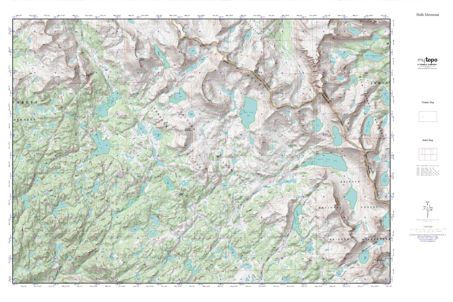
Halls Mountain MyTopo Explorer Series Map
Couldn't load pickup availability
Topographic map of Halls Mountain in the state of Wyoming. From the MyTopo Explorer Series.
This topo map features shaded relief and comes with UTM / MGRS and Latitude/Longitude grids.
For more than two decades, MyTopo has provided maps to the most adventurous among us.. those who love to explore our nation’s remote wilderness areas, climb our highest peaks, and trek across our vast public lands. This map is part of a curated collection of the most popular places for which MyTopo customers have designed maps. It is a “bucket list” of the most amazing places to hike, hunt, and explore.
This map contains the following named places: August Lake,Chris Lake,Dugway Lake,Edmond Lake,Eds Lake,Europe Canyon,Europe Canyon Trail,Fire Hole Lakes,Firehole Trail,Full Moon Lake,Halls Butte,Halls Creek,Halls Lake,Halls Lake Trail,Halls Mountain,Hat Pass,Howard Lake,Lake Ethel,Lake Ethel Trail,Lake Isabella,Lake Isabella Trail,Lake Prue,Lake Susan,Lake Vera,Lake Victor,Lake Winona,Long Lake,Macs Lake,Medina Lake,Medina Mountain,Middle Fork Lake,Middle Fork Trail,Mount Victor,Norman Lakes,North Fork Canyon,North Fork Falls,North Fork Lake,North Fork Peak,Perry Lake,Photo Pass,Pipe Organ,Pipestone Lakes,Rainbow Lake,Rambaud Lake,Sandpoint Lake,Shoestring Lake,Sunrise Lake,Valley Lake,Wilderness Lake