MyTopo
Ventana Cones MyTopo Explorer Series Map
Couldn't load pickup availability
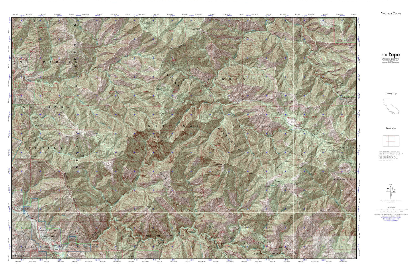
Topographic map of Ventana Cones in the state of California. From the MyTopo Explorer Series.
This topo map features shaded relief and comes with UTM / MGRS and Latitude/Longitude grids.
For more than two decades, MyTopo has provided maps to the most adventurous among us.. those who love to explore our nation’s remote wilderness areas, climb our highest peaks, and trek across our vast public lands. This map is part of a curated collection of the most popular places for which MyTopo customers have designed maps. It is a “bucket list” of the most amazing places to hike, hunt, and explore.
This map contains the following named places: Bad Gulch,Bear Basin,Bear Basin Camp,Bear Basin Creek,Blue Creek,Buckskin Flat Camp,Buzzards Roost,Buzzards Roost Trail,Cabezo Prieto,Comings Creek,Dolores Creek,Doolans Hole Creek,Hiding Canyon,Hiding Canyon Camp,Hopkins Ridge,Island Mountain,Jackson Camp,Jackson Creek,Juan Hiquera Creek,Launtz Creek,Launtz Creek Campground,Launtz Ridge,Liewald Flat,Lion Creek,Logwood Creek,Lone Pine Camp,Manuel Peak,Manuel Peak Trail,Miller Canyon Camp,Miller Mountain,Mount Manuel Trail,Oak Grove Trail,Pfeffer-Redwood Creek,Pfeiffer Big Sur State Park,Pfeiffer Falls,Pfeiffer Falls Trail,Pfeiffer Ridge,Pico Blanco Boy Scout Camp,Pico Blanco Rustic Campsite,Pine Falls,Pine Ridge,Pine Ridge Camp,Pine Ridge Trail,Pine Valley,Pine Valley Rustic Campsite,Post Summit,Puerto Suello Creek,Redwood Creek Camp,Round Rock Camp,Sawmill Flat Campground,Skinner Creek,South Ventana Cone,Sykes Camp,Terrace Creek,Tin House Campground,Uncle Sam Mountain,Vado Campground,Valley View Trail,Ventana Camp,Ventana Cone,Ventana Creek,Ventana Double Cone,Ventana Mesa Creek