
MyTopo
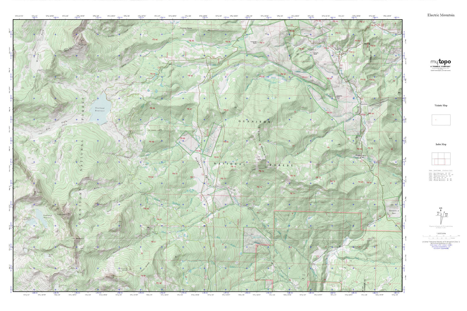
Electric Mountain MyTopo Explorer Series Map
Couldn't load pickup availability
Topographic map of Electric Mountain in the state of Colorado. From the MyTopo Explorer Series.
This topo map features shaded relief and comes with UTM / MGRS and Latitude/Longitude grids.
For more than two decades, MyTopo has provided maps to the most adventurous among us.. those who love to explore our nation’s remote wilderness areas, climb our highest peaks, and trek across our vast public lands. This map is part of a curated collection of the most popular places for which MyTopo customers have designed maps. It is a “bucket list” of the most amazing places to hike, hunt, and explore.
This map contains the following named places: Beaver Creek,Big Alder Creek,Branch of Bee Creek,Columbine Ditch Nuber One,Columbine Ditch Nuber Two,Columbine Ditch Number Five,Columbine Ditch Number Three,Columbine Ranch,Crater Creek,Crater Lake,Crater Peak,Dog Fish Lake Dam,Dogfish Reservoir,Electric Mountain,Elk Creek,Elk Park,Elk Park Trail,Fairmont Dam,Fawn Creek,Goodenough Number 2 Dam,Goodenough Reservoir,Hilltop Reservoir,Hubbard Park,Little Alder Creek,Little Dyke Creek,Lombard Slides,Main Hubbard Creek,Middle Hubbard Creek,Molly Group Mine,Mount Darline,Mount Hatten,Overland Number 1 Dam,Overland Reservoir,Peters Creek,Pilot Creek,Pine Cone Dam,Pine Cone Reservoir,Poison Park,Slide Creek,Terror Trail,Twin Spruce Ditch,West Hubbard Creek,Willow Dam,Willow Reservoir,Wolf Creek


