MyTopo
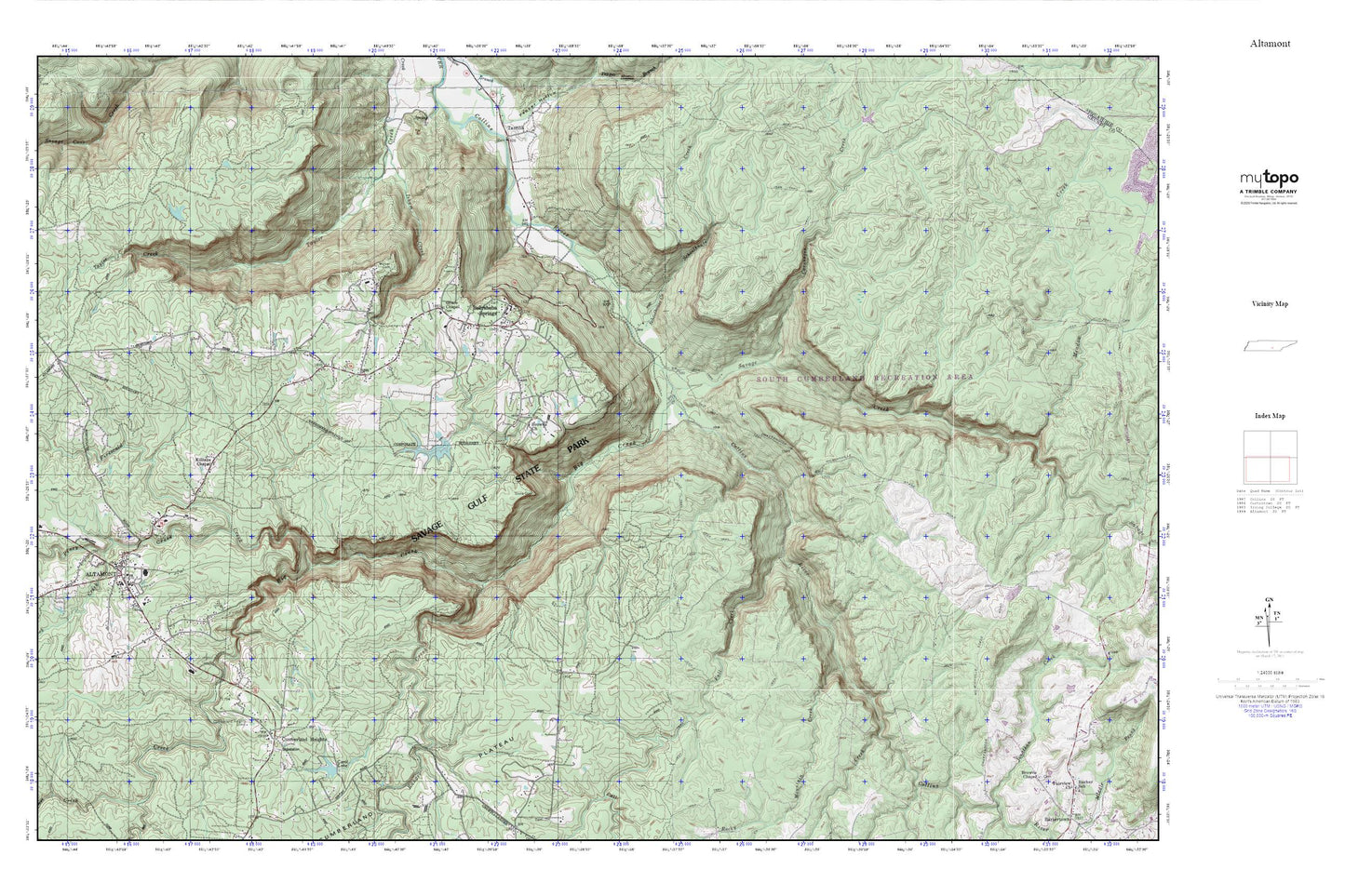
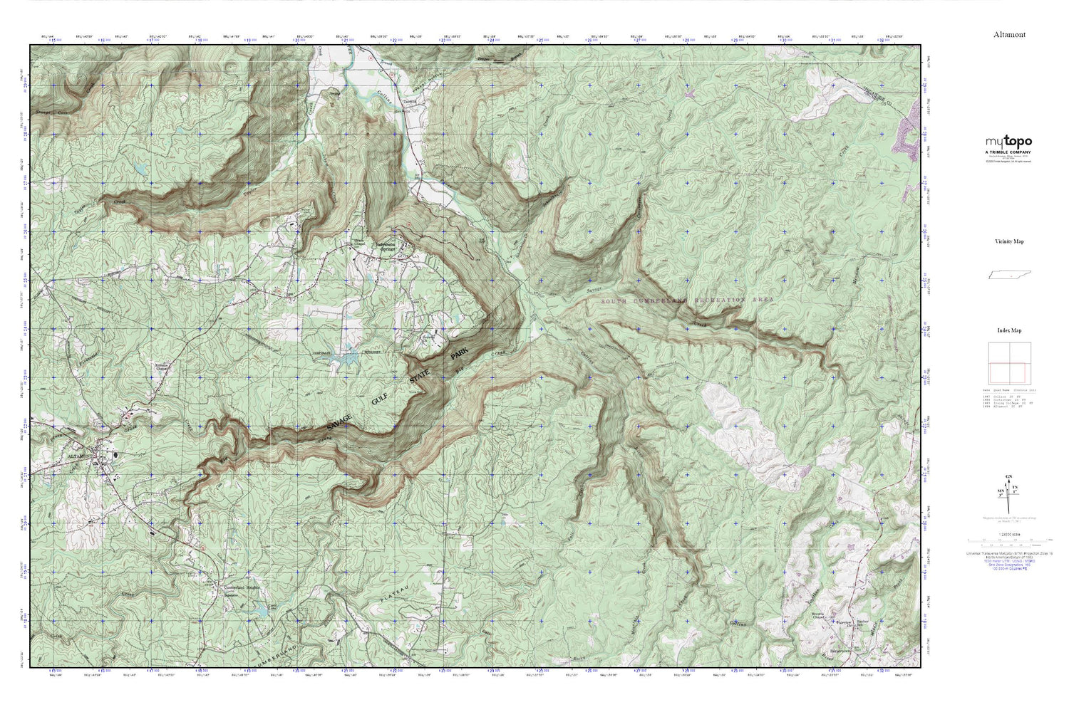
Savage Gulf MyTopo Explorer Series Map
Couldn't load pickup availability
Topographic map of Savage Gulf in the state of Tennessee. From the MyTopo Explorer Series.
This topo map features shaded relief and comes with UTM / MGRS and Latitude/Longitude grids.
For more than two decades, MyTopo has provided maps to the most adventurous among us.. those who love to explore our nation’s remote wilderness areas, climb our highest peaks, and trek across our vast public lands. This map is part of a curated collection of the most popular places for which MyTopo customers have designed maps. It is a “bucket list” of the most amazing places to hike, hunt, and explore.
This map contains the following named places: 37305,Altamont,Altamont Academy,Altamont Baptist Church,Altamont Cemetery,Altamont Division,Altamont Post Office,Altamont Volunteer Fire Department,Beersheba Springs,Beersheba Springs Cemetery,Beersheba Springs Post Office,Beersheba Springs Volunteer Fire Department,Big Creek,Browns Church,Carol Dam,Carol Lake,Caruenger Creek,Commissioner District 1,Cumberland Heights,Cumberland Heights Clinic,Fall Creek,Firescald Creek,Fults Cemetery,Grace Chapel,Grace Chapel Cemetery,Grundy County Courthouse,Grundy County Sheriff's Office,Killians Chapel,North Elementary School,Panhandle School,Piney Creek,Ranger Creek,Rock Creek,Rocky Mountain Creek,Round Mountain Creek,Savage Creek,Savage Gulf,Savage Gulf State Natural Area,Schoolhouse Creek,South Cumberland Recreation Area,Stone Door,The Church of Jesus Christ of Latter Day Saints,Town of Altamont,Town of Beersheba Springs,Utah School,Walker Cemetery,Whispering Pines School