
MyTopo
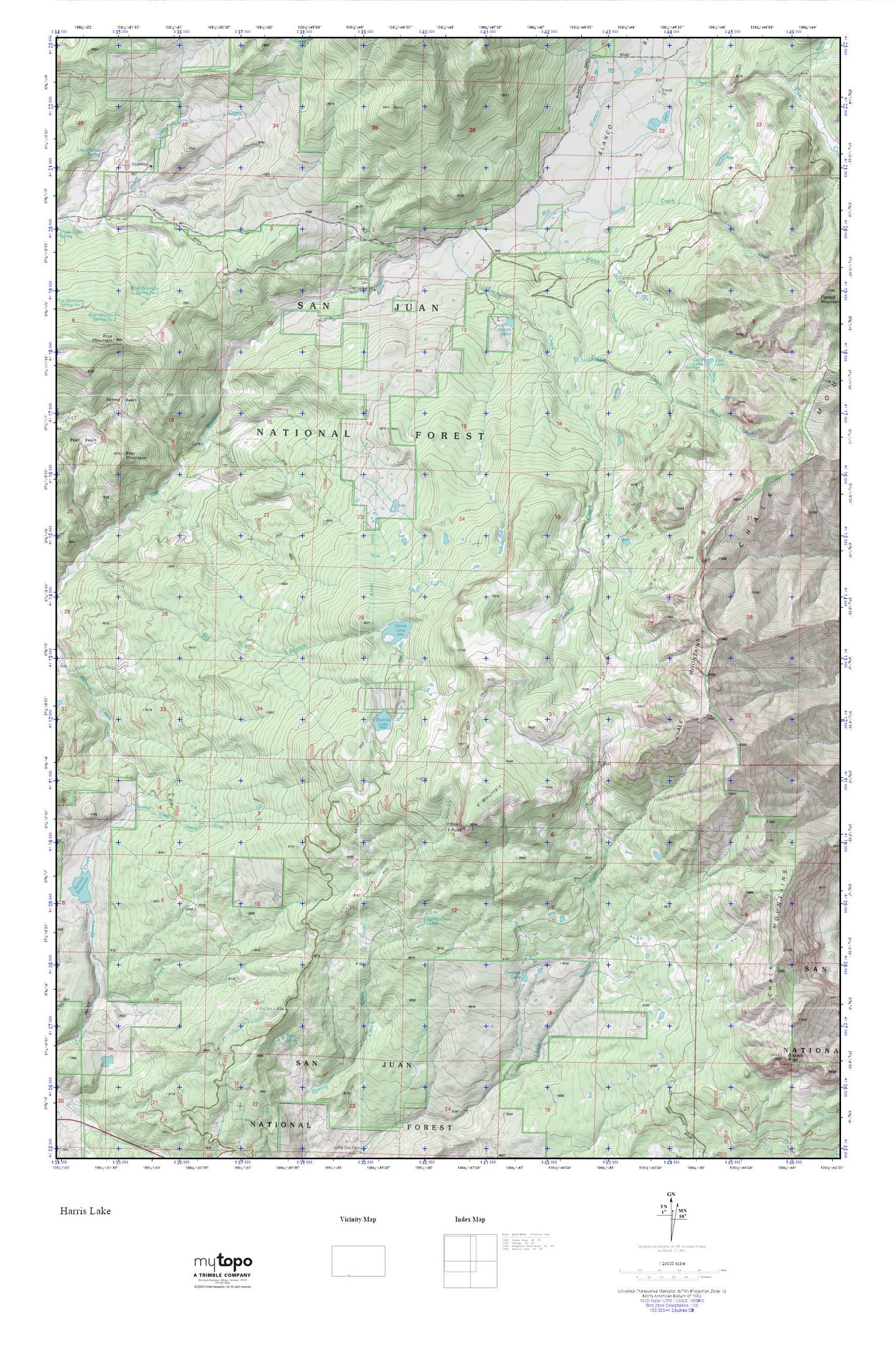
Harris Lake MyTopo Explorer Series Map
Couldn't load pickup availability
Topographic map of Harris Lake in the state of Colorado. From the MyTopo Explorer Series.
This topo map features shaded relief and comes with UTM / MGRS and Latitude/Longitude grids.
For more than two decades, MyTopo has provided maps to the most adventurous among us.. those who love to explore our nation’s remote wilderness areas, climb our highest peaks, and trek across our vast public lands. This map is part of a curated collection of the most popular places for which MyTopo customers have designed maps. It is a “bucket list” of the most amazing places to hike, hunt, and explore.
This map contains the following named places: Bear Mountain,Blanco Basin,Blanco Dam,Blanco Tunnel,Blue Mountain,Buckles Lake,Castle Creek,Chalk Mountains,Crescent Lake,Gardner Lake,Harris Brothers and Boone Number 1 Dam,Harris Lake,Harris Lake Dam,Leche Creek,Leche Creek Trail,North Fork Fish Creek,Opal Lake,Slesinger Dam,South Creek,Spence Creek,Spring Basin,Spring Creek Lakes,Squaretop Guard Station,Twin Lakes,V Mountain,V Rock,V Rock Trail,V Rock Trailhead,White Creek


